Hardy Bay, March 30, 2016
It was March…not exactly kayaking season. In many parts of the country people were still coping with snow and sub-zero temperatures. I was feeling an urgency to do some kayaking as soon as possible, which was a good feeling to heed, as there would be an unexpected turn of events that would turn our lives upside down in August.
Unlike in the summer, I couldn't go kayaking at any time. Because I worked at the school during the week and had an almost full-time job on the weekends, there weren't many opportunities for me to take off during the school year. James was a little freerer: he worked a half dozen 2 to 4-week mill shutdowns in the spring, summer and fall, with big breaks in between. I saw spring break coming from afar and set the wheels in motion for a kayaking trip for that time. Interestingly, the gods seemed to collaborate with my intentions. The weather on the North Island is usually quite soggy in March; however, those three days that we ended up going kayaking we had an unusual gift of mid-July type weather.
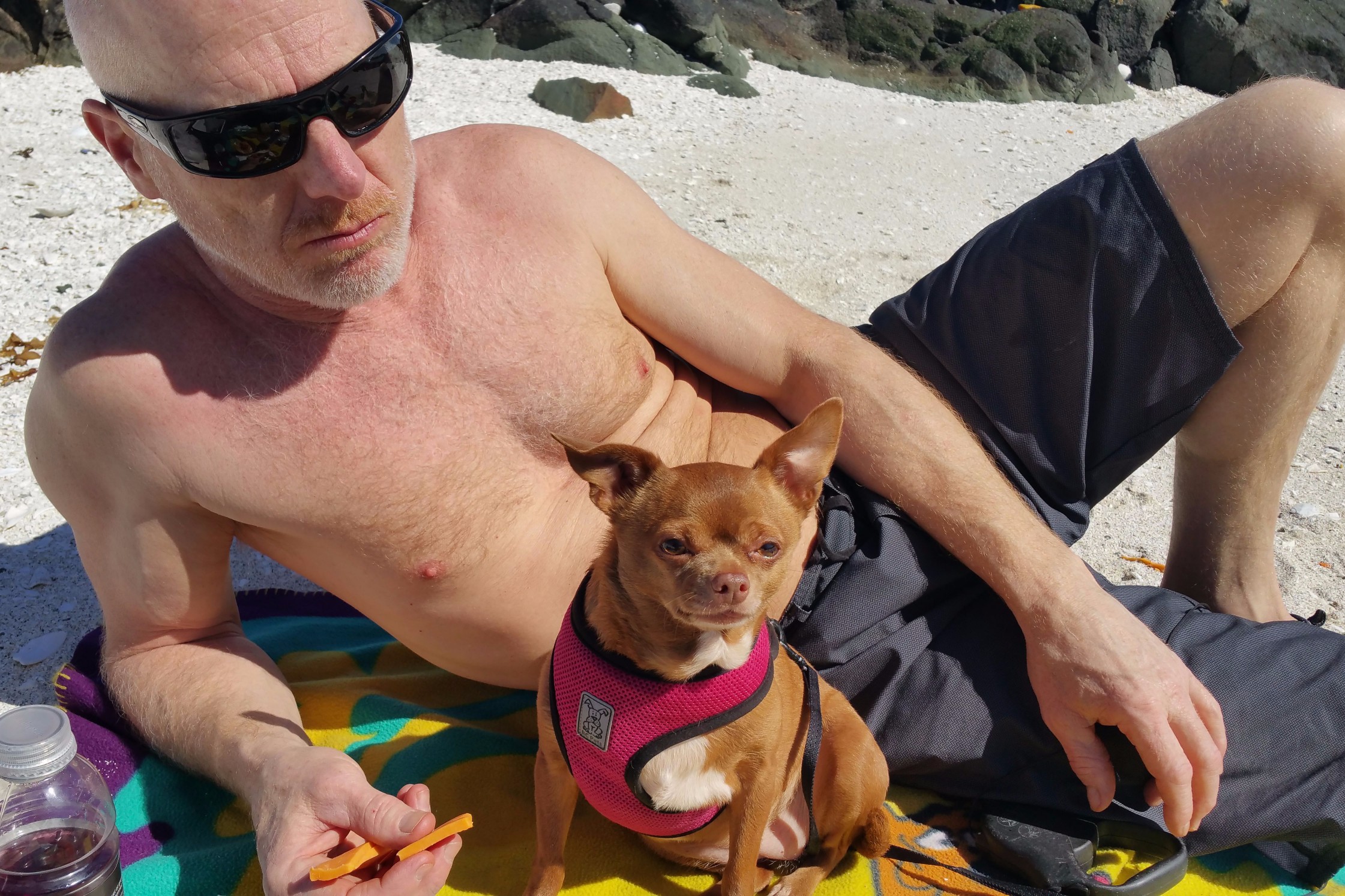
Things were looking good for a spring break trip, except for one hitch. I had to renew my first aid certificate for my lunch supervisor job at the school, and the course was smack dab in the middle of the spring break week we were planning to go. Also, I had to go back to work at my weekend job on Friday. We might have gone farther afield if not for that; but, as it turned out, it was a blessing. Our first kayaking trip had to be local. We considered Storeys Beach by Fort Rupert about 30 minutes away, but weren't terribly enthusiastic about it. We ended up discovering that it was a gem of a kayaking site, both "exotic" and suitable for almost all ages. Its funny how we tend to think how something exotic and exciting has to be far away and cost a lot of money to get to. So, if you have kids, maybe a Chihuahua or other kind of pooch and not a lot of time for a high kayaking adventure but want one anyway, try out Storeys Beach.
Another complication was lodgings. Our home (James moved out of his rental and into my place in November) was not too far away. There are no campsites at Storeys Beach, so we figured we had to stay at one in Port Hardy. It was a little weird. We would be camping in a municipal area, and there was still a 30 minute drive to our kayaking spot—and it was only a 45 minute drive from home! I guess we just needed to camp; it had been a long winter. We checked out two campsites, but one was closed. We ended up staying at the Quatse River Campground. Again, we were pleasantly surprised and delighted by this element in our close to home adventure.
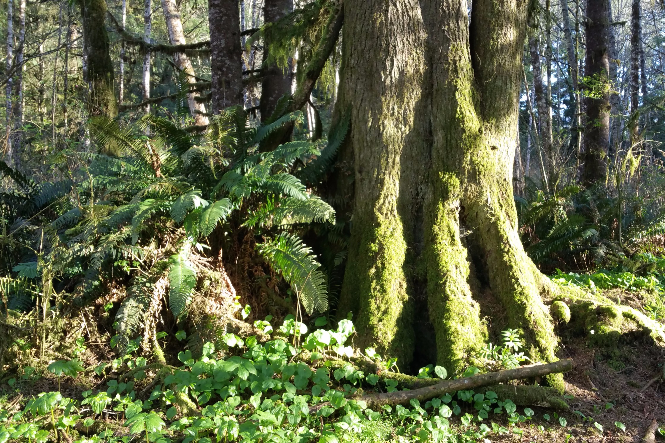
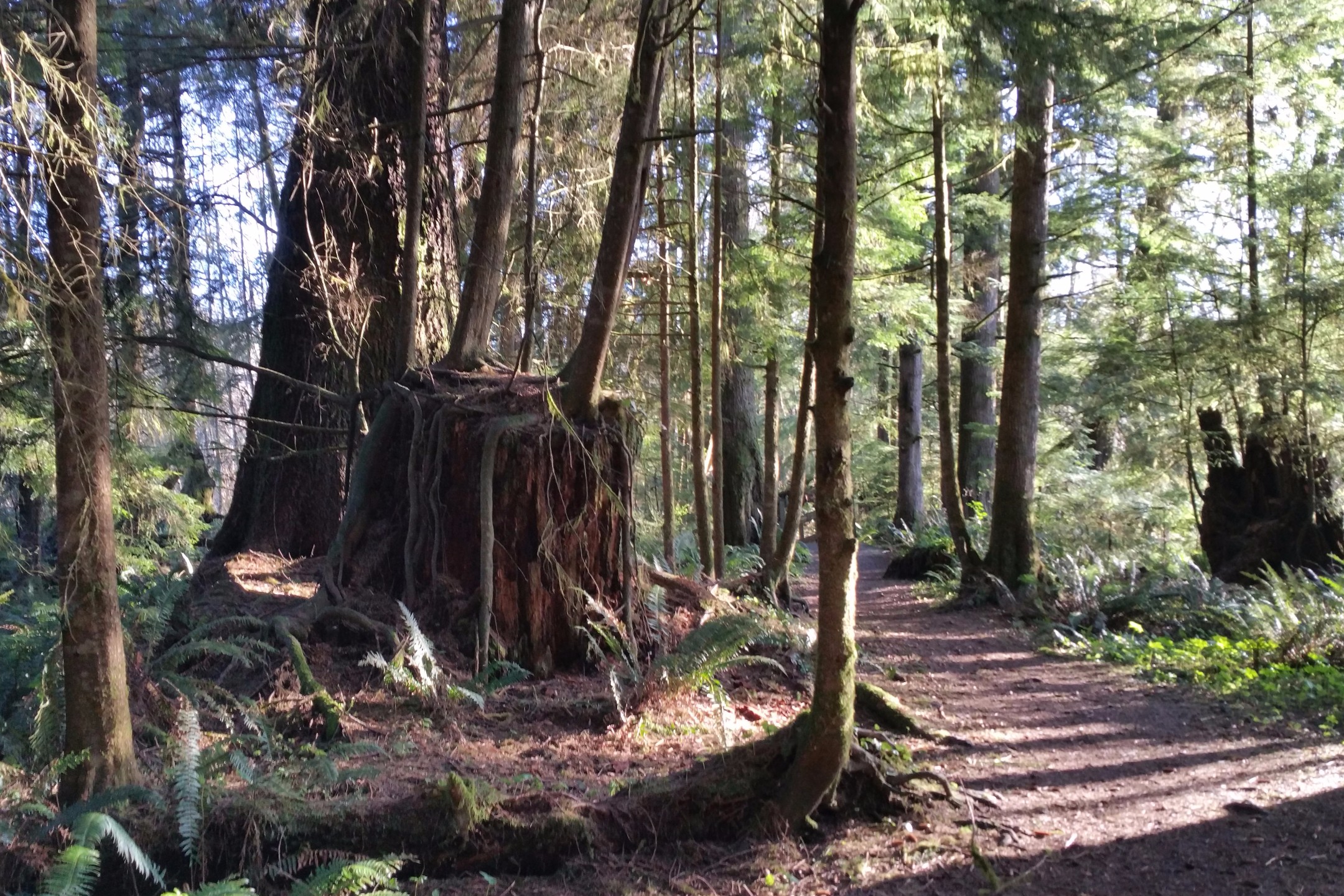
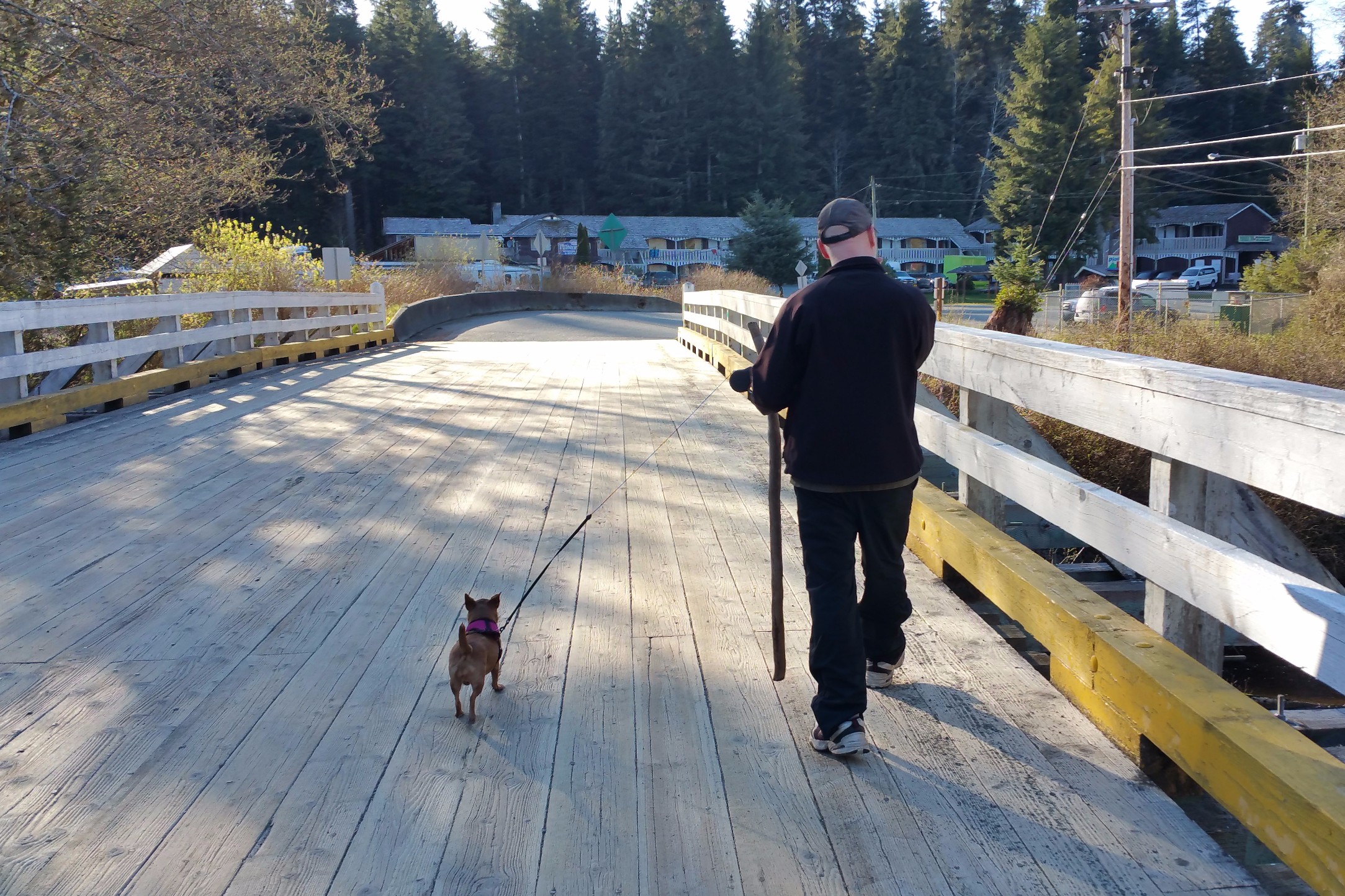
We arrived at the Quatse River campground on Tuesday and had our pick of camping sites. We walked around to find the very best one, finding it hard to decide. We settled for a site on the banks of the river. We ended up moving two sites down shortly after when a giant bus-camper from Florida showed up and marred our view. Before the sun went down, I took James on a walk on the Quatse loop walking trail. I lived in Port Hardy in 2009-2010, and I used to spend a lot of time on that trail. I was under a lot of stress, so the Quatse Loop Trail, with its tall and ancient Emily Carrish trees and cut-off-from-the-world feeling, provided me with a sanctuary of peace. I was delighted to share it with someone, especially with James who also tends to like that kind of thing.
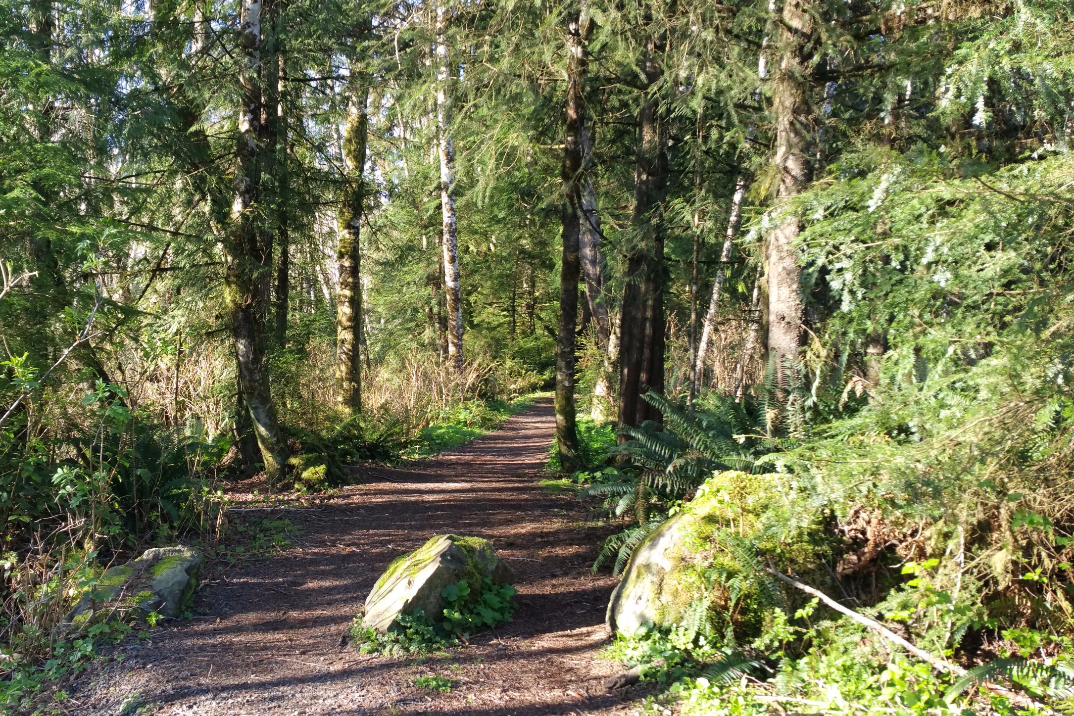 Quatze Loop Trail.
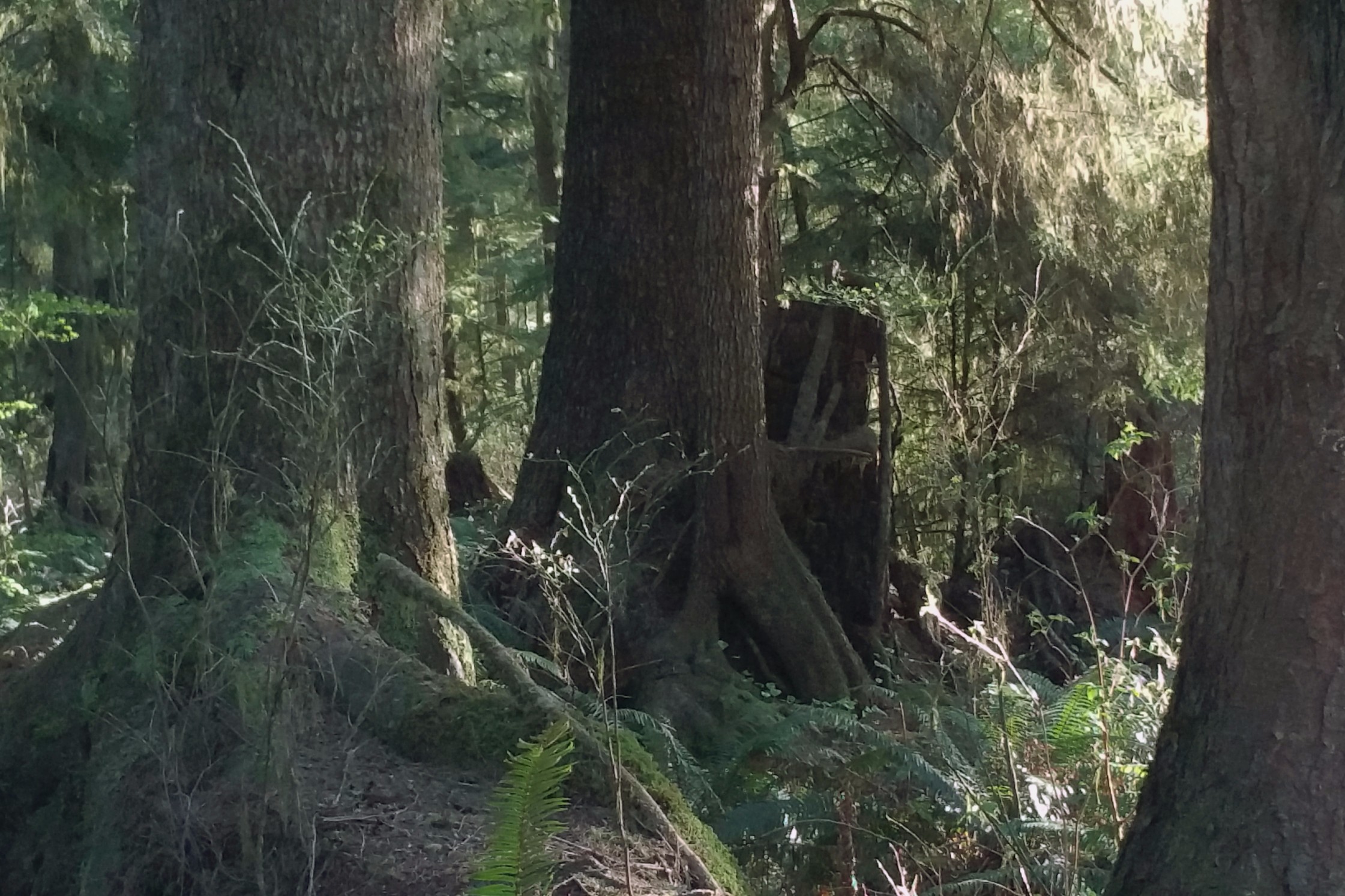
 Quatze Loop Monolith.
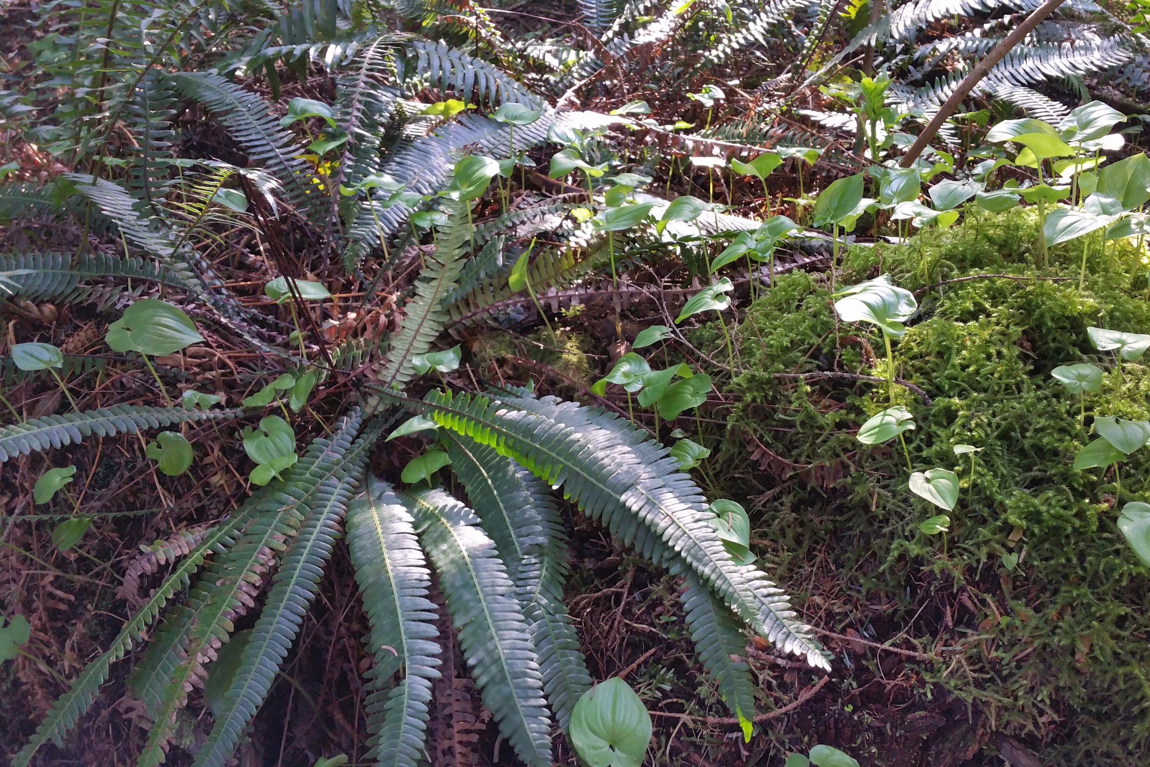 Understory.
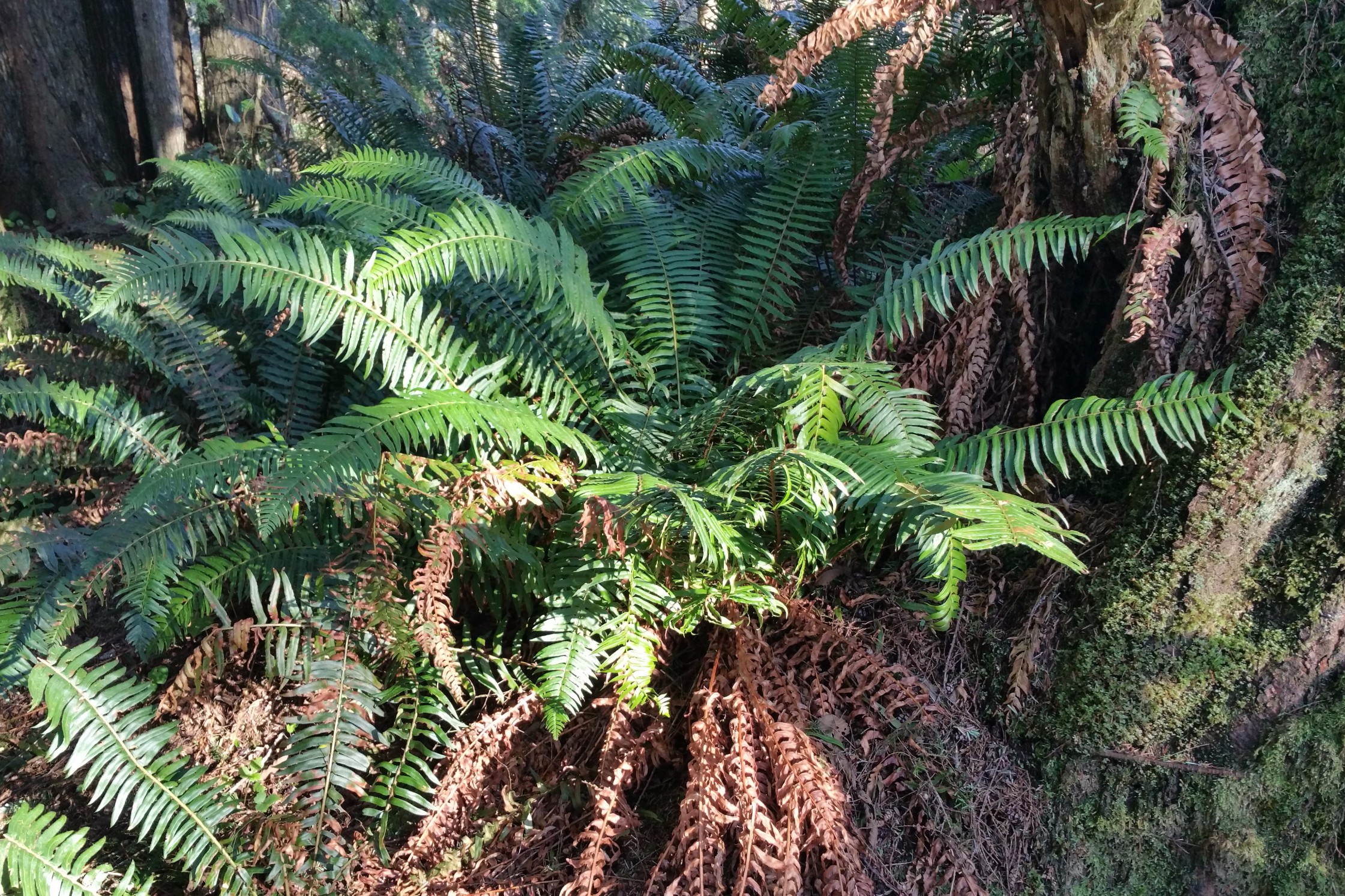 Ferns.
 Mother tree.
 Old souls.
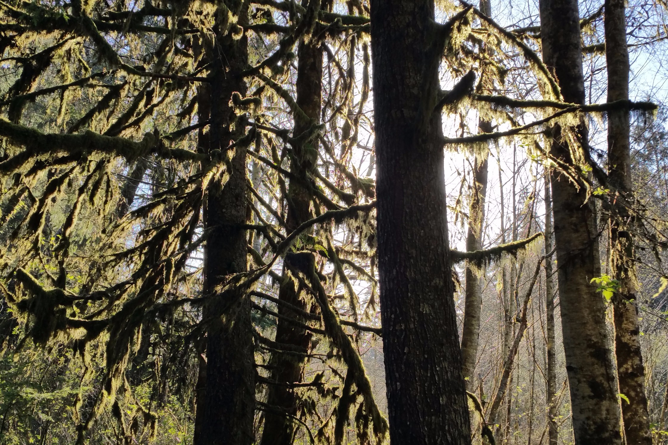 Old man's hairs.
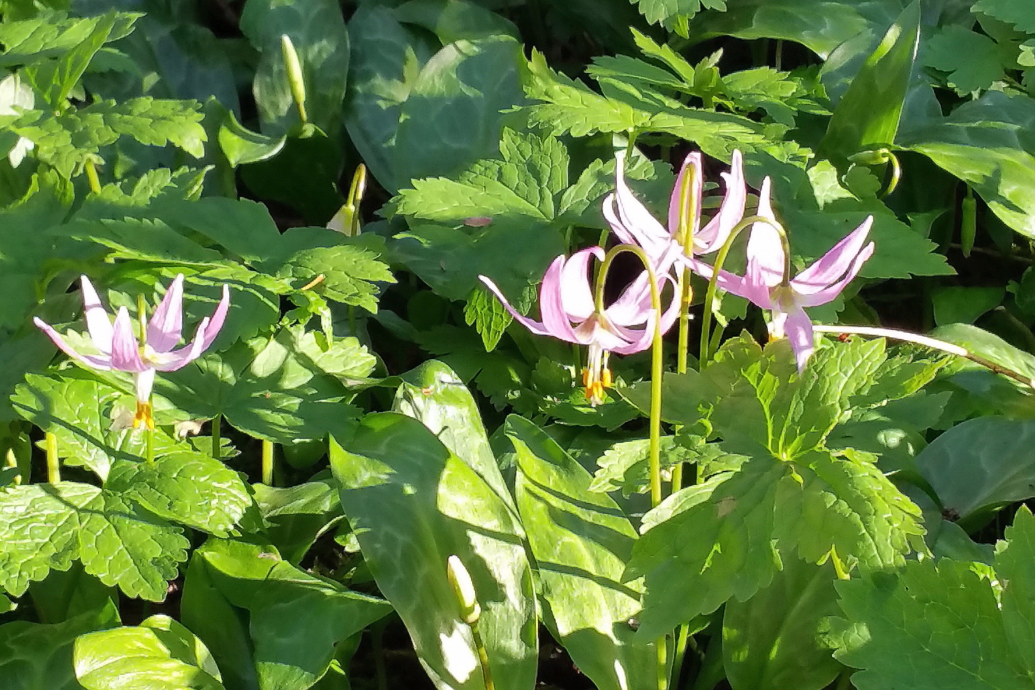 Wildflowers.
 Bank of the Quatze River.
 Back to camp.
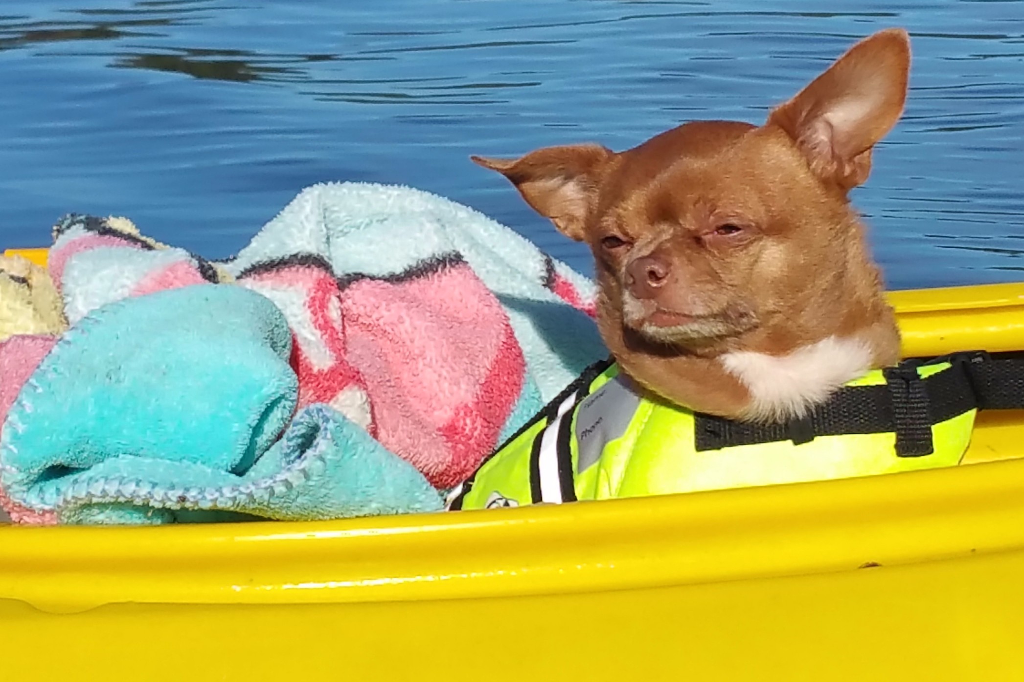
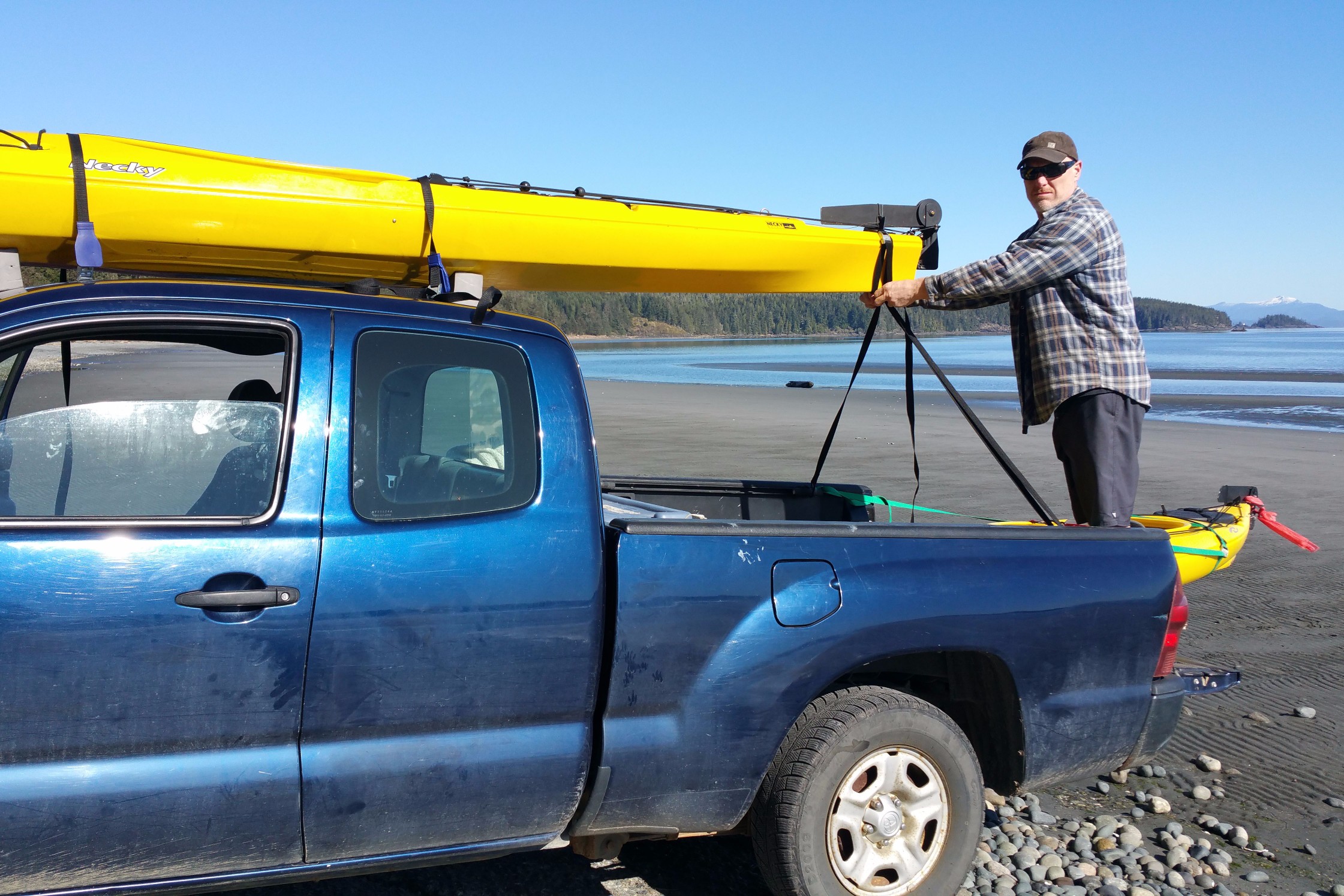
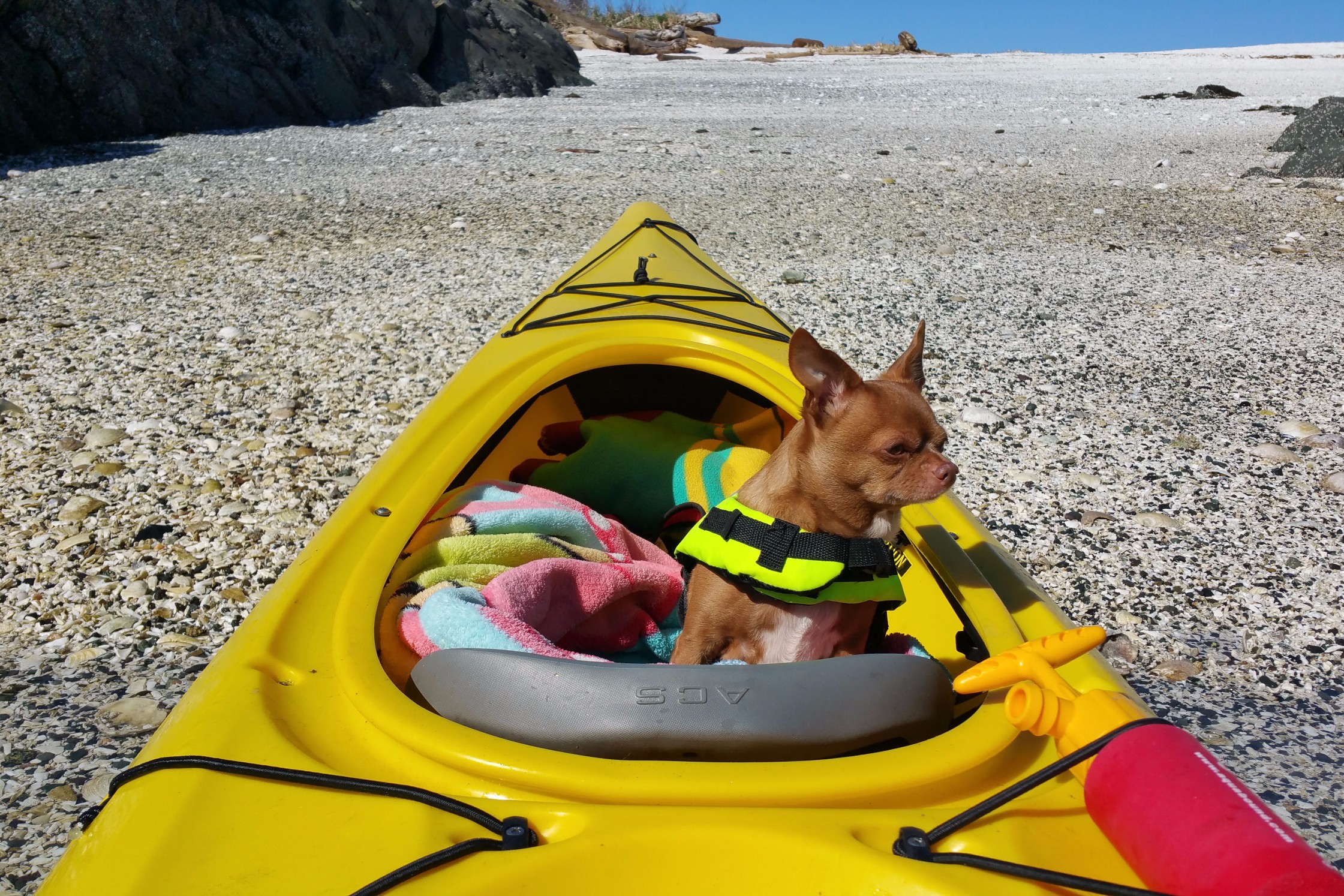
During the day on Wednesday, I did my duty by going to my first aid course at North Island College. After grabbing a quick bite to eat at Mo's, I met James and Chloe at the prearranged kayak launch point at the end of the sea walk on Hardy Bay. There is a little sign there indicating a kayak launch. I've walked by that sign dozens of times and never saw it before: it is interesting how what we see is so selective. I suppose our brains would be overwhelmed if we processed everything we saw. I think this applies to nature: it is such a complex system, I think we have barely begun to know all that is there. The First Nations people from thousands of years ago might have been a lot more aware, knowledgeable and sophisticated than we industrially-oriented "modern" people could begin to fathom. Methinks Mother Nature has been posting a lot of signs in our reality lately, and we have been missing all but a scant few of them. James already had both kayaks on shore and was ready to go.
 Daddy cares.
Then we wondered where to go.
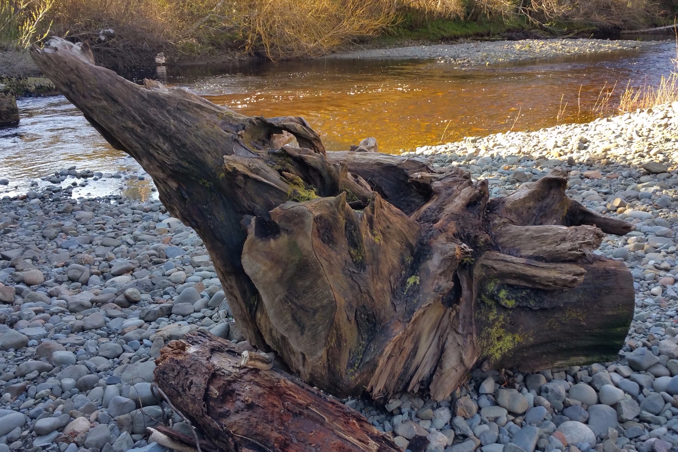
We thought about going north but, with the wind, the water was sure to be rough where it was open to the Queen Charlotte Strait. We decided to head south toward the Quatze River estuary—the "industrial" area, which, surprisingly, turned out to be a lot of fun. It was a novel switch from our usual remote adventures with no or hardly any people around. We took photos of a big barge loaded with heavy construction equipment, as well as a float plane coming in for a landing overhead. We paddled around the estuary—parts of which are solid ground at other times of the day—easily seeing the sand and rocks under the water and sometimes almost running aground. At low tide, this area becomes a sandbar and a graveyard for dark, spooky, dead driftwood tree creatures. A few of those creatures were still sticking out of the water. We came close to a couple of them to pay our respects.
 Hey baby? Paddling my way?
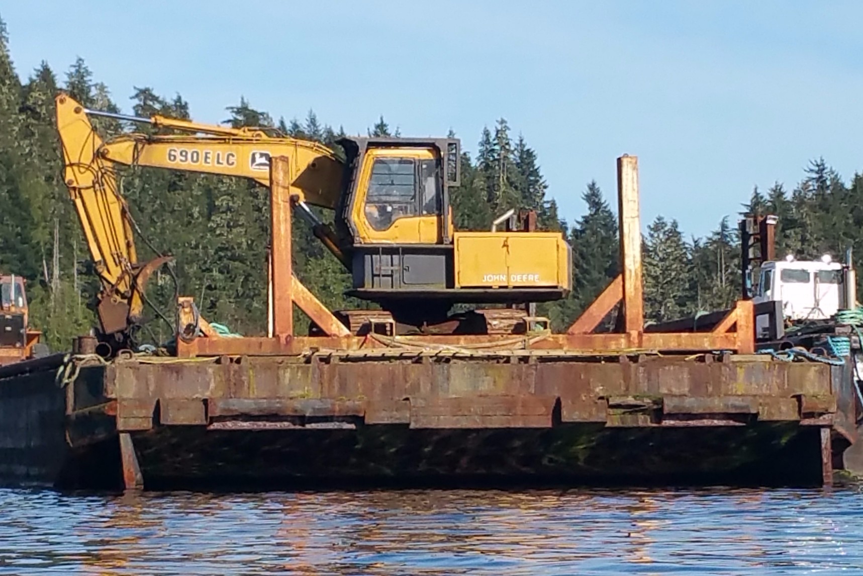 Barge with crane.
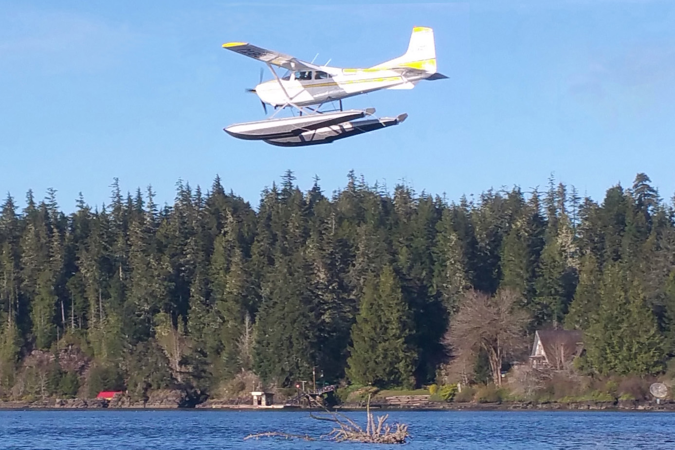 Float plane overhead.
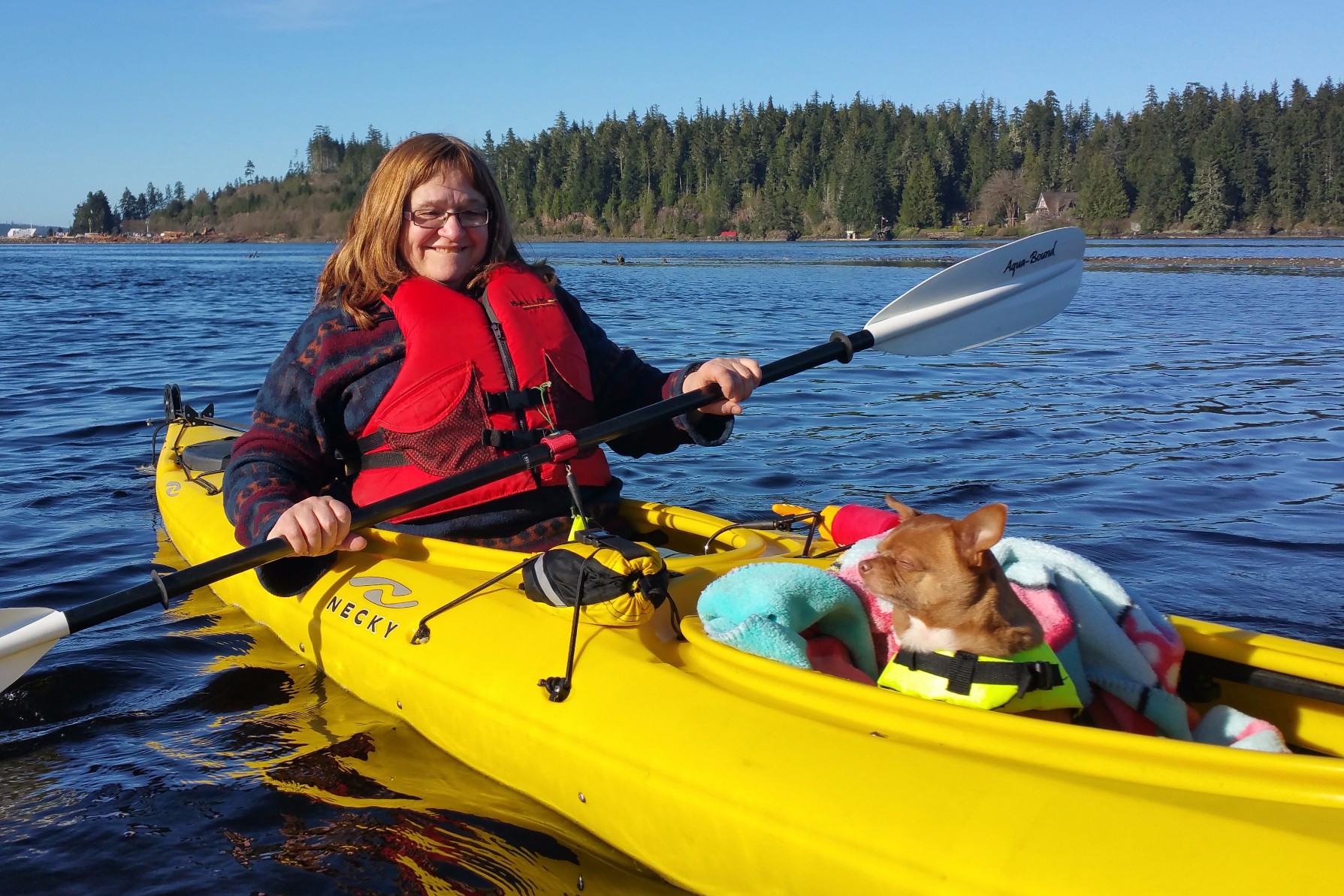 Mommy and Chloe.
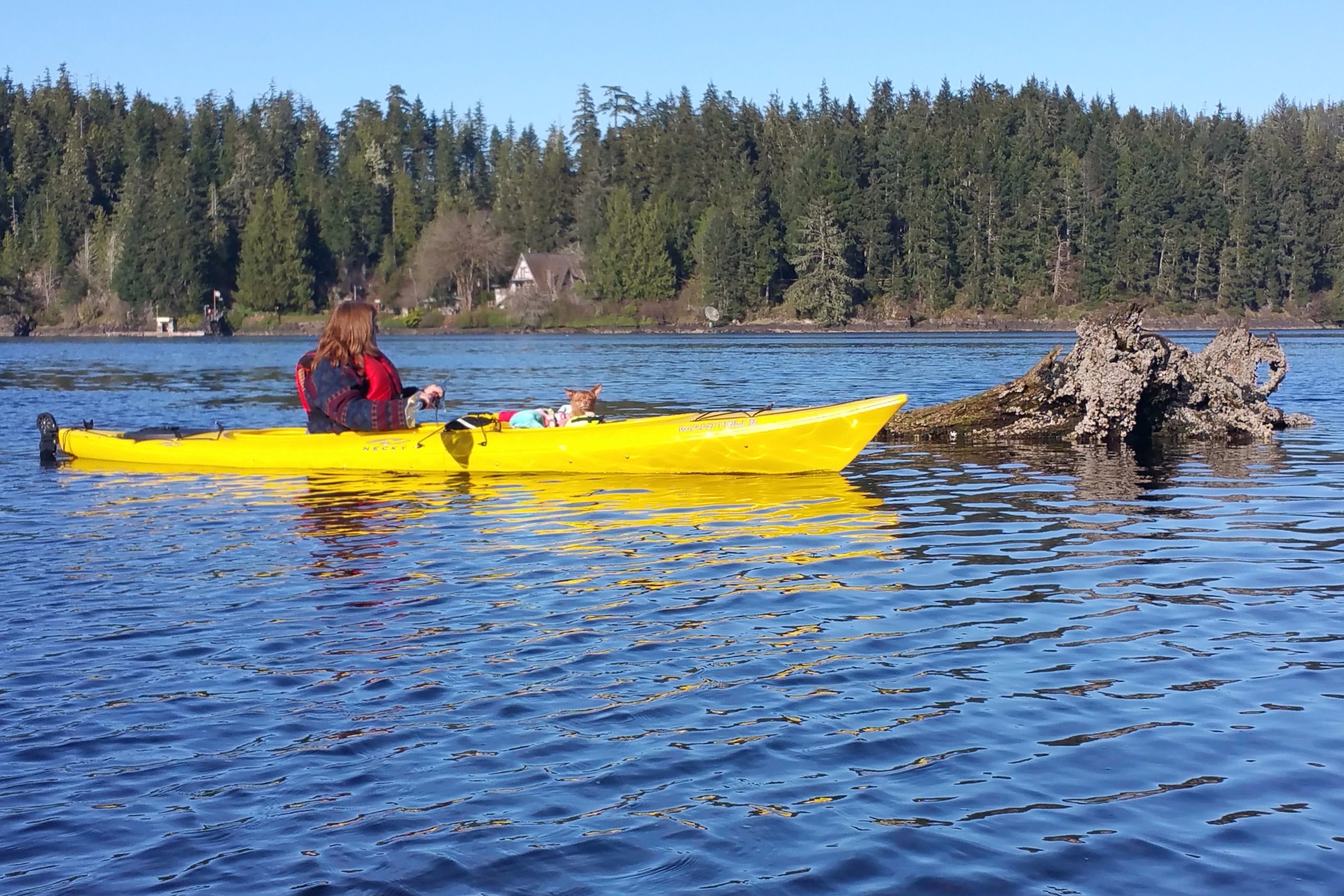 Paying respects.
 Steely-eyed captain.
We found a spot for a picnic on the east shore. As we ate, we were the main attraction for an audience of seals peeking out of the water. On our way back to the launch point, we came across a couple of teenagers pretending to try to push each other off of a very high pier and looking, perilously, like they might succeed. I told them to "be careful" but was totally ignored as they seemed to be having a whale of a time. Instead, I paddled slowly and kept watching them until they looked like they were out of danger.
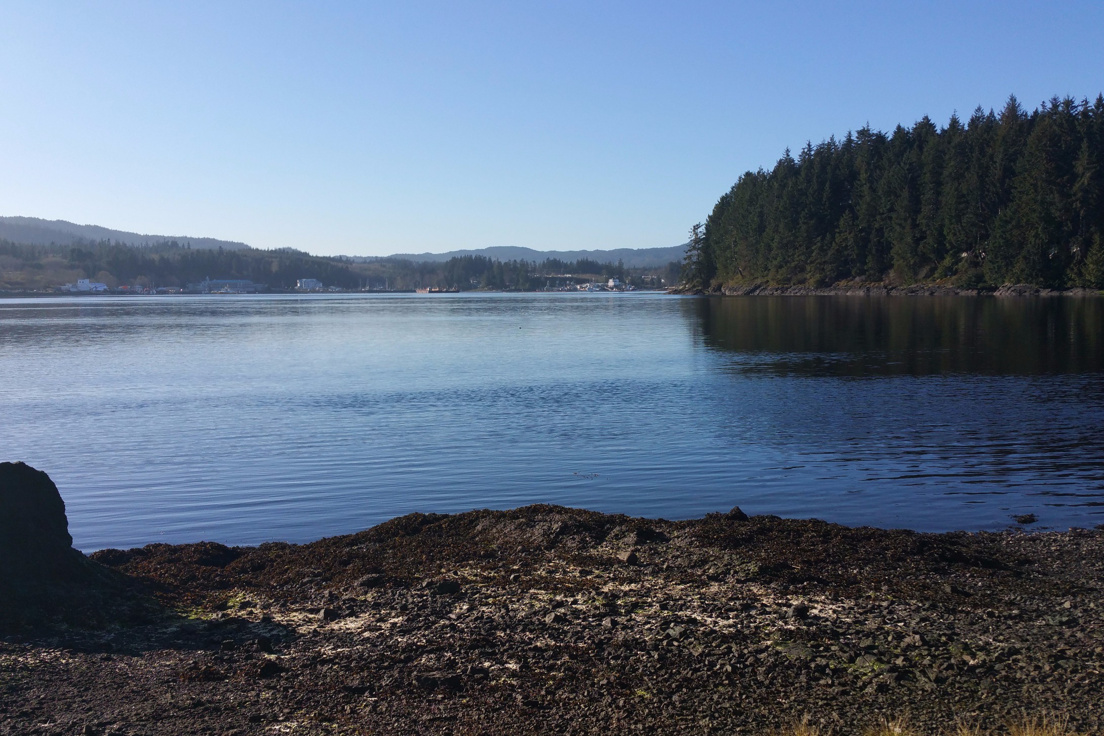 Quatze River estuary.
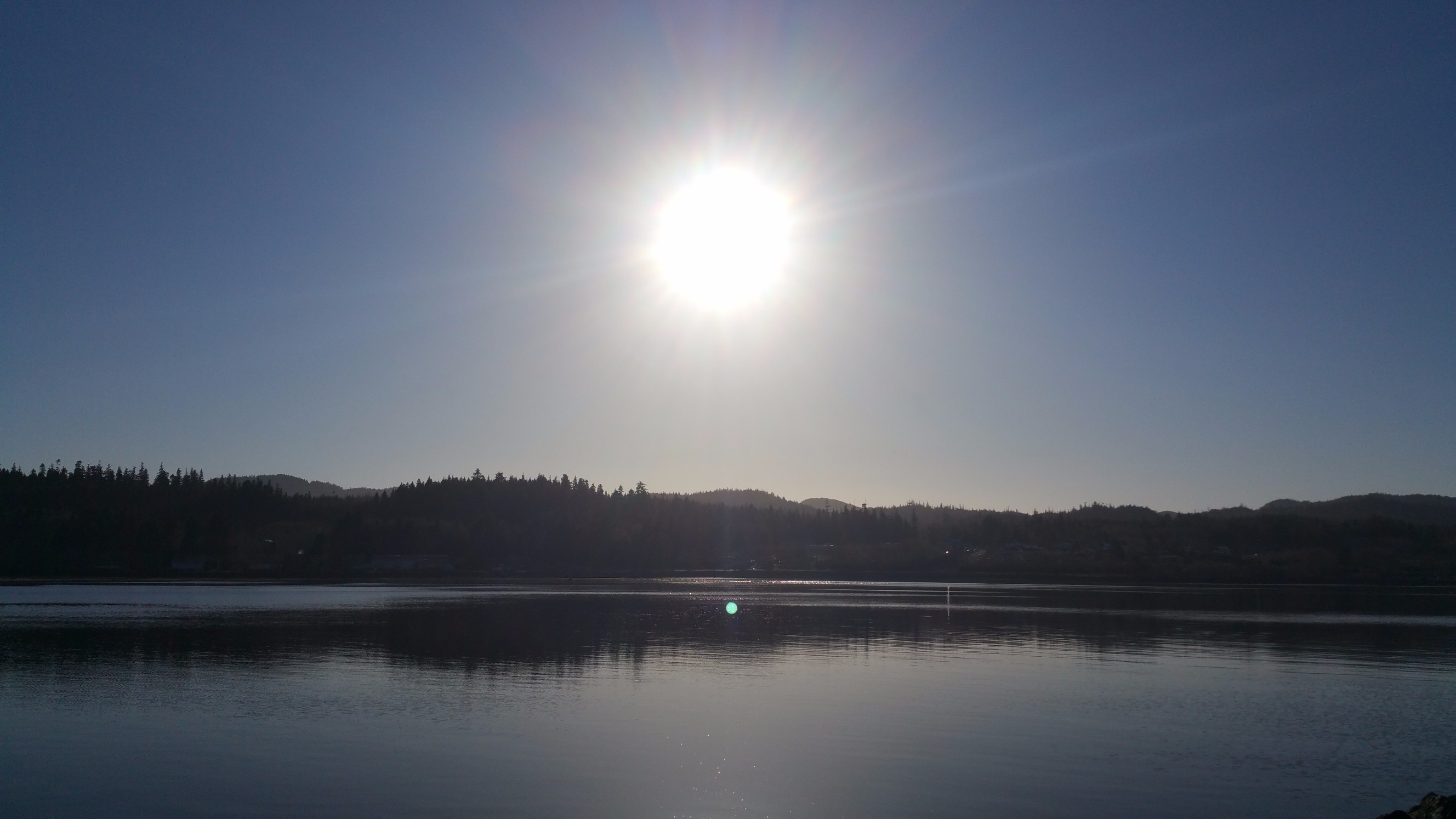 Setting summer sun.
 Creek bed.
Coming back into Hardy Bay, we saw a couple of lighthouses, one by the fish plant and close to shore, and one in the middle of the bay. I looked longingly at the lighthouse in the centre of the bay. Even though I hadn't said a thing about it, James told me that going to the lighthouse wasn't going to happen this time because it was too windy, the water was too rough and it was too late in the day. Remembering our paddle to the lighthouse on Neroutsos Inlet, I wasn't going to argue.
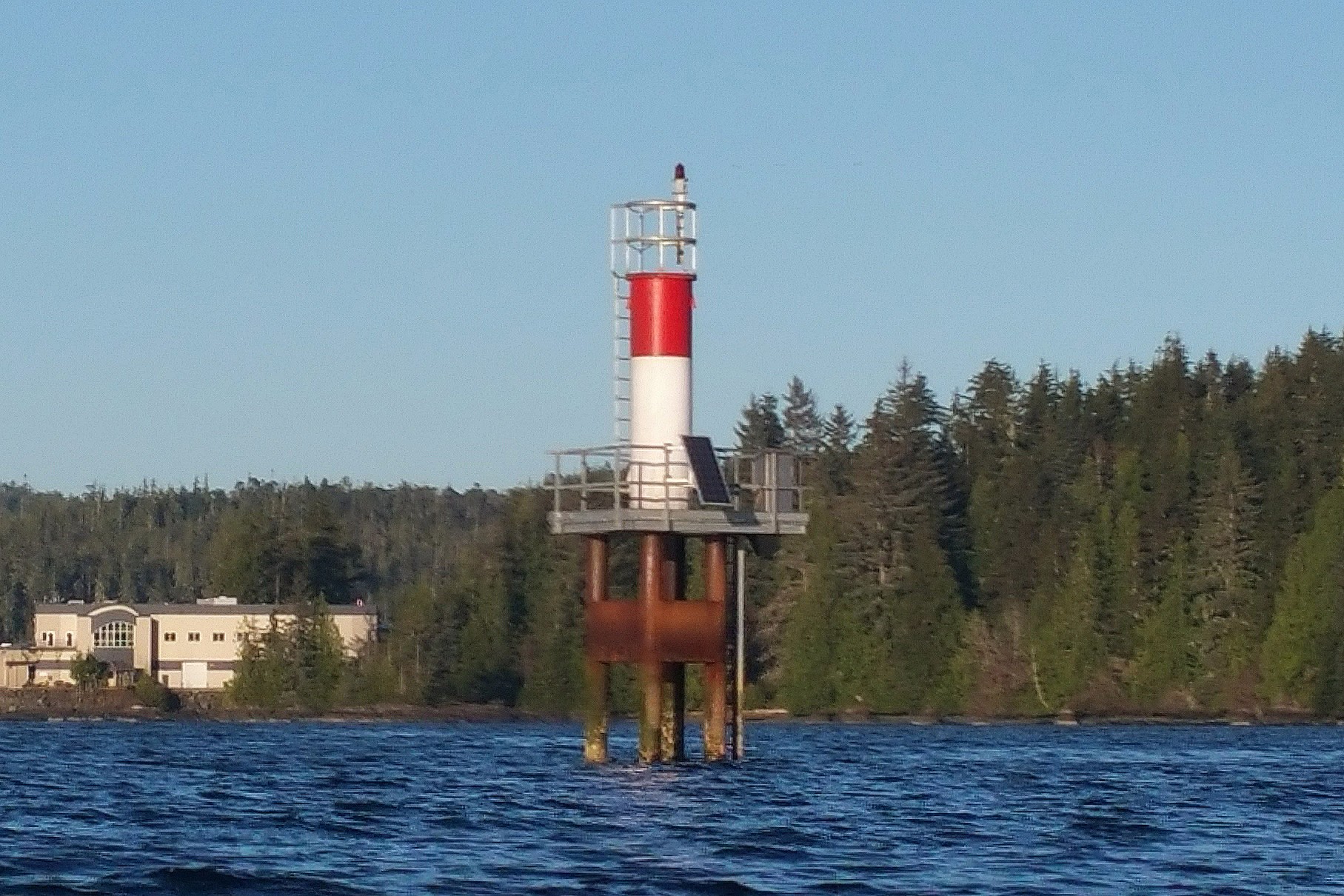 Lighthouse by the fish plant.
 Sunset Landing.
 Sunset on Hardy bay.
Our eventful day was not over. After kayaking, we went to visit James' son, Dakota, and daughter-in-law, Cassandra, and our new grand-daughter, Gabby, born in December. Back at the campground, we sat around the campfire and marvelled how bright the stars were in the March night sky. We talked about them and wondered what we were looking at. Then, James realized, that there must be an app for that! Sure enough, there was! We discovered the star that puzzled us the most was actually Jupiter. It was then that I realized—for the first time in my life—that the brightest stars that appear first in the night sky are planets. What was actually Jupiter, I used to think was the International Space Station. Before the internet, it seems like we were living in the dark ages!
Since we were camping in March and the nights were long, we ended up using a lot of firewood. It was chilly one too, so an extra comforter was must. After all, we were only a few days out of winter.
Storeys Beach, March 31, 2016
We planned our trip around the weather report and it fulfilled itself exactly as predicted: three sunny days in a row with the temperatures in the mid teens! Sometimes the weather guys do get it right! On Friday, when we packed up to leave, the clouds came right back!
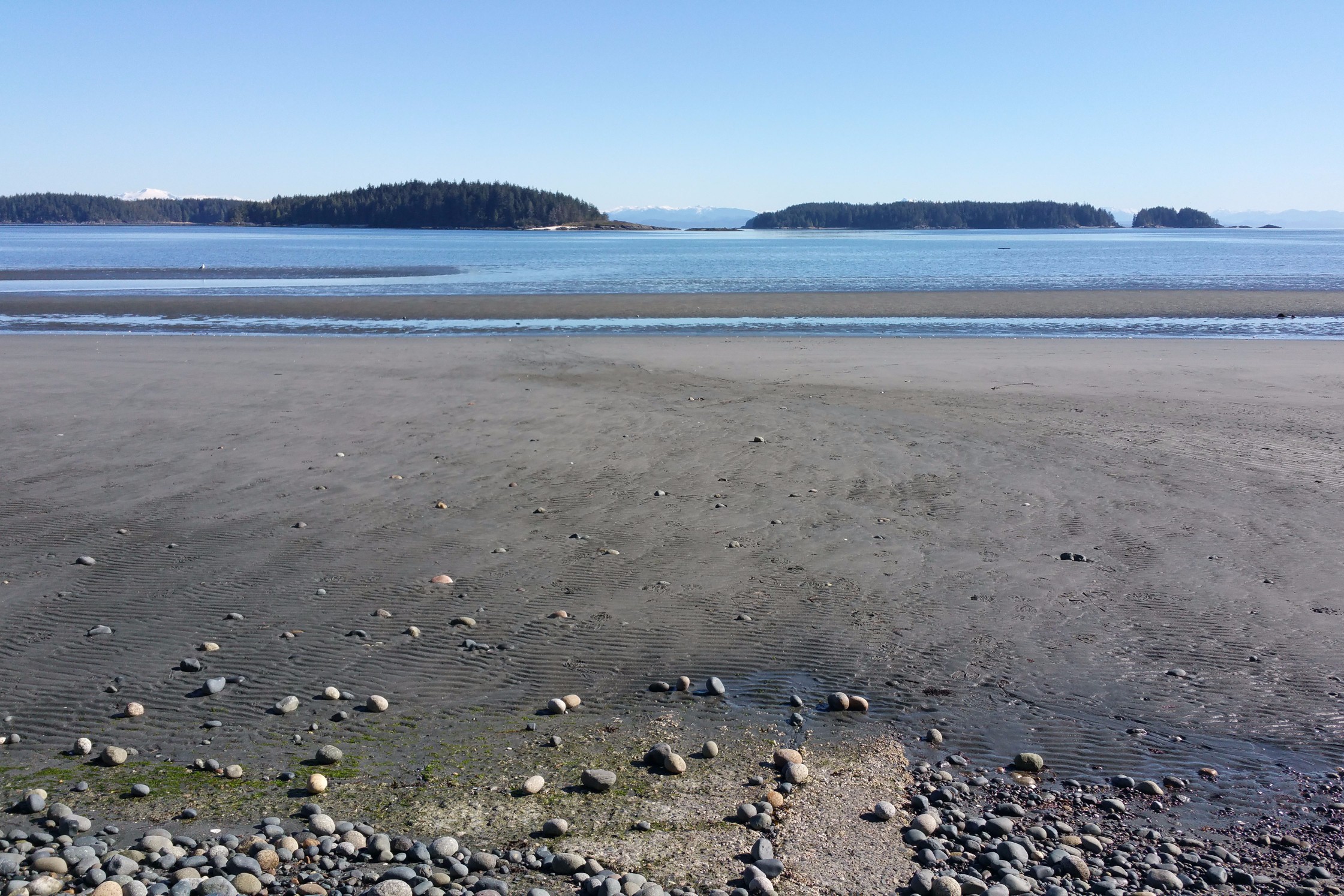
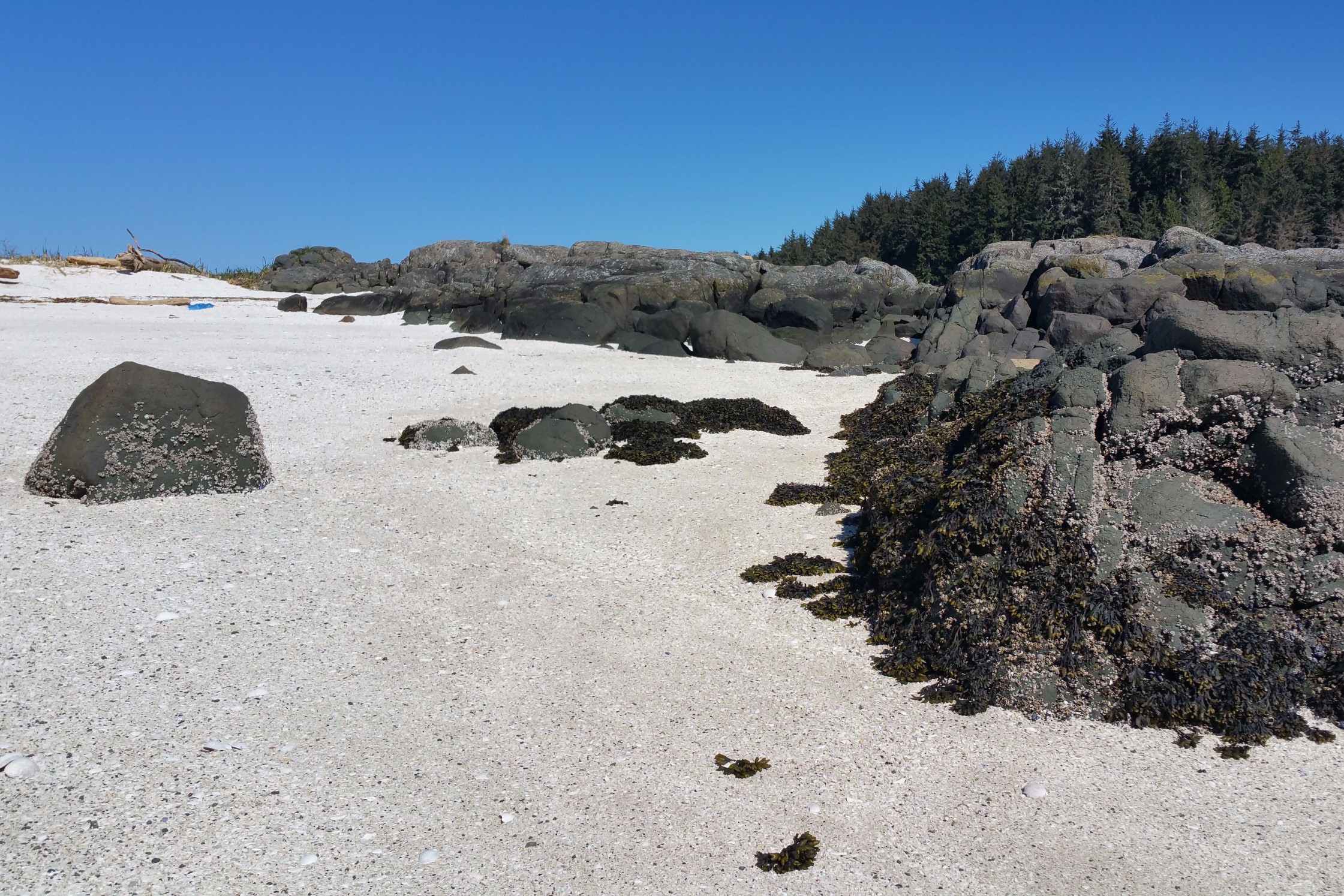
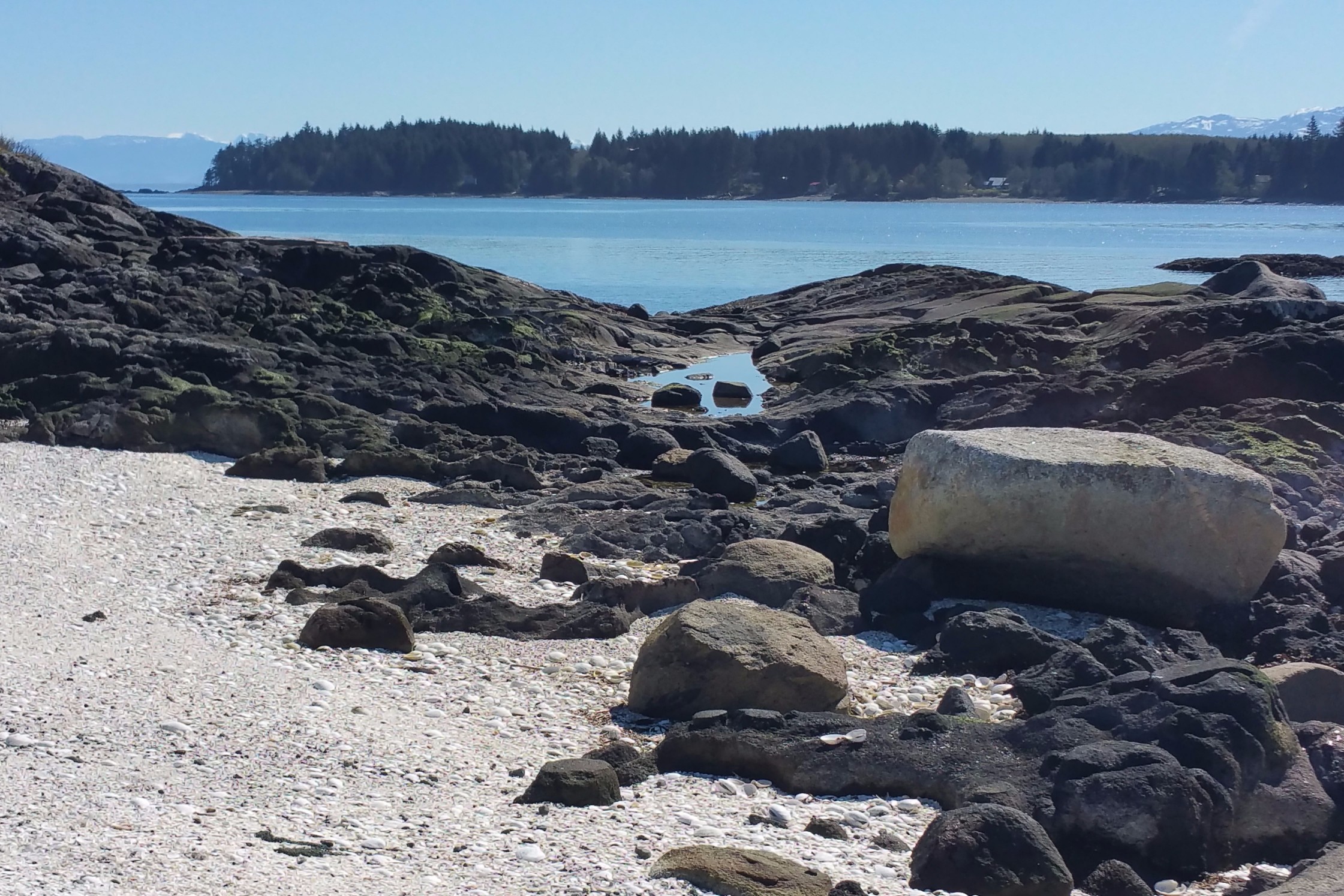
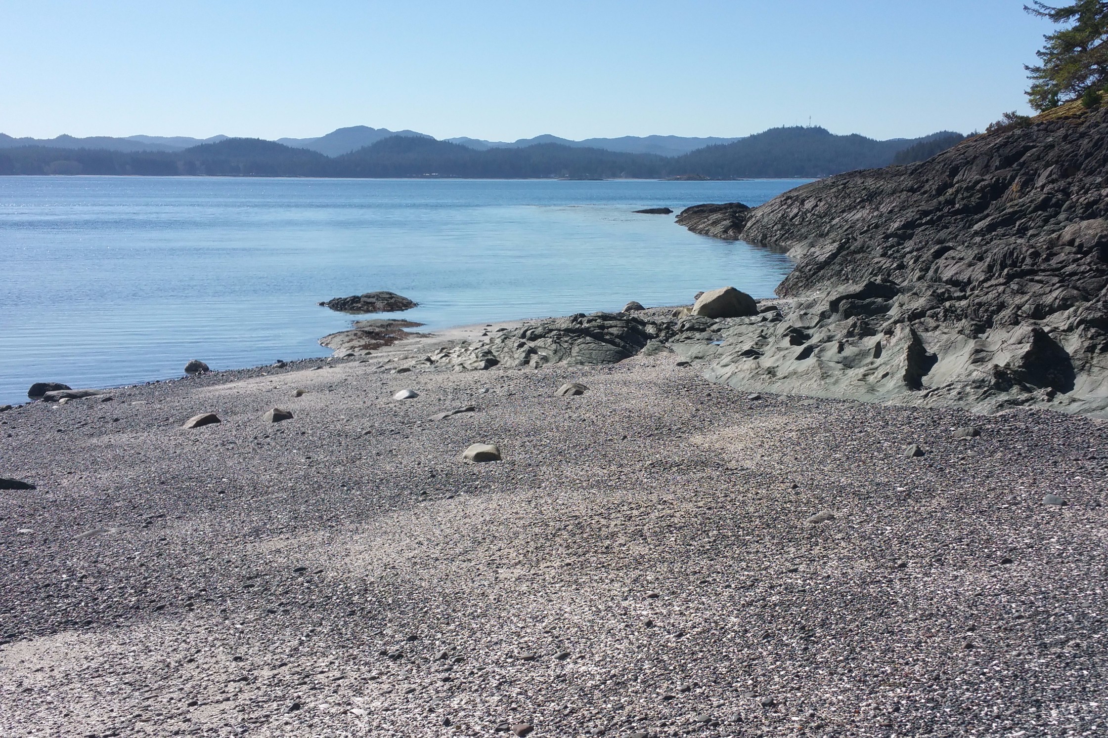
Storeys Beach is the shoreline of Beaver Harbour, located between Port Hardy and Fort Rupert on the east side of Vancouver Island. The shallow bay has four islands in the middle of it: Shell Island, Cattle Island, Deer Island and Eagle Island. This area is the ancestral home of Kwakiutl band of the Kwakwaka'wakw First Nation, and was once a happening place, in pre-European terms: plank houses adorned with carvings and family crests housed extended families engaged in seasonal routines of hunting and gathering, as well as periodic dance rituals, dramas and potlatches. With the arrival of Europeans, a trading post was established on the Nahwitti River, north of town. When coal was discovered in 1836, the Hudson's Bay Company developed a fortified trading post at Beaver Harbour. The hamlet of Fort Rupert got its name from the Hudson's Bay Company governor, Prince Rupert, Duke of Bavaria. In 1887, a former HBC employee who married a First Nations woman, Mary Ebbets, and had numerous children (political leverage), ended up reclaiming part of the land rights of Fort Rupert back to Kwakuitl residents. Although Storeys Beach seemed quite serene and empty at first; it definitely has the feel of a place that has had a lot going on in the past…for thousands and thousands of years!
 Storey's beach.
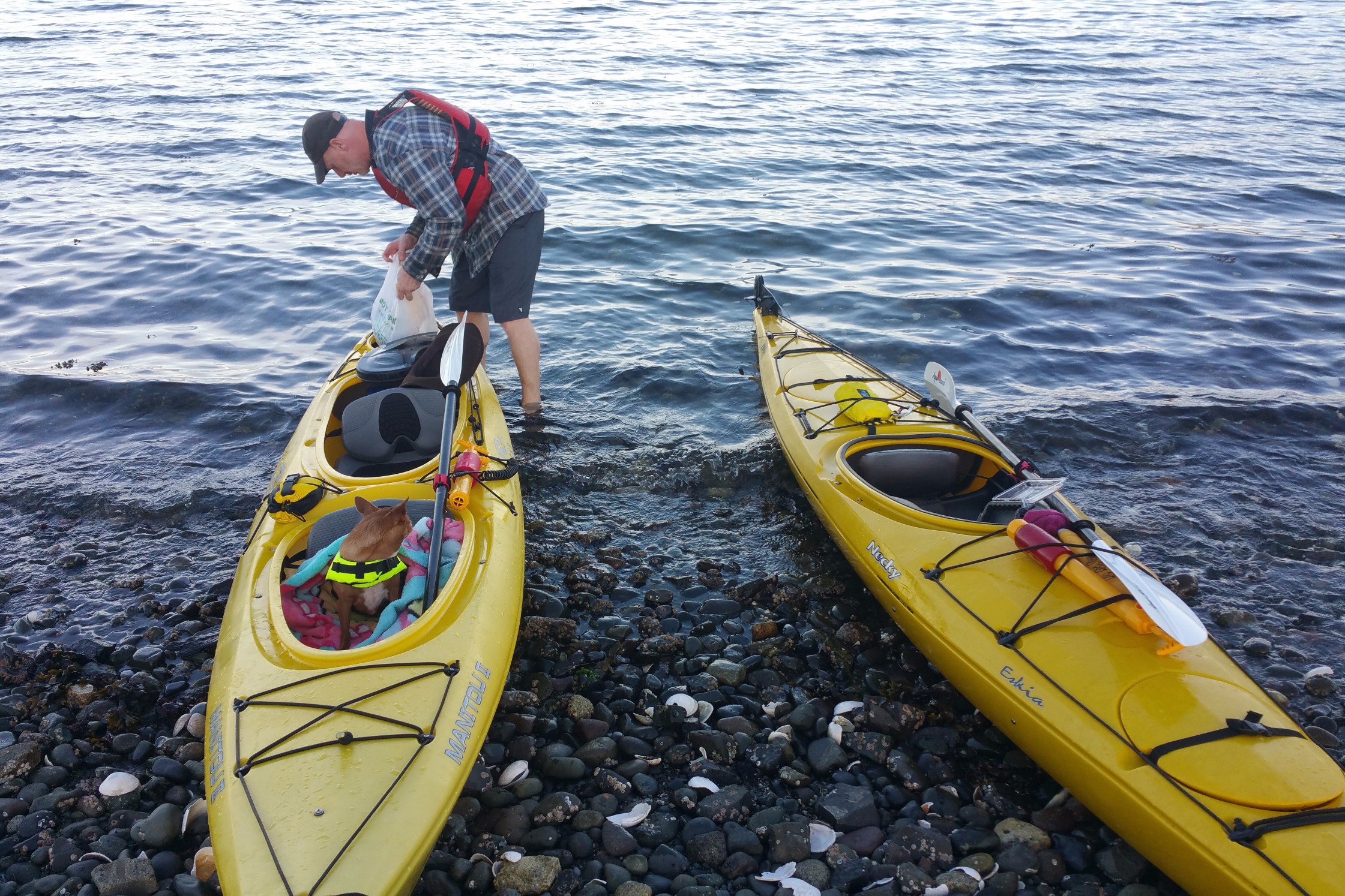
 Unloading the kayaks.
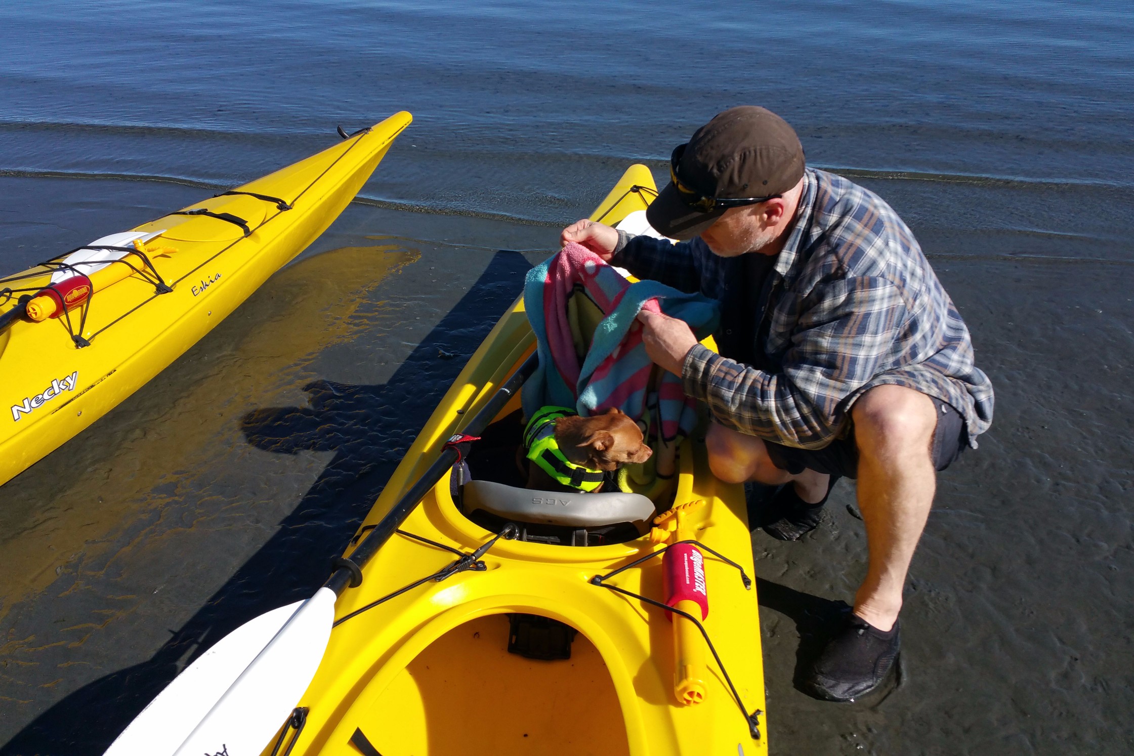
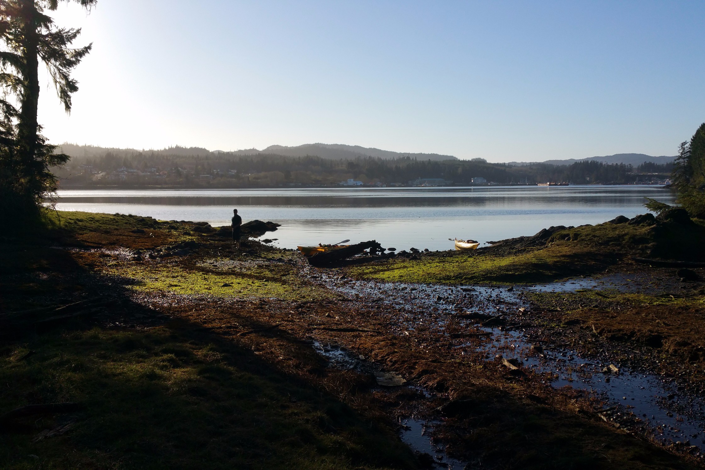
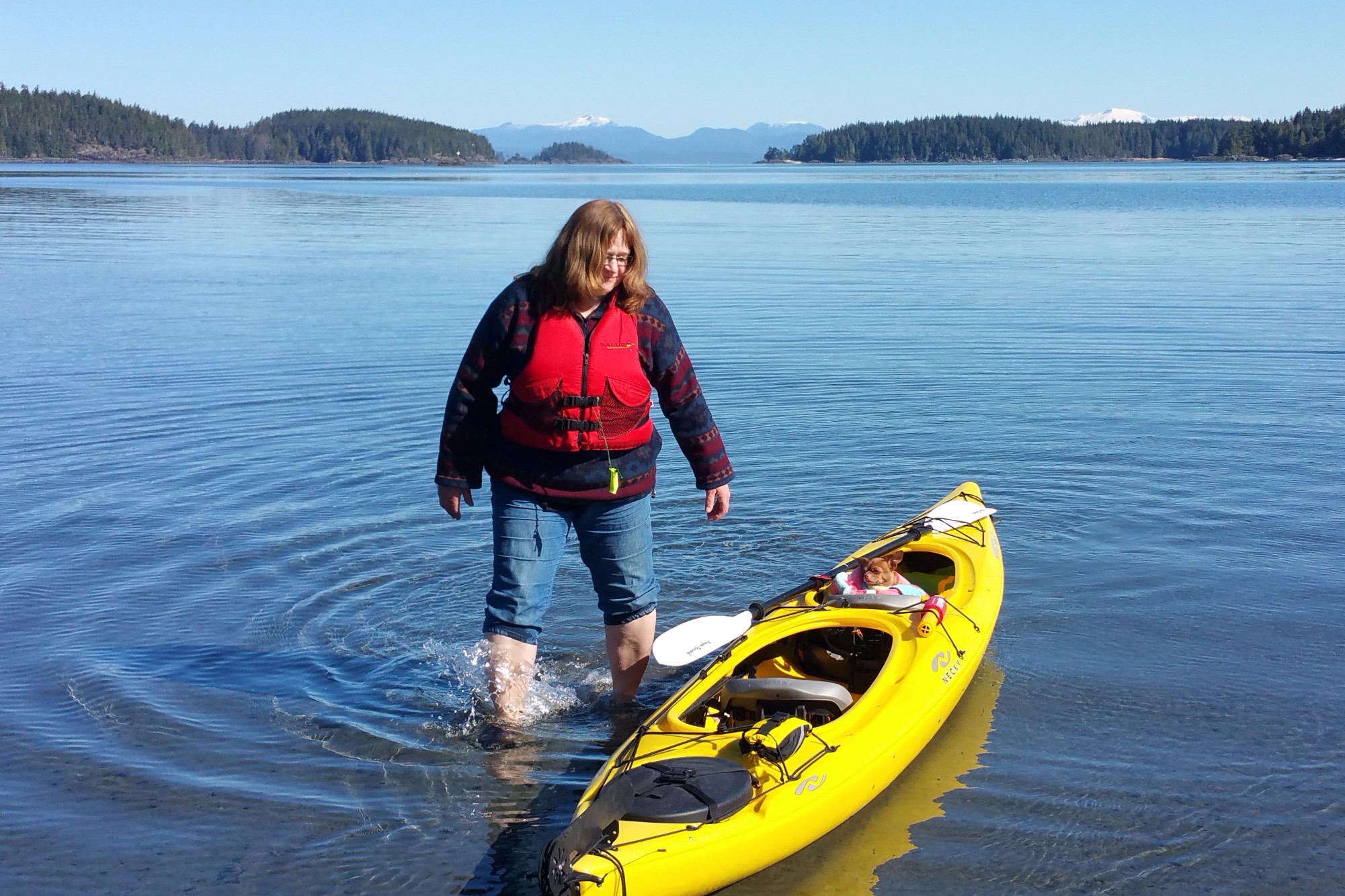
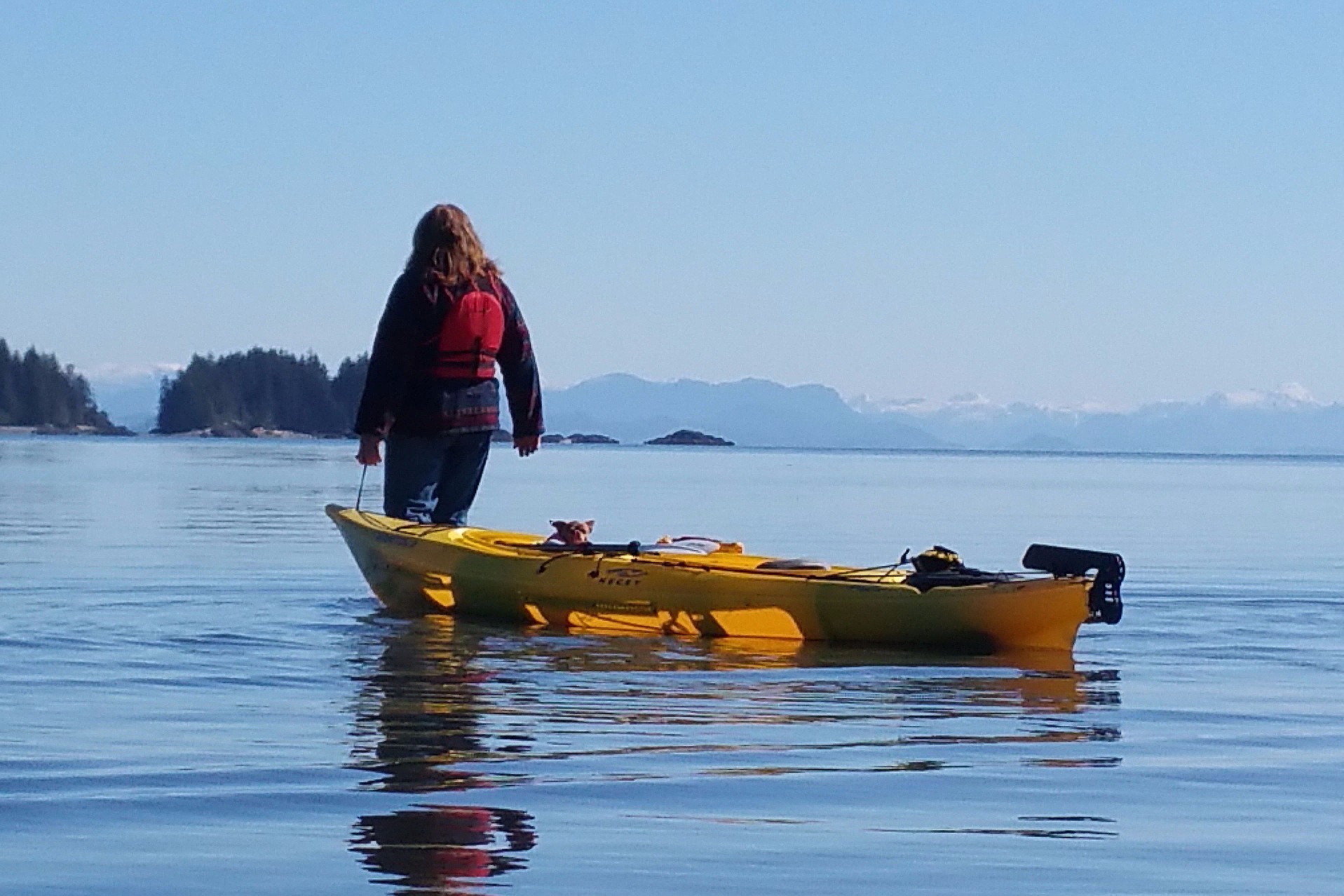
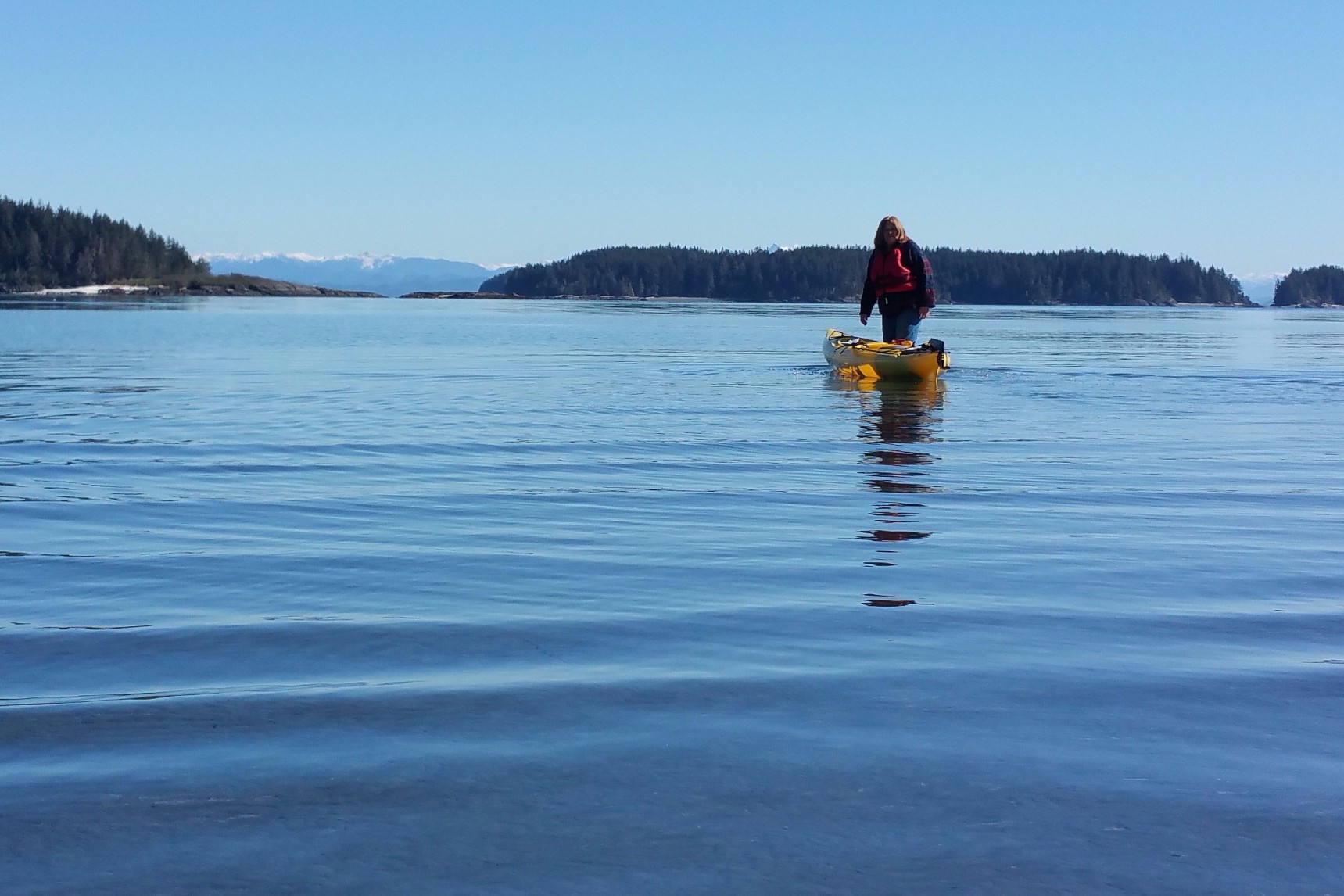
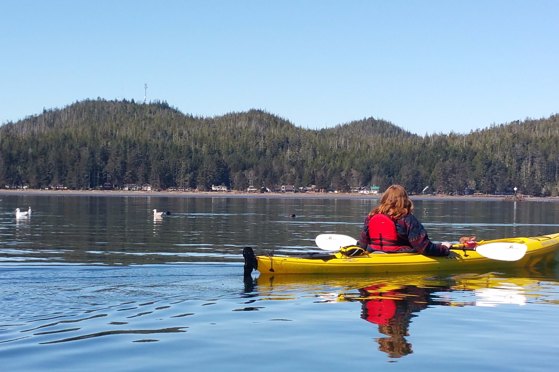
The night before, we checked the weather and the tide guides to make sure we were not launching during low tide…to avoid a long walk with heavy kayaks on the especially wide beach. High tide was a 6:30 am. We launched around 11:30, right in between high and low tide. We didn't have to drag the kayaks too far. I launched in Eeyore (the slow steady kayak) and James was in Tigger (the fast bouncy kayak). I had to paddle carefully, because the water was mere centimetres from the bottom of my boat. Just when I thought I was a good way out and could paddle normally, I got stuck on a sand bar! I said to James "I'm stuck!" perhaps sounding as if I expected him to come rescue me. He does tend to rescue me a lot, and I might be getting a little too used to it. Instead of dealing with a problem by "taking the bull by the horns" right away—as has been my way most of my life — I now tend to hesitate to see if someone else will take care of it for me. He snarked, "I guess you are going to have to get out and walk!" I replied, "I know that!" I got out and walked, pulling the kayak with Chloe in it. James snapped a few shots of me walking on water.
 Launching.
 Walking on water.
 Still walking.
Shell Island is a hang out place for all kinds of birds, mostly seagulls, though we did see some rather unfamiliar birds, including Harlequin ducks. When we approached, our arrival caused a kafuffle. Some birds took to flight, and others swam hurriedly away from us. Paddling in between Shell Island and Cattle Island, we saw two immature sea eagles perched on rocks, looking dopey and innert. At first, we thought they were Golden eagles, which is a common mistake. Young eagles look like Golden eagles until they mature and develop the dark brown body feathers and white head feathers. James came in close to snap a photo. The bird didn't move, seeming to enjoy the notoriety—or he was just too young to know any better. Seals were playing peek-a-boo with us. We drifted through the murky whitish (because of the shells) greenish water between Shell and Cattle Island, surrounded by tiny jumping fish, when we saw what looked like a totem pole and little fountains of water squirting out of the shore. With all the eagles and squirting somethings, we decided a landing at Shell Island was warranted.
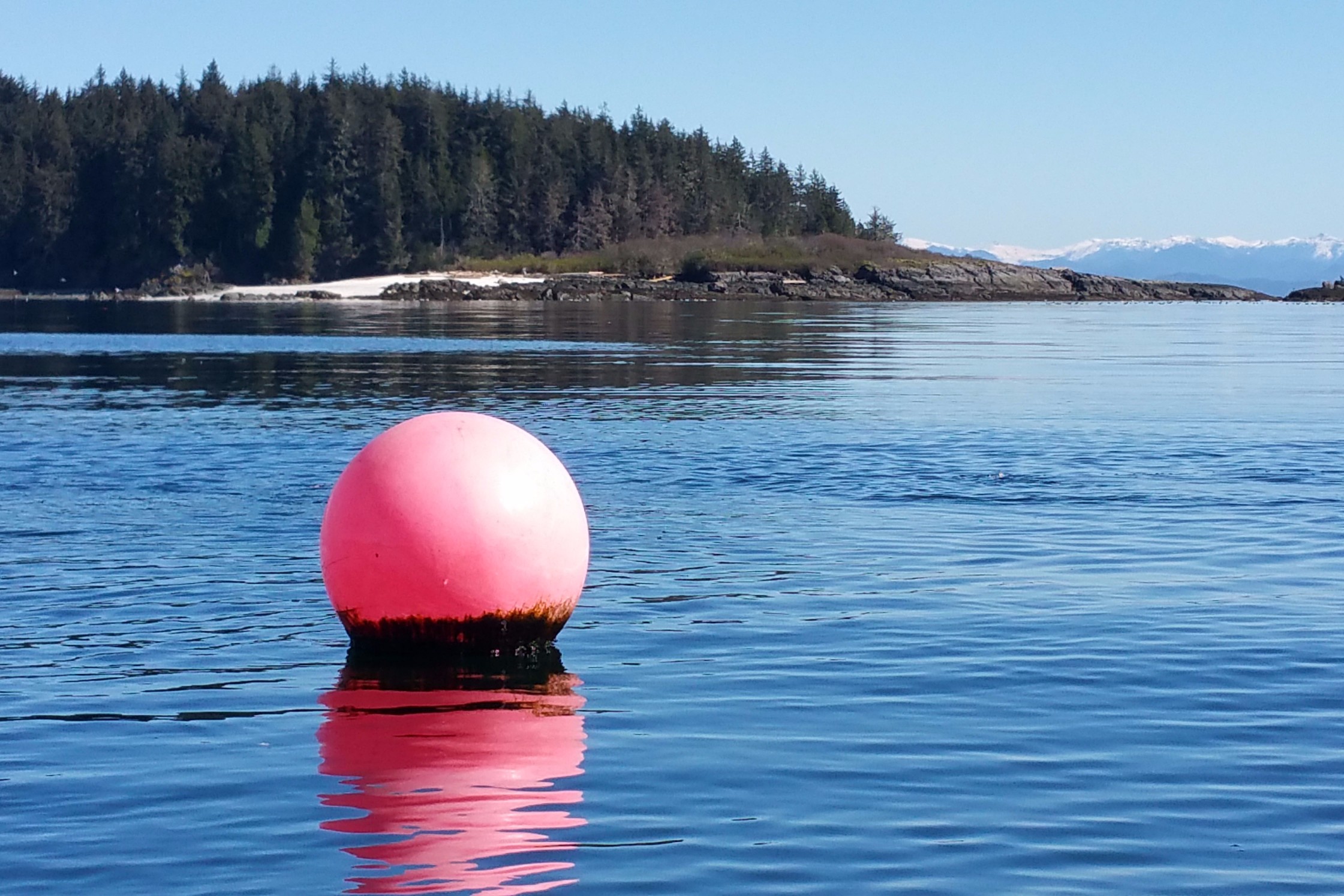 Crab trap buoy.
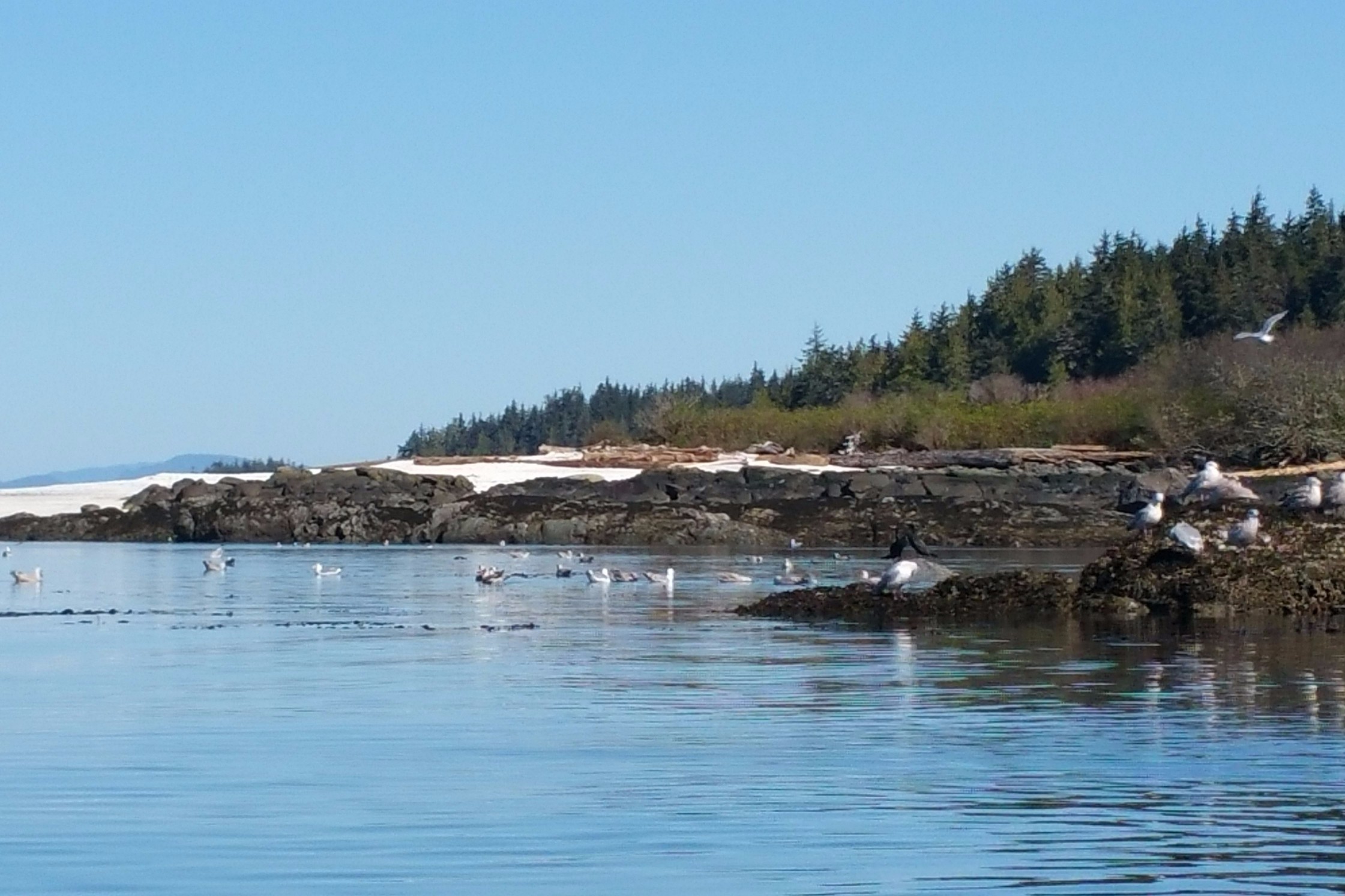 Bird sanctuary.
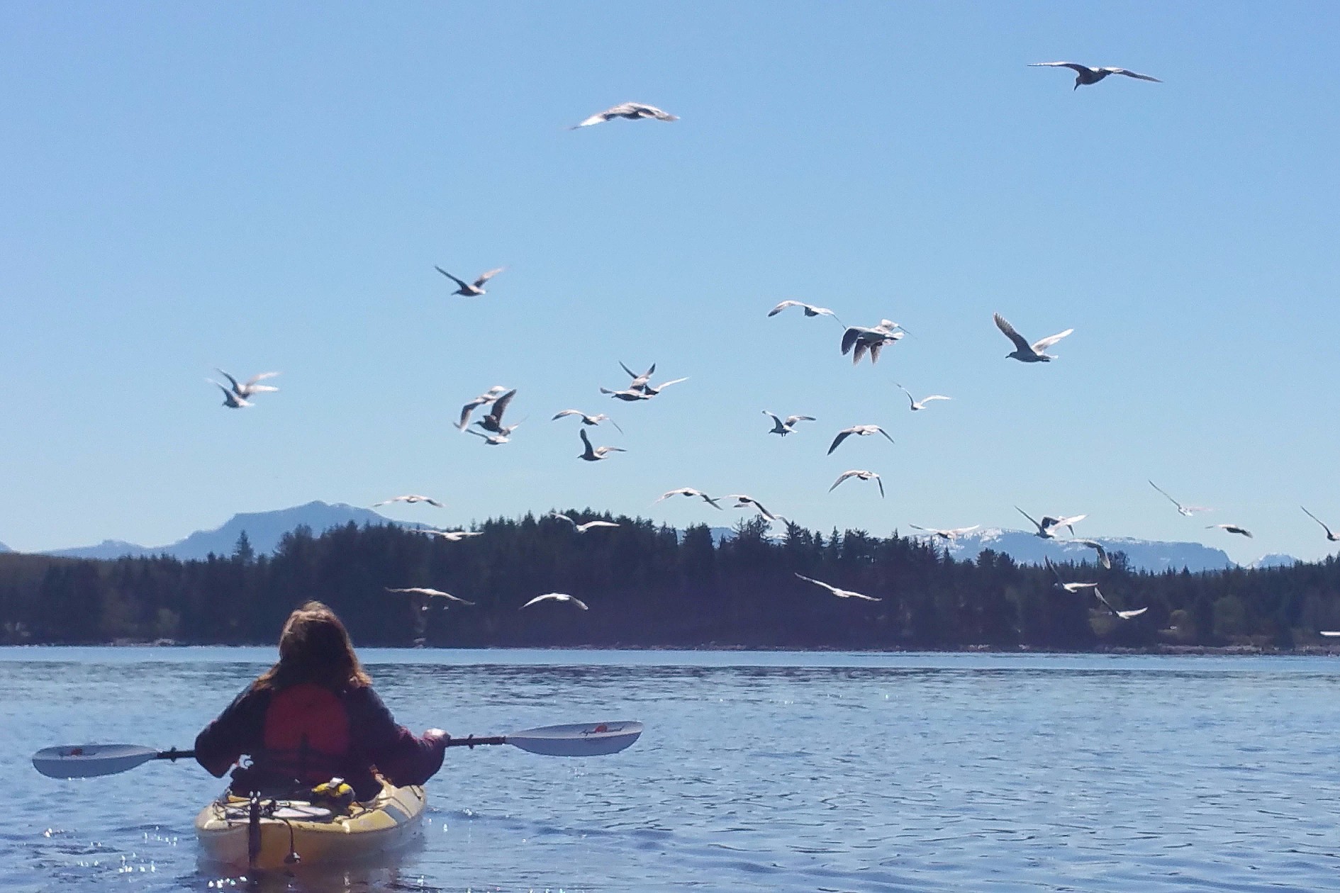 Causing a kafuffle.
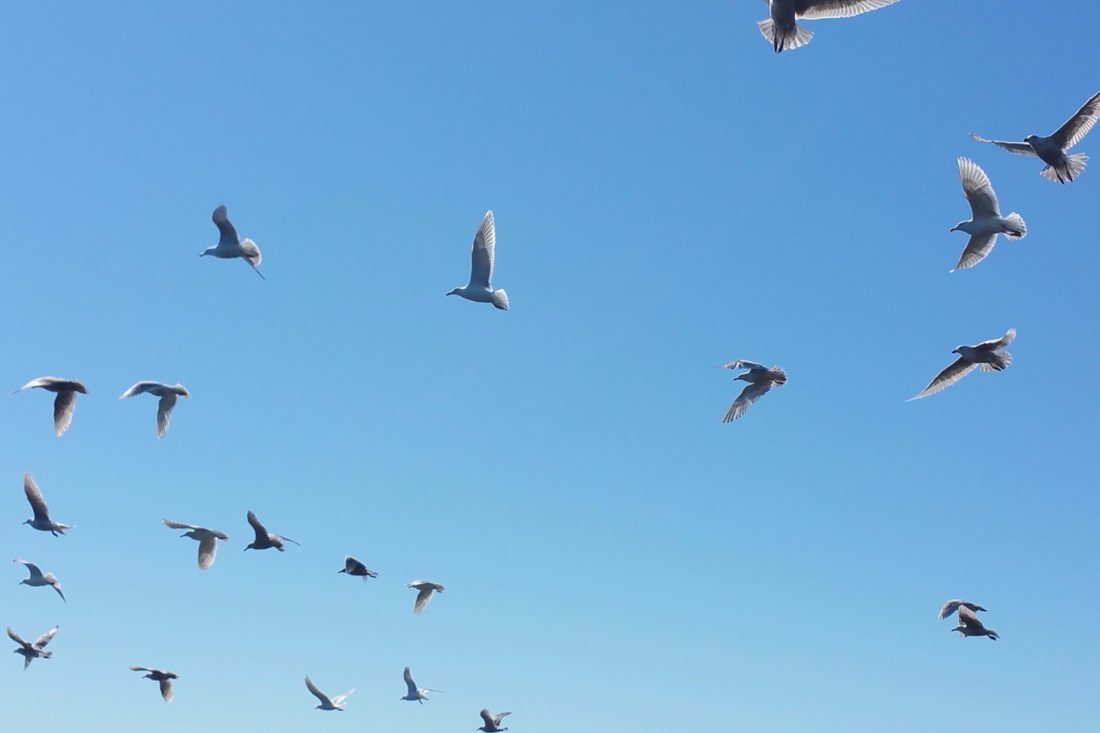 Birds take flight.
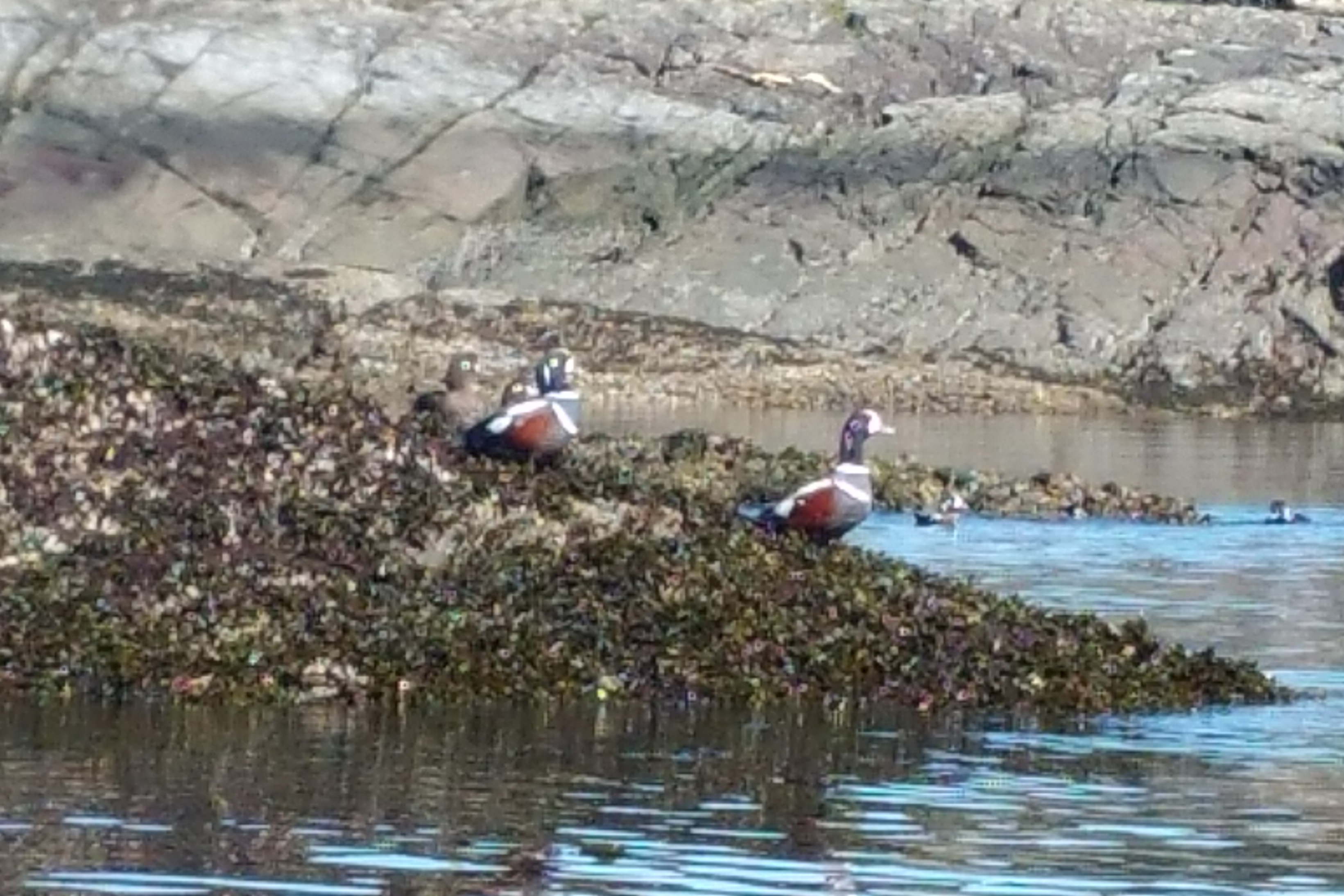 Harlequin ducks.
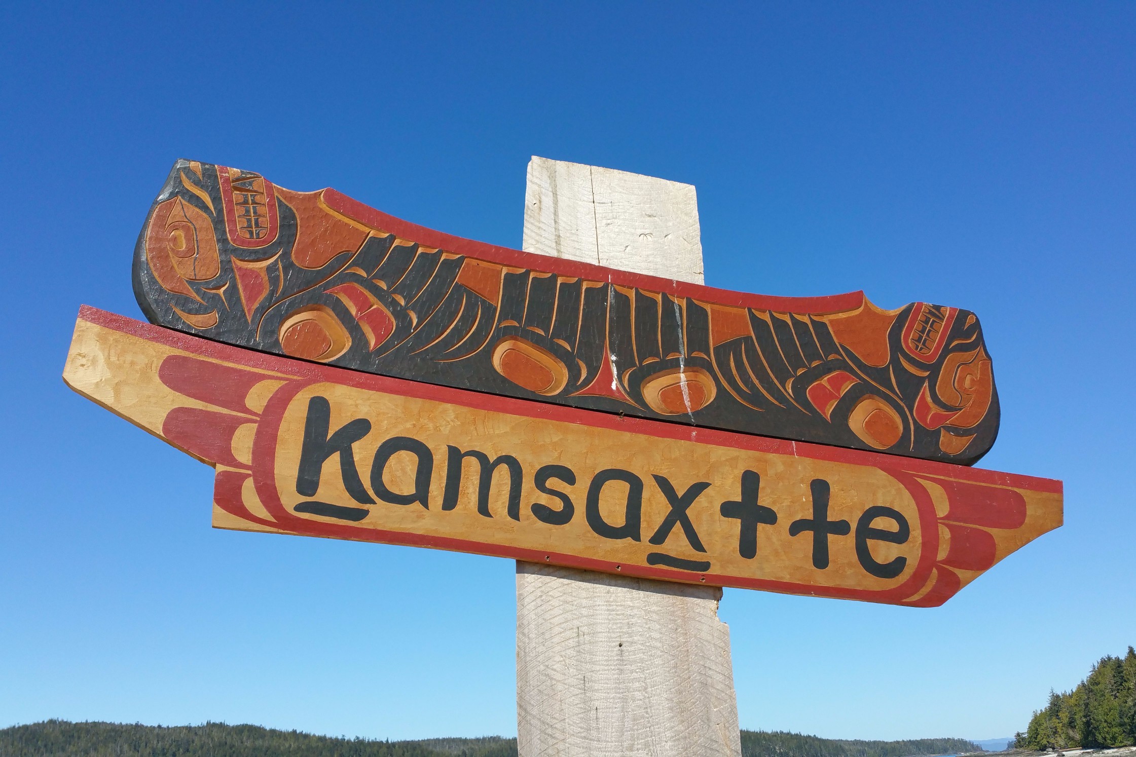 Sign on Shell Island.
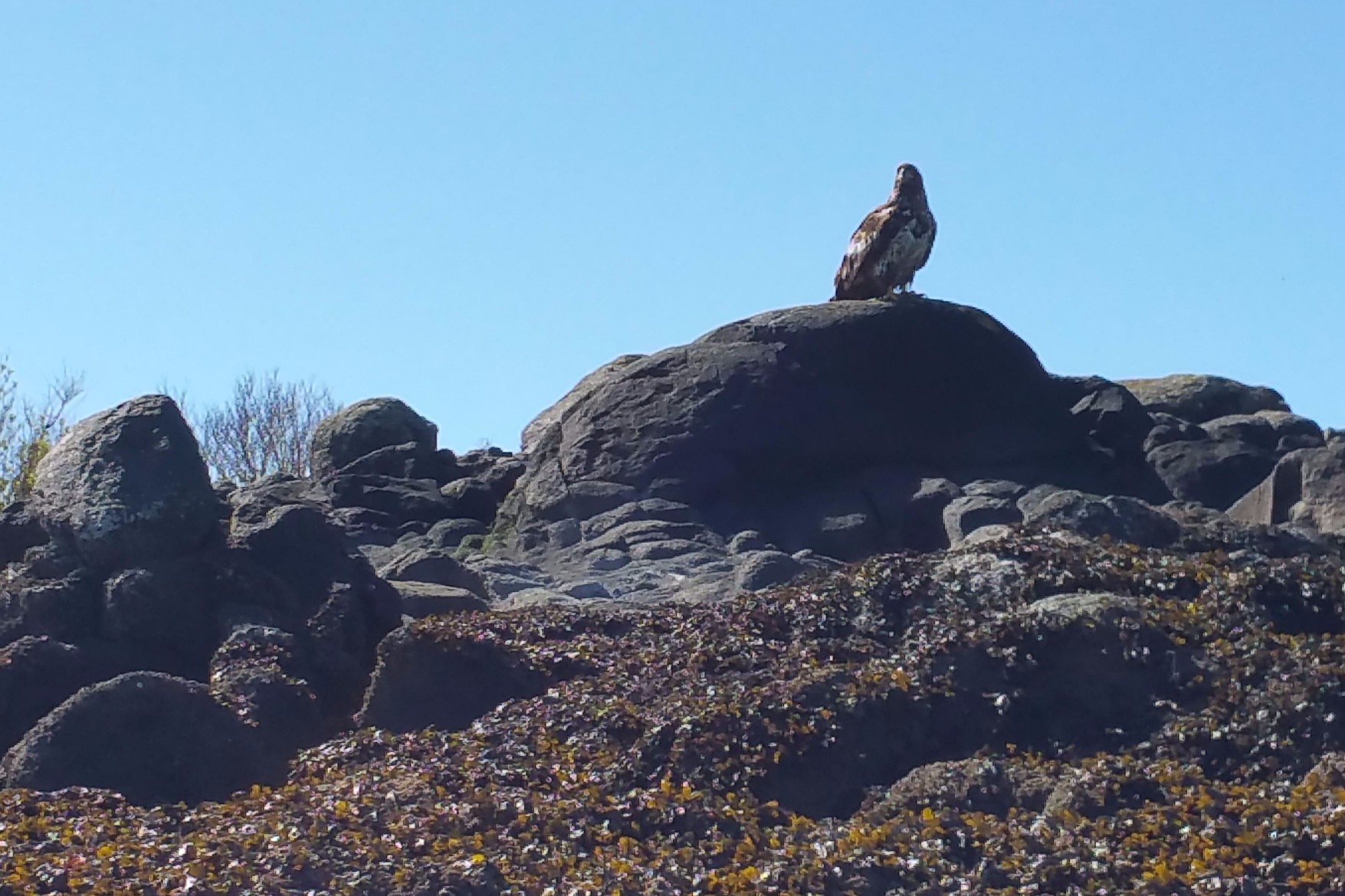 Young eagle.
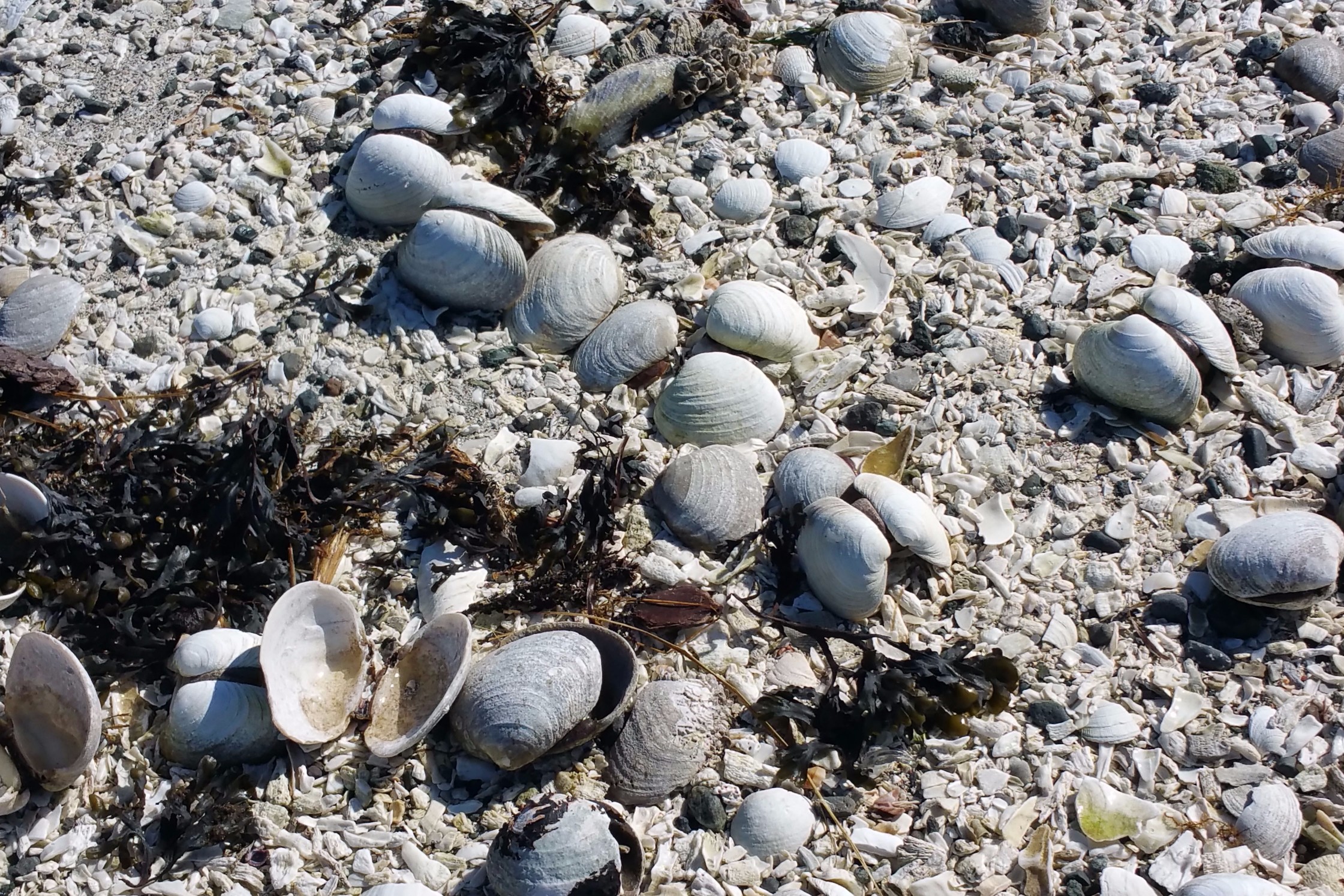
Shell Island is a photographer's dream, with black lava boulders contrasting with the white broken shell sand. Add to that the abundance of wildlife. James and I are in the process of shopping for a new camera, bemoaning that we did not yet have it so we could use a telephoto lens on the birds. What also added to the photographic delight was the fact that James was dressed in a black T-shirt and black sun glasses which, with his pale complexion, made him match the island! I took a million pictures. We had a picnic on the white rocky beach, stripped a little, and then laid in the sun like it was the middle of the summer (remember, it was March!). We checked out what we thought was a totem pole, but actually was a sign saying, "Kamsaxtte." Although I am totally ignorant of what the sign means and the significance of the island to First Nations cultures, it sounds a lot like "namaste" and I wouldn't doubt it has a similar meaning. I would also venture a guess that Shell Island is a spiritual sanctuary. I don't need to find this out, as the vibes are everywhere! If anyone who is reading this knows anything more about the history and significance of the sign and Shell Island, I would appreciate it if you enter your comments at the conversation section at the foot of this post. The squirting somethings we guessed to be barnacles just under the surface of the rocks and sand.
 Looks like snow.
 Where are we?
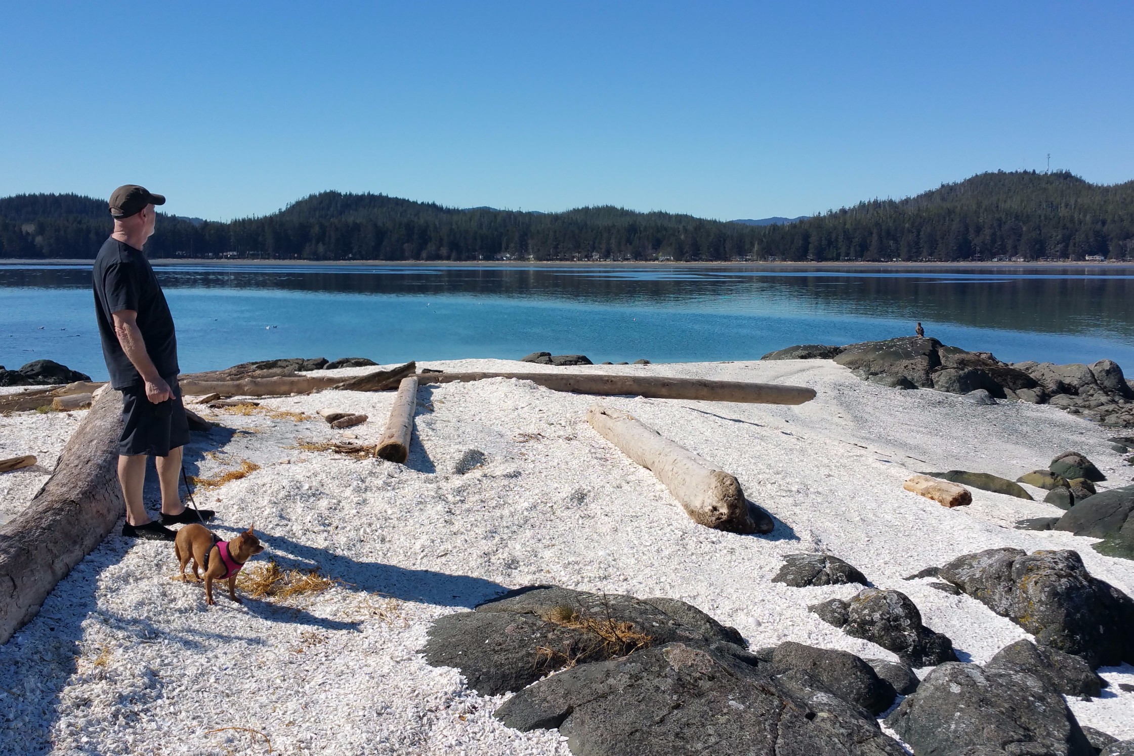
 White shell sand.
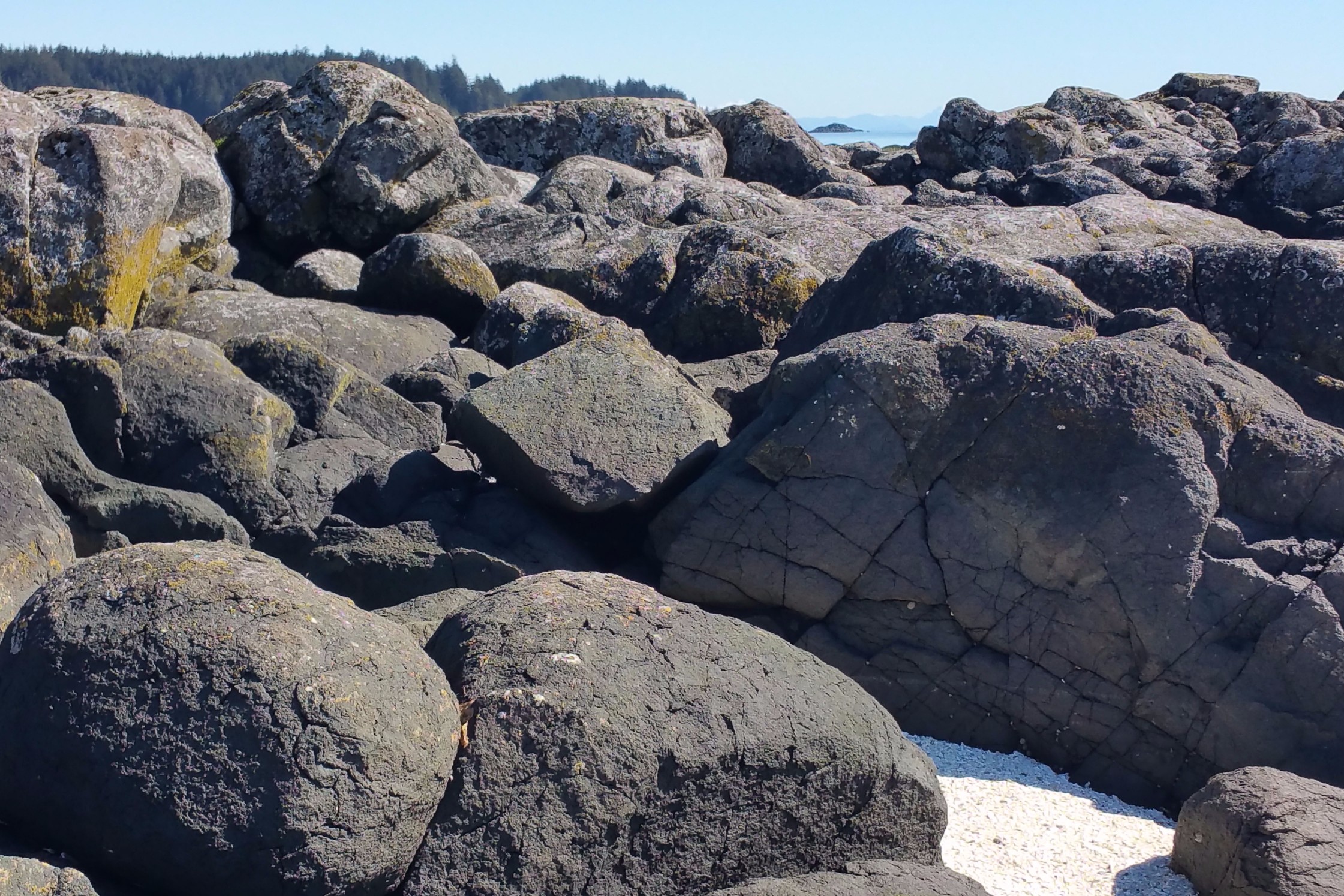 Boulders made from undersea lava deposits.
 Island of contrast.
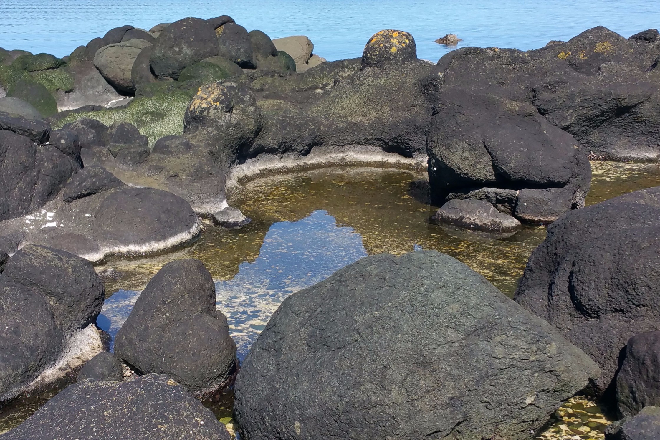 Tranquil pool.
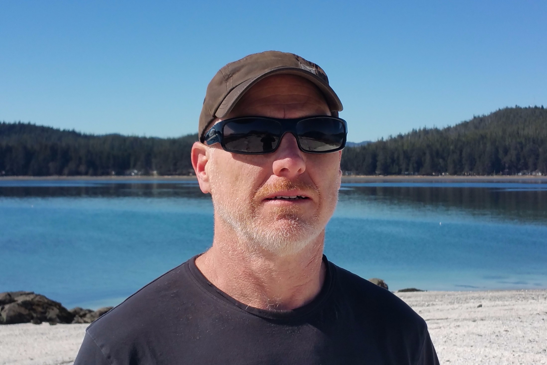 James matching the island.
 Chloe meet Eagle, Eagle meet Chloe.
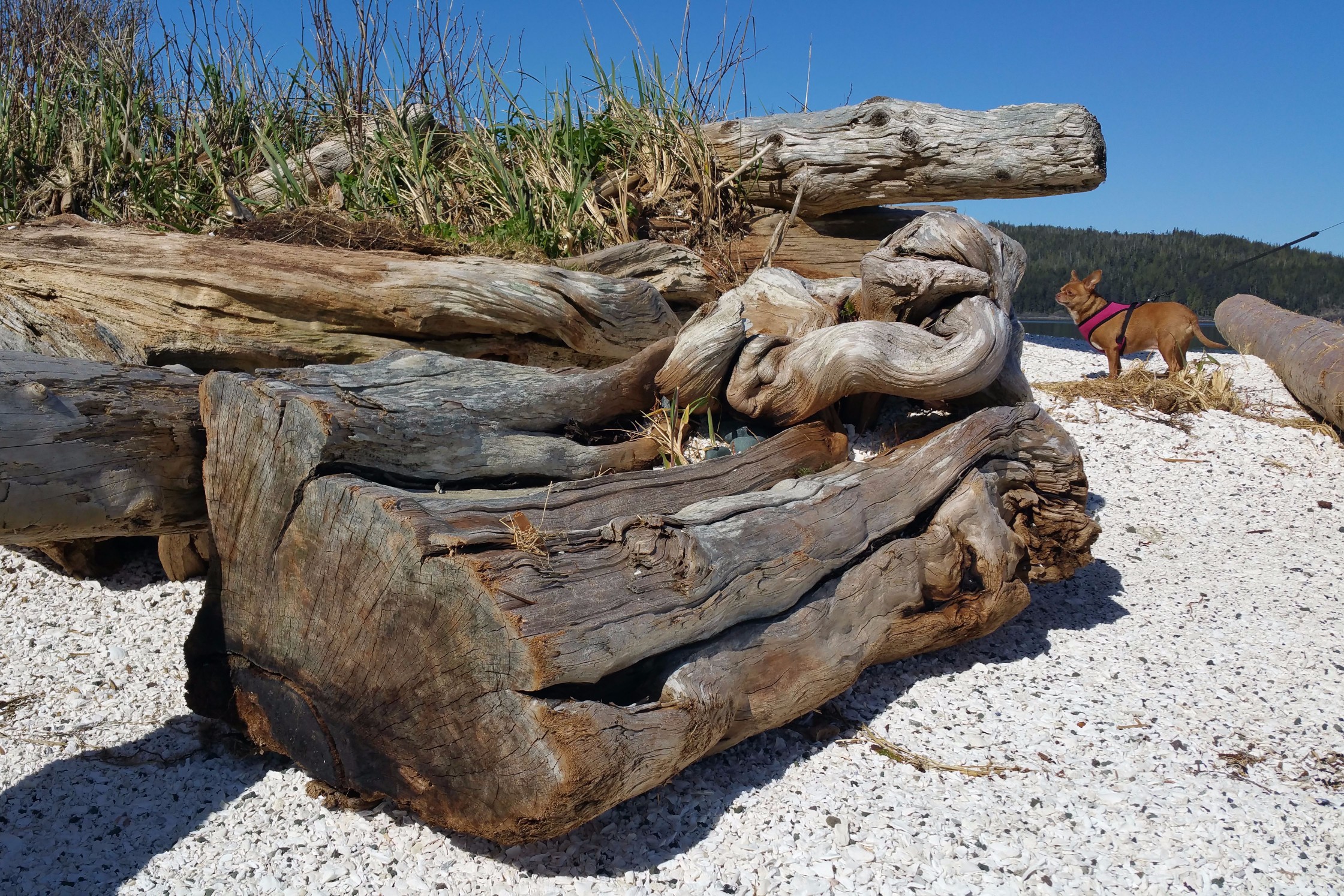 Chloe photo bombing my artistic driftwood composition.
 Sea shell composition.
 Two sun bathing beauties.
After launching from Shell Island, we went in the direction of Cattle Island, where we would get ourselves into a bit of a pickle, to put it mildly. Ever since we arrived, we had been listening to intermittent flurries of sea lions barking. A fishing skiff seemed to be at the epicentre of it. Sea lions were barking at fish workers who were tossing them fish scraps. Fishing skiff.
 Seals playing peek-a-boo.
In another area, we saw something weird. It looked like fins and tails swimming in a circle. I moved closer. I realized that if I continued along that trajectory, I'd glide right into the middle of the moving circle, which, in hindsight, would have been disastrous to say the least! James told me to take a wide berth. I went around, but had evidently already agitated the creatures in their ritual, as there was a sudden onslaught of hostile barking. I beat it away from the group, taking a quick look back at the circle. Just as I was turning my head to look, I saw the gigantic head of an enormous light grey seal bull with large black spots and a heavy set of jowls rise out of the water and give me a nasty penetrating look. No need for words! Mind reading between animals and humans definitely exists! When I was halfway around—heading toward Cattle Island the long way—the harem's barking intensified. We booted it. Chloe was getting scared and kept trying to crawl into my cockpit. Somehow, I managed to hold her back and paddle incredibly fast at the same time! Embedded in the cacophony of barking, we heard what sounded like the roar of a giant monster opening its jaws. When we thought we were far enough away, we relaxed and put down our paddles. As soon as we did that, though, the party of sea lions came rushing after us! They chased us for a couple hundred metres, then suddenly stopped. I think it was more of a threat than anything, as they could have easily caught up to us and done some serious damage.
We did some googling and believe we were dealing with Stellar sea lions. The females can weight as much as 350 kilograms (770 pounds) and measure up to 2 metres (7 feet). The males can weight up to 1120 kilograms (2500 pounds) measure over 3 metres (11 feet). We were being chased by several thousand kilograms of angry sea lions!
Deer Island is owned by the Kwakiutl First Nations (so is Shell Island, but people are allowed to go there for day trips), and is out of bounds. You have formally request permission to go there. Paddling by, we saw a bunch of raw wood constructions and a tarp over a dome shaped frame: tables and possibly a sweat lodge. Paddling around to the north, we ran into an abundance of kelp on the water. I started picking them and dropping them into my cockpit. I had images in my mind of making kelp chips in the same way I make kale chips. As we rounded the island, the kelp appeared in greater and greater abundance. I ended up filling up my cockpit and getting my shorts thoroughly soaked! James was getting impatient with me. He kept ordering me to stop, but I couldn't help sneaking a few more here and there. Just think, generations of people have probably been collecting seaweed over millennia in this very spot!
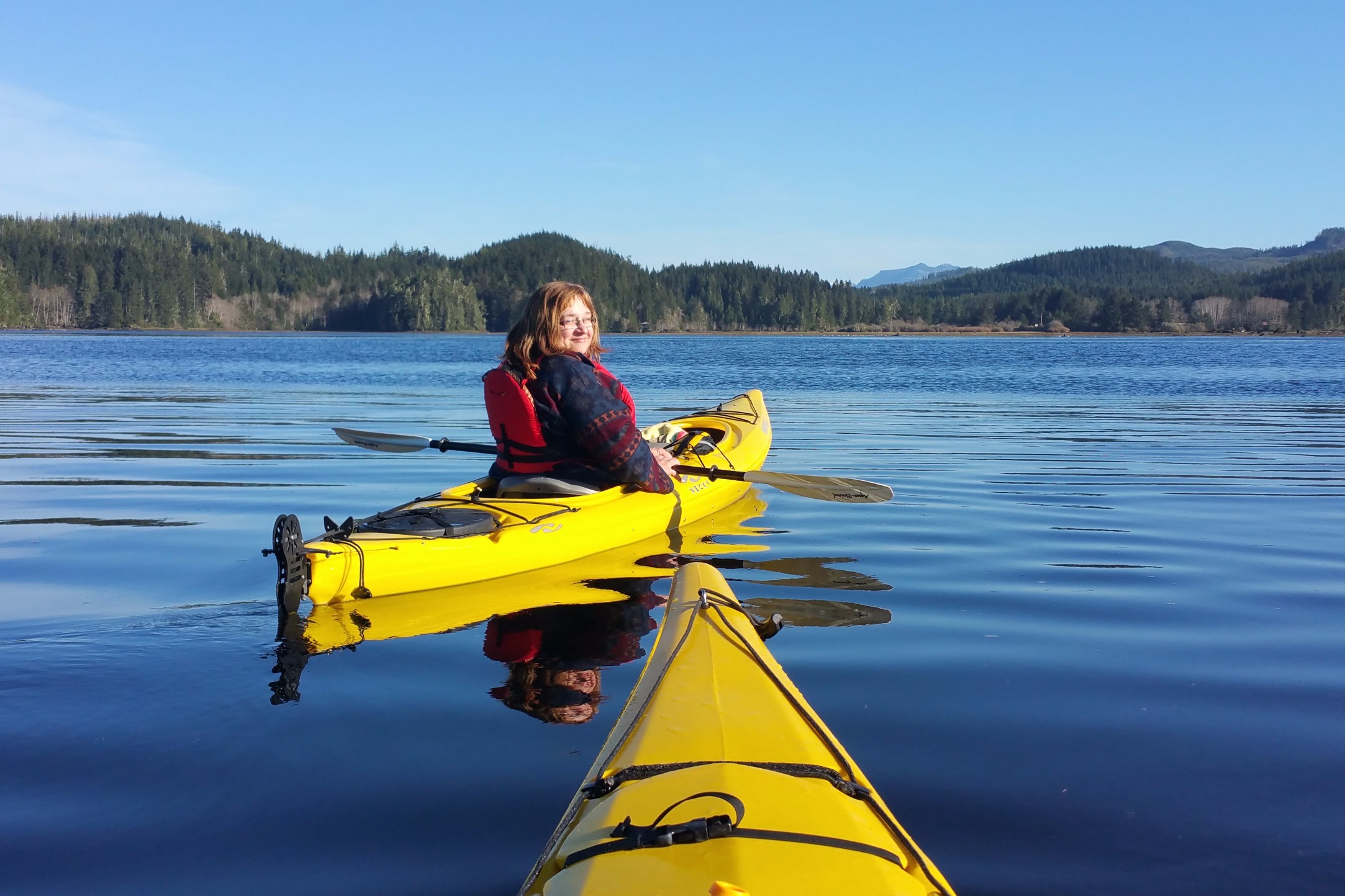
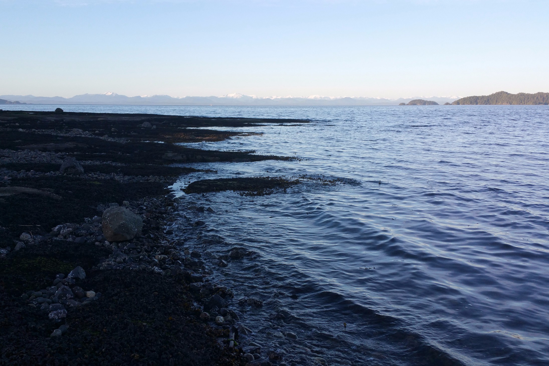
As we rounded Deer Island, facing the open water, the ride got rocky. I looked to the east and could see the mainland in the distance, with a whole lot of blue water in between! After our trip down the wilder side of the islands, we came around Eagle Island and landed for another picnic and some sun-bathing. As we relaxed on the pebbly beach, we marvelled at how we had hard time telling it wasn't July. We were even sun burnt in places. Our inner seasonal time clock was experiencing a lot of confusion. The trouble with feeling like it was the middle of summer is that it gave us the uneasy feeling that fall was just around the corner! It's was a unsettling thought, especially when we only said goodbye to winter a few days ago.
 Eagle Island.
Throughout the day, we kept hearing a repetitive blast that sounded like a cannon. On Eagle Island, the sound seemed a lot closer. We looked and looked, trying to figure where it came from. We then realized that there was a flight path overhead, and that the airport was not too far away from us on shore of Vancouver Island. James figured out the blast was from canons trying to scare birds away from the landing strips.
The next stop on our trip was a return to Shell Island, but there was a large body of choppy water in between. James gave me the lighter kayak because he felt sorry for me, and he took the Manitou. We determined we had to do a serious warp drive paddle across, or the trip would take us all day. I was really going. James later confessed he was having a hard time keeping up with me.
Back at Shell Island, we turned left and headed for shore. We couldn't see our truck, and didn't know exactly where to aim. If we would have gone in at the wrong angle, we could have ended up a kilometre or two away from our launch point and we didn't have enough energy left in our bodies to correct it. We finally recognised a microwave tower that we saw when we left, and oriented ourselves with that. We saw the sea lion's love-in going on in another part of the bay and gave them a wide berth. The water was, more or less, at the same level it was when we left—we had been paddling and exploring the bay for roughly six hours. This time, though, we didn't have to walk on water. We determined that we ended up doing a serious 12-kilometre paddle. It was nice to experience a little bit of summer, even if it wasn't actually summer.
When we were packing up the truck, I had thrown my seaweed into a clean garbage bag. When we got back to our campsite, I spent the evening rinsing the seaweed in fresh water from the campground tap to remove the slime, then hanging it on a line between two trees to drain and dry a bit. The next day, when we got home, I rigged a line on my balcony so the seaweed could dry further. Before it was completely dry, I made a batch of kelp chips in the same fashion as I make kale chips. Taking about half of my spoils, I cut them up into small squares, drizzled them with olive oil, and salted them just a little—just enough to bring out the flavour. Kelp already has lots of salt to start with. I put them in the oven at a low heat, about 300° Fahrenheit, (about 150° Celsius) until they became thin and crispy but still green. The first few bites were hard to get used to, because it is a slightly different taste from kale chips, but it didn't take long for me to start liking them. James missed out on the culinary experience because he was working a shut down out of town. With my busy schedule, I ended up neglecting the other half of the kelp on the line. They started to get too dry, so I took them off the line and put them in a pan under a cloth, ready to make kale chips for the next time I had a chance. By the time I got around to making them, they were way too dry and didn't crisp up in the oven properly. If you make kelp chips, cook them when they are still damp. Determined not let this wonderful nature's bounty go to waste, I threw it on my garden for fertilizer and slug repellent.
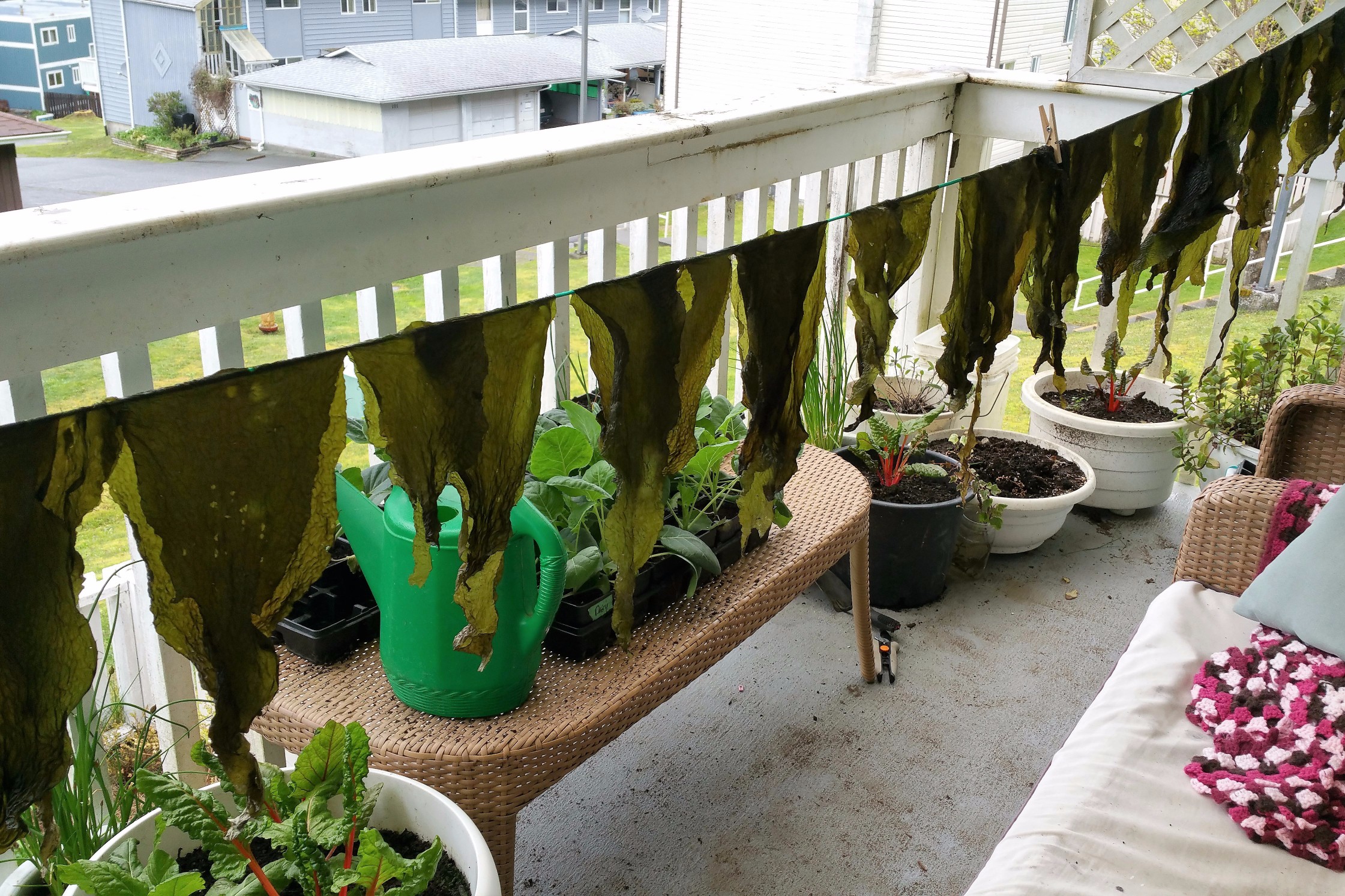 Seaweed drying.