June 6, 2015
This is a story about two goofballs (and one Chihuahua) who got lost again, and again, and again. Even though it was a weekday, we were eager to make use of our new kayaks. Our first intent was to explore the inlet behind the mill. James loaded the kayaks on both vehicles by himself while I was working at the school and we took off after. We drove up to a dock in front of the effluent treatment holding tank; but, as soon as we got out, James nixed the plan. He admitted that he didn’t know what he was thinking, with the wind kicking up some significant waves on the inlet. Our next brain wave was to drive behind the mill and launch into the inlet there, hoping the mill would act as a block for the waves and produce calmer waters. James stopped on the road to have a discussion with me about the possible futility of our efforts (the theme for the day!). Finally we decided we should give Atkins Cove a try since it wasn’t too far out of town and it would be sheltered.
We drove north along Marine Drive and made a left turn on a gravel road just past the gas station. To help maintain the mood of “lostness” of this story, I will give you accurate directions to Atkins Cove at the end. The first part of the trip was gravel road and I was feeling fine. James probably told me the directions before we left, but they didn’t sink in. I wasn’t that worried, as he seemed to know where he was going. After we passed a short road that lead down to the shore, it made sense to me that it should have been the route to our cove. I tried to stop James by honking and honking. Finally, I got his attention by stopping the truck and waiting. He finally backed up to see what had happened to me. With the radio on and the windows closed, he couldn’t hear me. He told me to flash my brights the next time. He said the turnoff was 12 kilometres from town and that he was watching the odometer. He told me his instructions from a friend were to drive past a side road with a cable across it (with a red ribbon on it which wasn’t actually red but pink) and take the next left.
After our drive along Neroutsos Main with marvelous views, we turned onto a decommissioned logging road and got swallowed by trees! It was a very overgrown road that James jokingl y called “a goat trail.” The road was firm and drivable but the branches scratched the sides of our vehicles, making an eerie screechy sound that seemed to ask, “Do you know where you are going?” As we drove along, methinks I may have seen the elusive trail ribbon that James was looking for but missed. Only I didn’t know that was what we were looking for! We kept driving deeper and deeper into this jungle. Every so often James would have to get out of his car and throw or kick rocks out of the path of his little Toyota Camry. At a couple of spots we had to remove branches and trees from the road. One tree was still attached to its base and no amount of pushing or pulling would get it to snap and be out of our way. We tried to push it together with all our might, but it would just swing back to its favoured position. We bemoaned that we had not brought a Swede saw or an axe. It was something we did not consider because we were supposedly on a “short day trip.” Some short day trip: it was beginning to feel like a trek into the abyss! Unfortunately, we did not have to be in that dilemma as, as that point—we would find out later—we had passed the ribbon that marked the trail to Atkins Cove and were well on our way to nowhere! Finally, I suggested he hold the tree as much out of the way as possible while I drive both vehicles past. It would have been a great idea, if we had actually needed to do it!
Once we passed the immovable snag, the trees seemed to squeeze even more tightly around our vehicles and we were dodging bear crap everywhere! We came to a fork in the road. We debated and debated which one to take, and decided to take the one to the right. When that one turned into a dead end, we went back and took the one to the left. At the end of it all, they were both dead ends! “The one less travelled” and the one more travelled were both equally futile! After all that we took a third fork which turned out to be futile as well! Actually, the truth of the matter was that none of them were travelled at all! Maybe they were travelled a lot once upon a time by logging trucks, but no more, except perhaps for the occasional batch of hunters on quads, and maybe…goats.
On the trail to the right, the branches seemed to squeeze even more tightly around our vehicles! They ended up swiping the foamy under the Eskia off the car. I honked and honked to get James to stop. In an especially thick patch of trees, we put the foamy back in place while fighting off groping branches. Finally, we came to an open area and saw a tiny patch of water. I climbed on top of the truck to see what I could see, but I could see little more. With the situation seriously challenging relationship harmony, we took short walks to check things out. We found a good place to turn our vehicles around, and drove back through the too thick trees. I hit a bump and lost a foamy and a strap and drove quite a ways without realizing it. James honked and honked at me to no avail. Finally, when I noticed he wasn‘t following me, I stopped the truck and waited for my lecture on leaving the window closed and playing the radio too loud.
Irritated, dejected, inclined to call it quits and go home (though I wondered if we were all that sure of the way home anymore), all three of us hopped in the truck and took that left fork, which was also a dead end, but, thankfully, a shorter one. Then, dumb and dumber decided to go back to third road, which lead to a slightly longer road with a dead end. With a bit of panic starting to set in we decided to call it quits and go home to get more information. Not long after we passed the tree that wouldn’t move, I was coasting along and noticed James wasn’t following. I put the truck in reverse and discovered that he had parked his car on a small pullout. Like a man redeemed, he joyfully and ecstatically informed me that he had found the ribbon. By then I wasn’t in the mood to be ecstatic about anything, but I thought I’d better not rain on his parade. He said he noticed it because he could see water through the trees. It made him look around and notice the ribbon. I then informed him that I had seen that ribbon on the way in (that I didn’t know we were looking for) and it produced a chorus of moaning and groaning.
He suggested we tromp through the woods to look for the cove. I was only wearing crocs and was no longer in the mood for exploring, so James went alone. He came back not long after, jubilantly announcing that he found a well worn trail. Though somewhat disheartened, I went along with his suggestion to take just the tandem kayak. We both carried the Manitou to the ribbon in the trees on the road. Just across from it was an archway of branches and leaves that framed the entrance to the trail. If one did not have some instructions and a basic familiarity with the BC backwoods, finding this is pretty much like finding a needle in a haystack! James jubilantly pulled the Manitou down to the shore like it was as light as a balloon. The trail was well padded down, as it looked like it had been used by a considerable number of people pulling kayaks. We were assured of where we were going by the numerous fluorescent ribbons tied to trees along the trail, but the trail was quite distinct as well.
Arriving at our lost lagoon, we felt victorious! Looking around, we released many sighs and “oooohs” and “ahhhs.” I suppose what is special about Atkins Cove is its very tranquil out of the way feeling. It is enclosed by land masses, with only a narrow exit to the inlet. Protected from the wind, the water was serene and still. Out in the middle of the cove were a couple of abandoned rafts from some kind of mining operation, which really didn’t mar the beauty of the peaceful secluded setting.
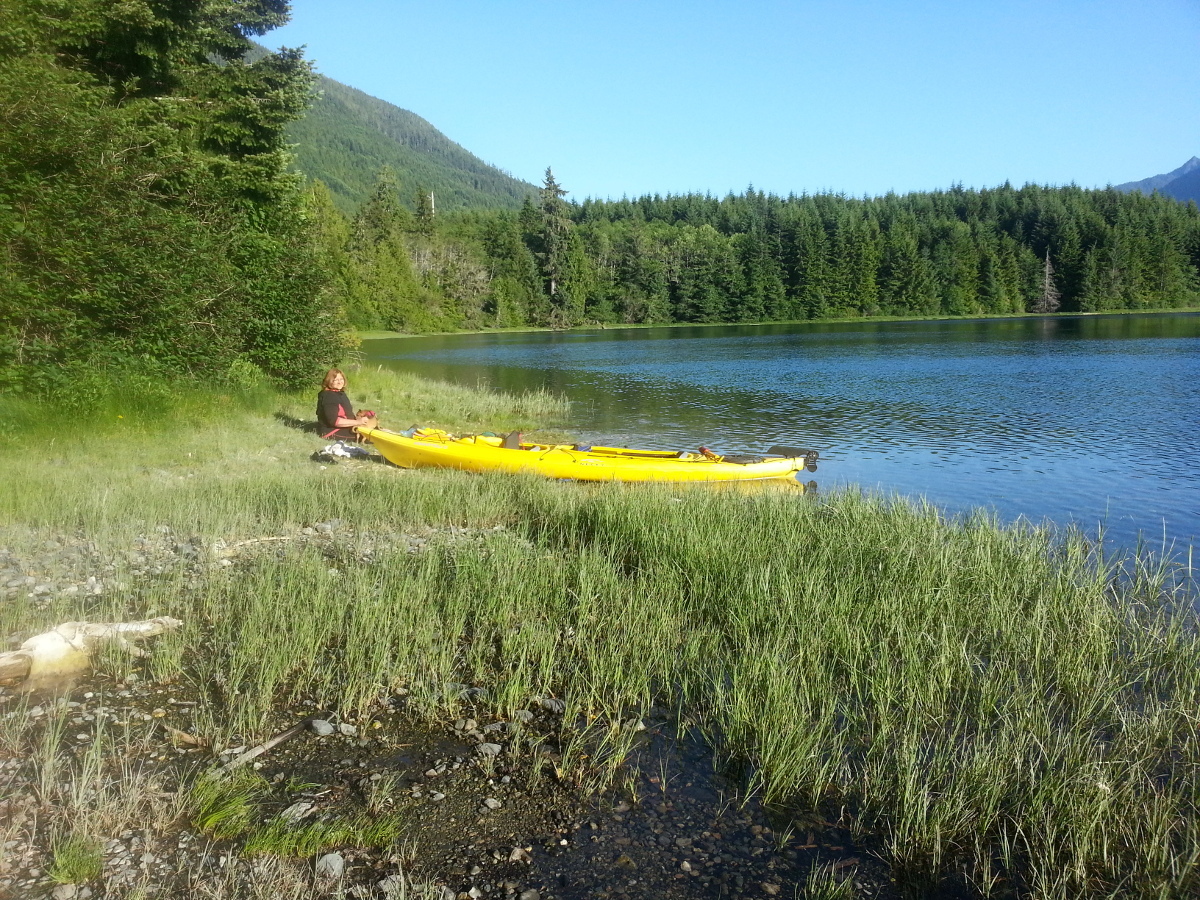 Atkin's Cove.
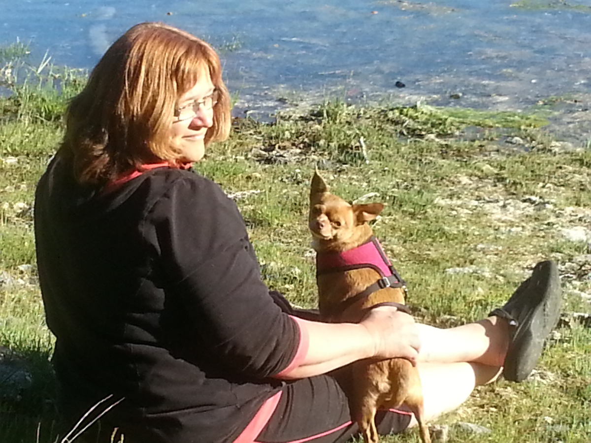 Me and Little Miss Big Ears.
We packed up our Manitou to give it a run with all of us in it, even though it was supposedly made to hold no more than 120 pounds in the front cockpit. James had previously checked the Necky website and found out that the Manitou was capable of holding a total of 500 pounds. Between the two of us, we still had about a hundred pounds of leeway. I was a few pounds heavier, so I sat in the back and James sat in the front. Chloe sat on some blankets between my legs in the back cockpit. As soon as we were both in, the kayak was noticeably low in the water. Too much tilting one way or the other would have meant a flooded cockpit and a rescue operation.
Surprisingly, though the Manitou is smaller than a full fledged double kayak, we were able to paddle rhythmically without knocking paddles much. I basically copied James’ paddling, except when I became preoccupied by Chloe’s restlessness. Because we were two paddlers, Chloe was getting dripped on too much! Chloe doesn’t like getting wet! She loves going for walks in sunshine and she doesn’t mind going for walks when it’s cold; but, when it’s raining, she will go to the end of the carport and that’s it! We end up having to pick her up and take her around a corner so she can’t see home; then, she will walk the usual route back home in the rain.
We took a short trip around the point and followed the shore. We came across a a small beach and had our snack of cheese, gluten free rice crackers for me, granola bars for James and a couple of near beers. We offered Chloe some cheese but, amazingly, she didn’t want to eat it. She was probably still perturbed by her uncomfortable travel accommodations.
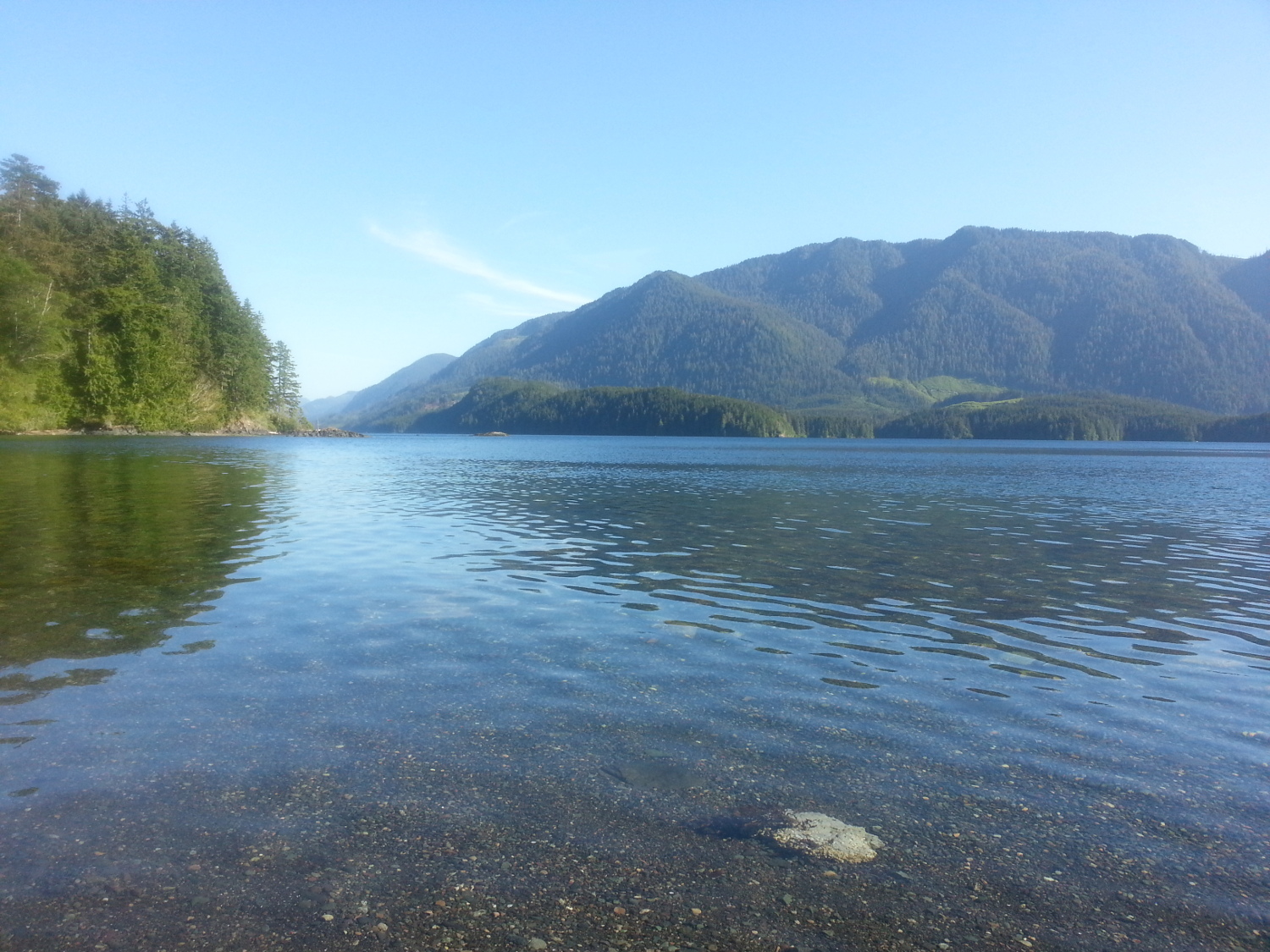 View of Neroutsos Inlet from our picnic spot.
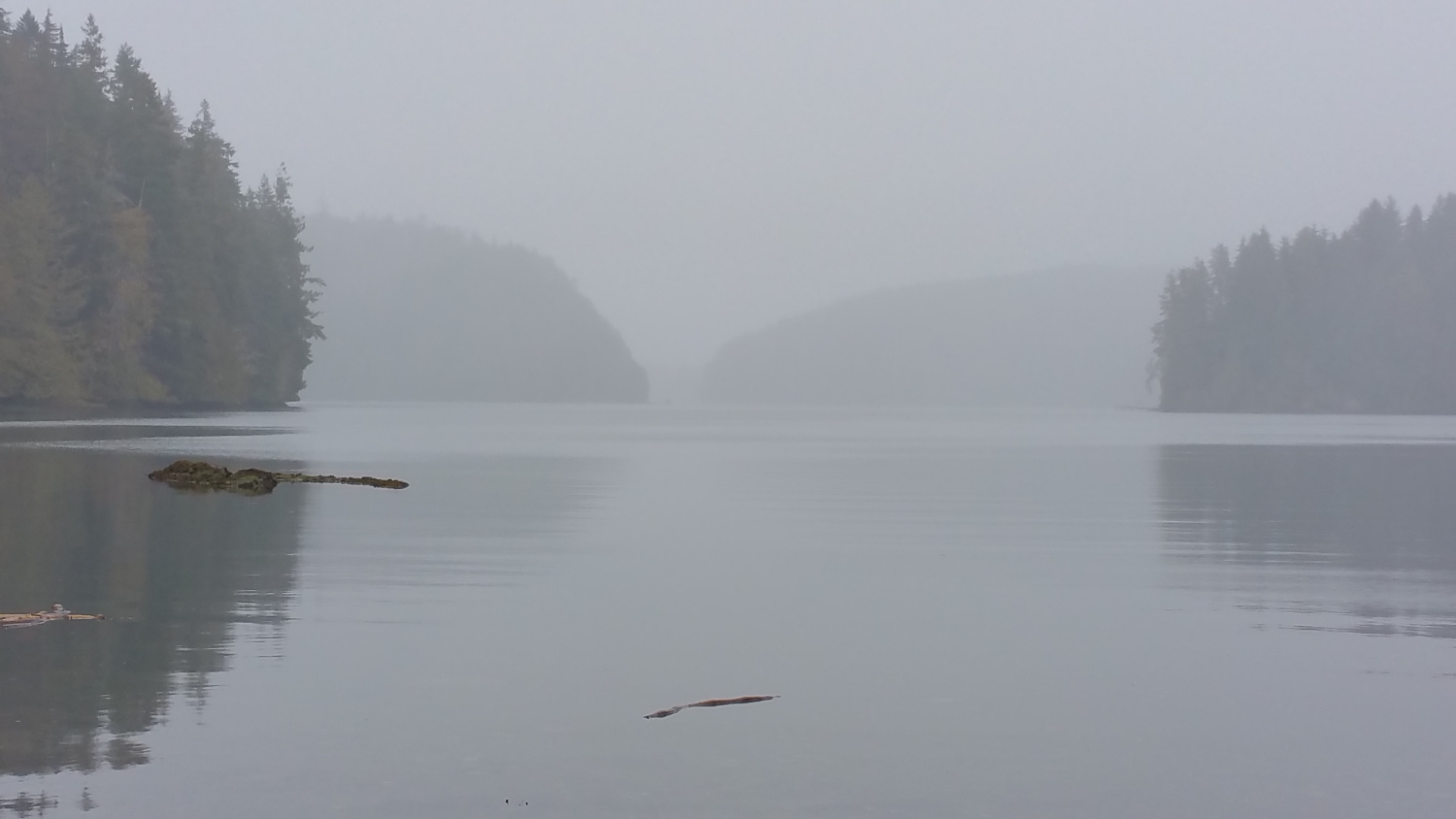
Looking around from that beach we saw numerous possibilities for kayaking. There was Drake Island with Pamphlet Cove nestled in the middle of it. Supposedly, there are the ruins of an old hotel there. Farther west is the Quatsino Sound and the Quatisino Provincial Park. To the north, around Evenson Point, is the remote village of Quatsino. To the east of there is Hecate Cove, Marble River Provincial Park and the Quatsino Straight. As kayakers, we had our work cut out for us! Atkins Cove is a good launch point for travelling to these areas as; otherwise, you would have to spend all day paddling down the Neroutsos Inlet. Because of inflow winds, the inlet most often gets choppy in the afternoon.
 View of Drake Island in the evening light.
Getting lost used up a lot of time. The sun was starting to set. We had to cut our kayak trip short and head back around the point. At the first part of the journey, Chloe wasn’t getting too wet, thanks to her fleece blanket. Towards the end though, the fleece was soaked. She tried to hide herself in the covered area between two cockpits, but that didn’t work very well either. She came out of the cockpit and peered over the edge of the boat, looking like she was ready to jump. I ended up leaving the paddling to James while I held her in my arms.
As we came close to the shore where we launched, James paddled slowly, trying to stretch out this usually short kayaking trip. We checked out the mining rafts in Atkins, trying to picture how the operation worked. Just before getting to our landing spot, we heard rushing water behind some willows. We were wondering if it was something like the Disappearing Waterfall that is in another part of this area, but it turned out to be only a stream hidden in the trees. When we figured it out, we had to untangle our paddles from some water vegetation. We then slowly and reluctantly drifted back to our launch point. Even though it was still quite light in the cove itself, it was feeling like night on the trail. James pulled the kayak back up by himself. By the time he got to the top, he was definitely huffing and puffing. It was a lot different going up! I had offered to help; however, he wanted to sprint hard and fast. I have an arthritic knee and it would have made the going too slow for Mr. Fast Twitch Muscle Sprinter Guy.
As we loaded up, James spent quite a bit of time swearing at himself for missing the ribbon. James can be pretty hard on himself sometimes so that I often have to say to him, “It’s OK to make mistakes.” Heck, if people didn’t make mistakes, I wouldn’t be able to entertain you with a silly story like this one! Besides, the heightened emotion brought on by our misadventures, made this a very memorable trip. I now look back on it with a little bit of nostalgia. It really was an adventure because of the many unknowns, even though Atkins Cove should have otherwise been a very tame trip.
On the gravel road part I saw a black bear picking salmon berries before it ran away. James missed it because he was a bit behind me.
When we got back to my place, the people who gave James instructions how to get to Atkins Cove passed by (speak of the devil) while I was watering the garden and James was washing the kayaks. They admitted they got lost for a while too. James stopped beating himself up after that.
So What Have We Learned?
So what have we learned from this? First of all, the value of proper planning and preparedness! Have at least a couple of maps or more. Especially when it comes to logging roads, as there can be inaccuracies and even major discrepancies. Several times we encountered roads that weren’t on the map, roads on the map that weren’t there and roads in the wrong places. Plan your trip as accurately as you can. Discuss it in depth and check and double check your instructions. Be willing to question instructions, maps and yourself.
Second, make sure all adult members of your party know where they are going and how to get there. There may be some confusion as how to interpret directions from any source. The more everybody knows the better.
Third, tell someone where you are going and when you plan to be back. The movie 127 Hours is a good example of what can go wrong if you don’t. It is about how Aaron Ralston went hiking in the canyons of Utah one day without telling anybody. He ended up trapped in a crevice by a rock that landed on his arm. Since no one knew of his whereabouts, or even that he was gone, he ended up having to amputate his own arm with a dull instrument in order to get help. Normally, our cat sitter is the one who knows where we are going and when we plan to be back. When we went to Atkins Cove “on the fly,” however, we were only planning to be gone for the afternoon and didn’t need a cat sitter. No one had any idea of where we went, or even that we were gone!
Fourth, make sure you have extra provisions: food, water, proper clothing, proper foot ware, a first aid kit, matches, blankets, etc. in case you are stuck somewhere longer than expected.
Fifth, if you are genuinely lost, a good way to get found is to start a campfire in the middle of the day. When I was a forest fire lookout, I reported a good number of fires that ended up being just some campers having a wiener roast. If you have a good sized fire, the column can go up pretty high and be seen for many kilometres by a fire lookout or a passing aircraft or even a member of the public on the ground. There are lookouts all over Alberta, so that there is really not much area that can’t be seen by someone in the summer. There are a handful of active lookouts in BC, about twenty (at one time there was 320!); but, there is a lot going on in the air and on the ground. The forests of BC and Alberta are interspersed with industry, including logging, fire-fighting, oil and gas and mining operations, aviation, shipping, farming, tourism and so on. It is probably similar in other provinces. There are people everywhere! In the “wilderness” they are just spaced farther apart. Be wary, though, about starting a fire in extreme hazard or during a fire ban. For one thing, your bones could end up being tinder sticks; and, for another, you could be sued millions of dollars for the cost of fighting a fire you started. I would rather be stuck a few more days in the bush than have to deal with either of those two problems. I’d avoid starting a fire in windy conditions. I’ve seen many a small fire grow to an enormous size in high or even moderate winds.
I read the kid’s book Hatchet by Gary Paulsen some years back. It was an enjoyable read about a teenager lost in the bush. Although time has faded my recollection of the events in the book, I remember thinking that the only thing this kid has to do is to light a small bonfire in the middle of the day and his rescue probably would have been instantaneous! Some lady in a lookout tower or a pilot would have been obliged to report it as a possible forest fire. It would have to be investigated—and—the lost is found! Hikers and hunters usually light their campfires in the evening, so, if a fire is burning in the middle of the day outside a designated camping area, it is more likely presumed to be a forest fire…and forest fires get a lot of attention! There are even forest fire fighting operations in the Northwest Territories, the Yukon and Nunavut! Practically every square kilometer of bush in Canada is monitored, patrolled or checked on at some point in the summer! You are never really alone! If you are lost in the bush and think the only thing you are going to meet is your maker, you are probably blowing the situation out of proportion.
Sixth, trust your gut. If you are going down a path and you are overcome by a feeling that something is very wrong, trust it. In some cases, your guts might be the only thing you have to go on, as the back roads of BC are confusing and not well marked. Our guts told us to give up and go back home, and that’s how we found Atkins Cove.
How to Get to Atkins Cove
On Valentine’s Day 2016, we took a trip out to Atkins Cove to make sure our directions were clear. A lot had changed. The road had been cleared. We later found out that a group of people are clearing trails as part of Port Alice’s new tourist initiative. James has recently signed up to be part of this group. We even found a kayak trail going down to Kokwina Cove on the opposite side of Atkins, which makes a more direct kayak route to the village of Quatsino and Drake Island. You can even access the Quatsino Narrows from there, if you are willing to brave them, to get to Rupert Arm and Holberg Inlet. To kayak the Quatsino Narrows you have to time the tides just right or it could be very hazardous indeed, and you should definitely not do it with a Chihuahua! The Quatsino Narrows are very “narrow” (hence the name), and, when massive amounts of tidal waters pass through them, it can make for a lot of turbulence. It is through that narrow passage that enough water has to pass through to fill up and empty two huge inlets! The Quatsino Narrows is a trip for an experienced kayaker only, though James keeps suggesting we do them some day. We’ll see.
To get to Atkins Cove you have to get on the Neroutsos Main, which is a logging road running north and south along the east side of Neroutsos Inlet. There are three roads that lead to the Neroutsos Main: one starts from the highway, the other starts just a little past the gas station, and another goes through the community of Jeune Landing (pronounced “June Landing” here). Whichever one you take will eventually lead you to a wooden bridge at the start of Neroutsos Main. If the bridge is kilometre zero, it is a total of 11 kilometres to the pull out at the head of the trail to Atkins Cove. As you drive, you will soon notice a fork in the road that goes up to the right. This is Quarry Main. Don’t take it if you want to get to Atkins Cove. It will not lead you to Atkins Cove, but it will lead you up to a beautiful lookout point higher up the mountain that you might want to check out another time. This is how I got the pictures of Neroutsos Inlet and Quatsino Sound for my introduction. You can make it up there most of the way with a two-wheel drive to a nice picnic spot. Only the very last part, to another picnic spot, you will need a four wheel drive. After passing the fork to Quarry Main, you will drive past the Quatsino log sort, which is a rather interesting sight to behold with heavy machinery and piles of logs in gentle hues of deep brown. You may want to stop your vehicle just to spend some time looking at it.
Keep going on the Neroutsos main for 9.8 kilometres. About halfway to Atkins Cove you will pass a picnic spot with a good lookout point and an odd plaque screwed to tree stump.
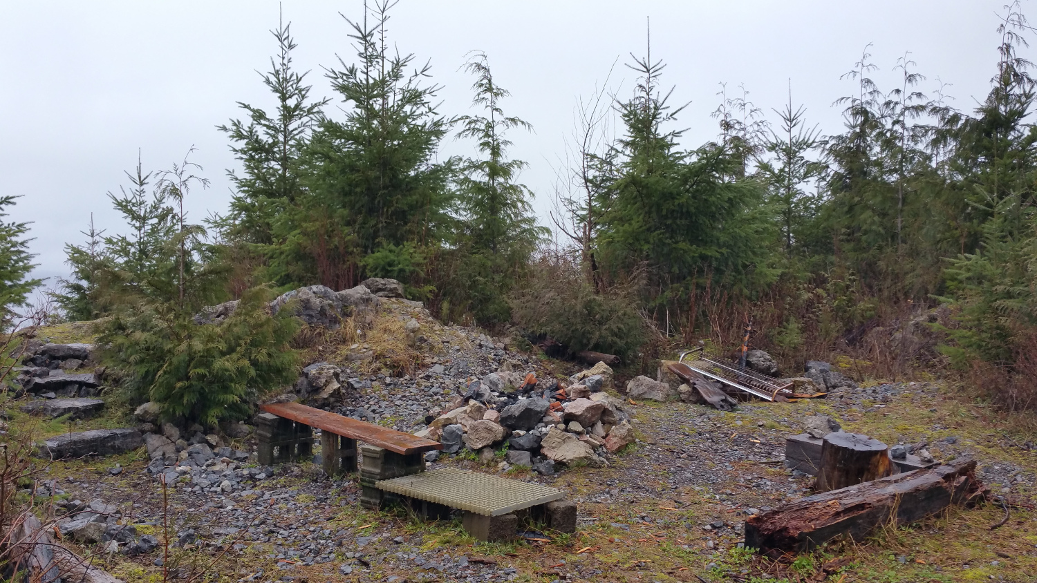 Halfway picnic spot.
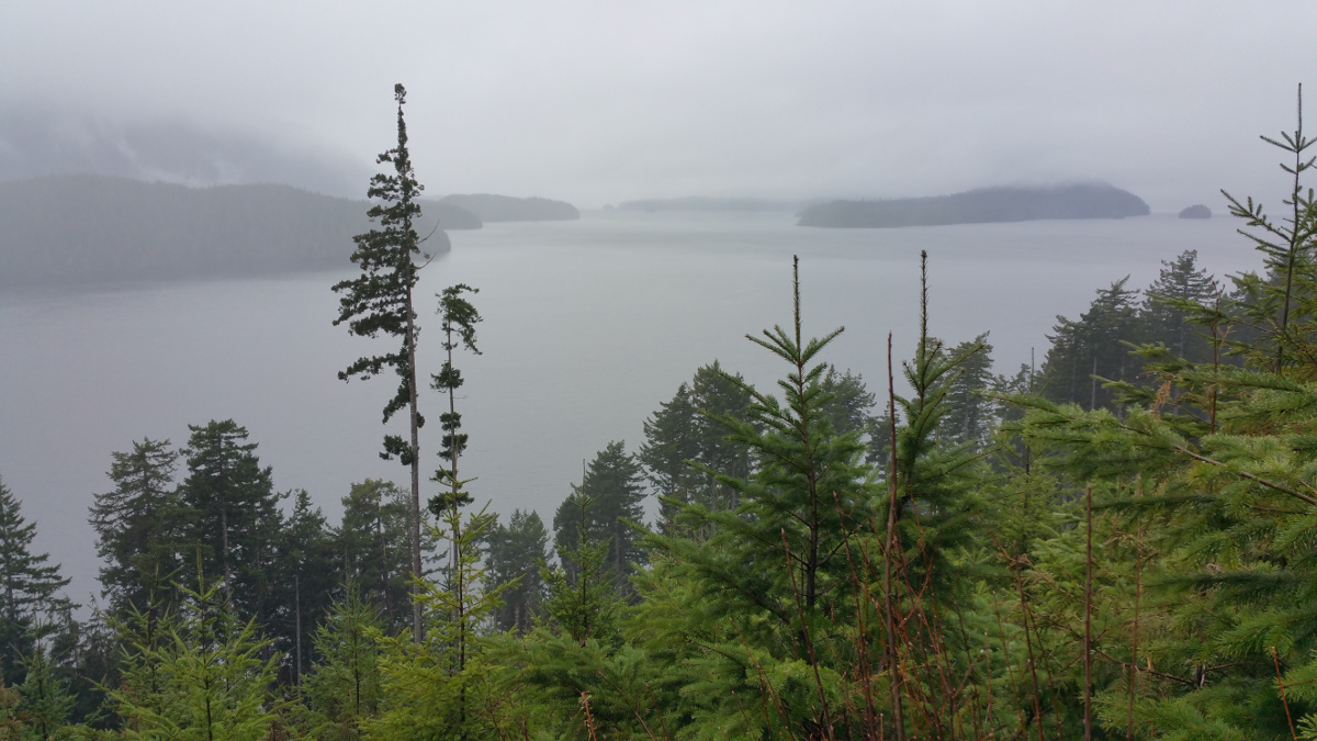 View from lookout point.
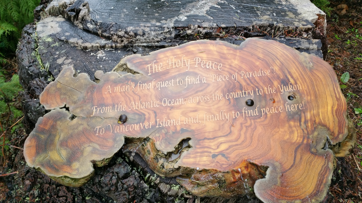 Weird plaque.
When you get to 9.8 kilometres, you should be able to look back over your shoulder down to the left and see an overgrown road with a cable tied across it. There are several pink ribbons hanging from the cable. The turn off is the next left after this one, about 50 metres ahead. We found a “crew working” sign at the turnoff and much of the vegetation that squeezed around our vehicles was all cleared. There is still a pink ribbon at the head of the trail down to Atkins Cove. Another kayak trail head to Kokwina Cove is about 200 metres north of the Atkins Cove pull out, but it is not, as yet, marked (we didn’t have fluorescent ribbon with us). You could deposit your kayaks at the head of the Kokwina Cove trail, kayak around Evenson Point and land in Atkins Cove for a little round trip. For an overnight trip, you might want to include Drake Island and the village of Quatsino. Just be careful around Quattische Island that is on the west side of Kokwina, as the waters get narrow enough to cause complications. That area is actually part of the Quatsino Narrows. You would have to time the tides to do it safely. I suggest that you consult The BC Coast Explorer and marine trail guide, vol. 1, by John Kimantas— probably the most thorough Vancouver Island kayaking guide you can get—to find out exactly how to go about it. If you want to play it safe, you should probably take the Atkins Cove side.
 Kokwina Cove with view of Quattische Island and Quatsino Narrows.
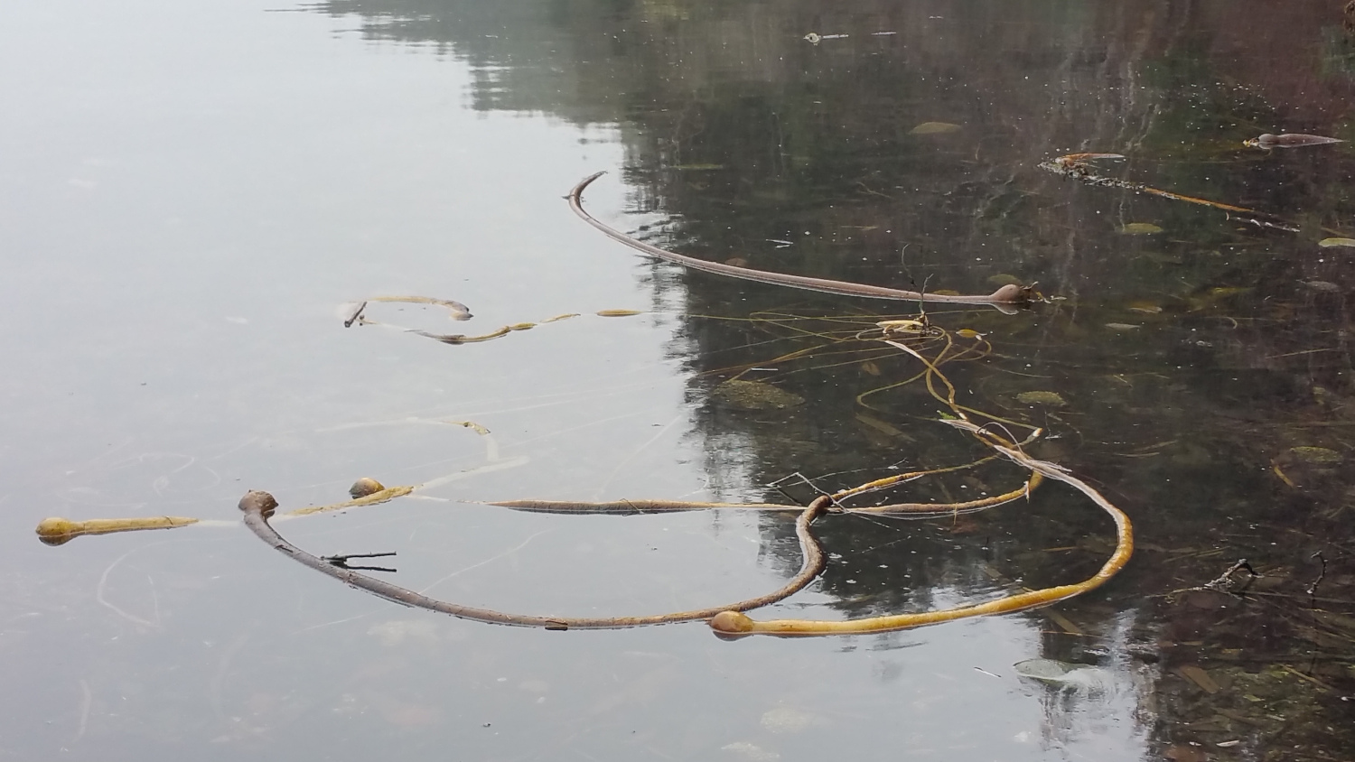 Kokwina Cove kelp.
If you go to Google Earth, you will be able to see the various dead ends that befuddled us in June of 2015.