August 4, 2015
Gooding Cove turned out to be our “adventure of misadventure”—and the misadventures were on straight out of the gate! On our way to the Wild West Coast, we followed Marine drive around the south end of Neroutsos inlet. Because I was so busy with my several part time jobs, I had to leave the research of how to get there all to James. I was blissfully tuned out as he was navigating. He followed the instructions in the BC Coast Explorer, telling us to follow Cayuse Main. We took a turn on Cayuse Main, driving for quite a while on a very undeveloped road, until, after coming up on a couple of fallen trees, James said a despondent “something’s wrong.” I was inclined to start chopping, but, as I later learned, the road to the Wild West Coast was a well enough travelled road that it should have been clear. We put our heads together and studied the book and the maps and figured out the BC Coast Explorer probably had a typo. We turned around and went back to Marine Drive. We followed it until it “became” Teeta Main (no turns taken) and just continued on. We then felt we were on the right track.
So, if you’re going the Wild West Coast, do not take Cayuse Main! It would probably lead you there eventually, but I wouldn’t recommend it unless you happen to be driving a bull dozer! Just follow Marine Drive until it becomes Teeta Main. After that, follow the rest of the instructions in the BC Coast Explorer. As we were driving along Teeta Main, looking for the switchback that was supposed to be 25 km from Port Alice, checking out this side road and that side road and wondering if that was it, what did we come across but a great…big…LOGGING TRUCK! James turned very white! He shifted the truck into reverse and goosed it! Luckily, the logging truck had been slowing down to make a turn from a side road onto Teeta Main, and he was able to stop in time. It was obviously a little bit sooner than he expected, as his cab bucked up and down harshly from the abrupt deceleration. Realizing the logging truck had stopped, James shifted the truck into drive and goosed ahead! As we made our getaway, he informed me that our bacon was probably saved by the other pick up trucks that had passed us earlier, warning the logging truck drivers over the two way radios about a couple of yahoos with kayaks.
I have mentioned this before, but I will mention it again: if you don’t have the foolhardiness to travel on logging roads while the logging trucks are working, avoid travel between 6 am and 6 pm on weekdays. There are many stories around the Island of people who were seriously injured and even killed meeting up with a logging truck. Because logging trucks have the right of way, they are not even liable if they run into you. Some roads are not too bad, such as this one to Gooding Cove and Side Bay, as they are quite wide and have enough room to let two vehicles pass—in most places at least! It helps that James is familiar with logging roads, but I’m going to push for travel after 6 pm from now on, when feasible. If you come from a place where logging roads are a remote concept, you should travel during the safe hours, or better yet, hire a local to guide you. The village office/tourist information centre can give you some good leads. There is talk in Port Alice about having bus tours to Side Bay and Gooding Cove, but the idea is still in the “contemplative” stages at this time.
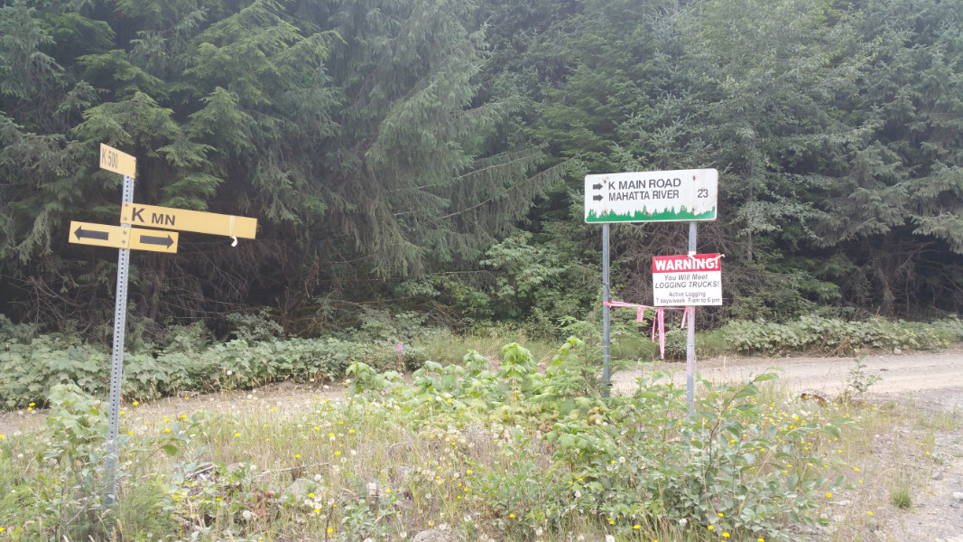 Forest Direction Signs.
You might notice that on one of the signs in this photo, it says there is logging activity seven days a week. I’m not sure what to say about that, as there was a much greater preponderance of signs saying there is activity only on weekdays. Also, there is a mantra going around Port Alice that says “loggers keep banking hours.” In our travels, we haven’t seen any activity on weekends. I do know, that on the road to Link River, gravel trucks travel seven days a week and we need be careful about that. I’d say that travel on the weekends is generally safe, but, as with everything in life, there might be exceptions. Keep your eyes peeled at all times anyway.
We finally came across the switchback as described in BC Coast Explorer, and were heading up on K500, then on K main over the mountain pass. From K Main, we went on I main, then J main. As we got closer to the Wild West Coast, there were bold red and white hand painted signs pointing the way to Side Bay and Gooding Cove (I guess if you managed to make it this far, you finally earned the right to know where you’re going) so we were able to put down our books and maps. The road was pretty good in some places, and it even became a two lane highway in one stretch. It turned out to be a nice drive for a while. All the forks in the road had direction signs…except for one…and that was a problem!
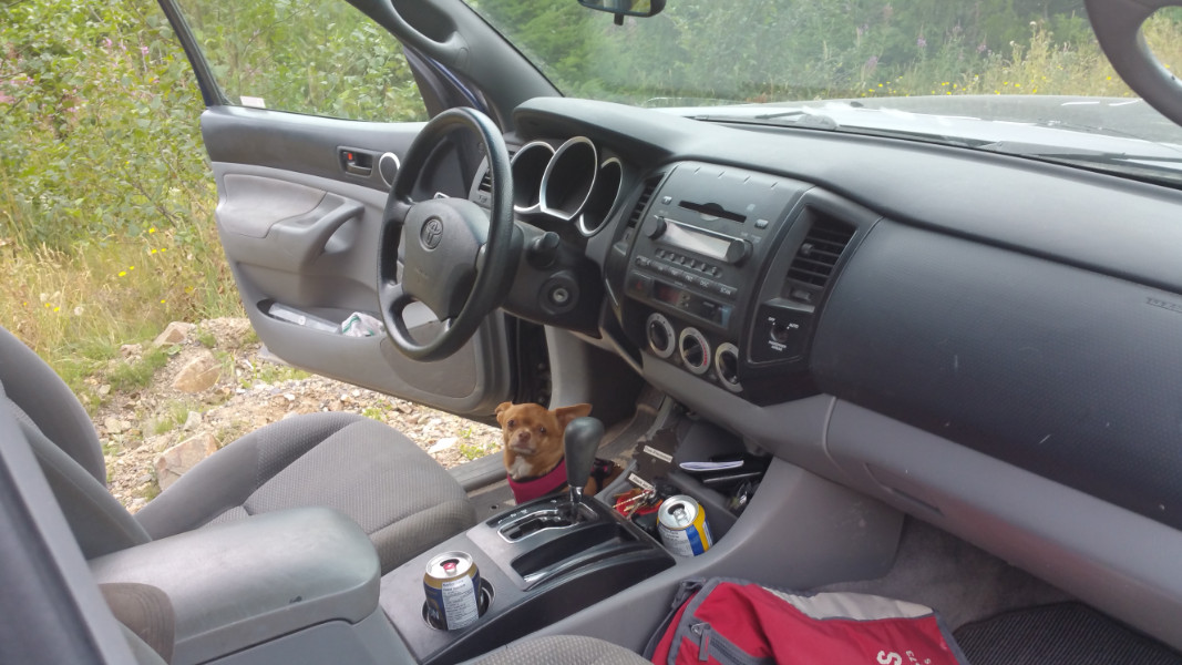
 Chloe having a scratch while James adjusts the straps.
 Mountain pass with fireweed.
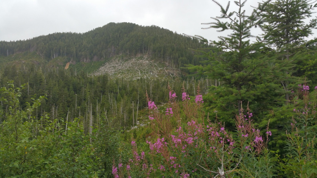
 Mountain pass with pine trees.
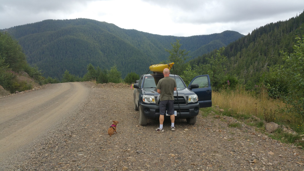
 Let’s get this show on the road.
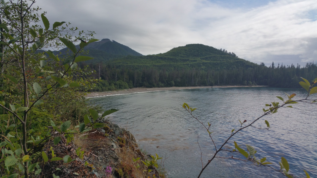
After we passed LeMare Lake we came across a fork in the road with a sign post that didn’t have a sign. We pondered and debated which one to take. We took the road to the right, thinking that the cove would be just on the other side of the ridge. It definitely turned out to be the road less travelled….to our chagrin! As we were driving, it struck me that it seemed like we were going up, but we couldn’t tell for sure because the trees were masking our surroundings. I started turning to a Nervous Nellie, complaining that this road was giving me a bad feeling. We debated and debated, but kept wondering what was behind the next rise. We drove up one rise only to find another one, which lead to another debate about whether or not we should take it. By the time we were certain we were on the wrong path, we were greeted by a spectacular panoramic view of the Quatsino Sound!
We found ourselves on a mountain cut block and quite nearly at the very top! We stopped at a little pull-out (emphasis on the “little”) because I really had to get out. My Nervous Nellie jitters turned into a full blown panic attack. I got out of the truck and didn’t care if I had to walk all the way down! Even so, I still grabbed the camera and took numerous shots of the incredible view! I couldn’t conceive how anyone could turn around on that narrow road with not much of a pull out, but somehow James did it! When I got back to Port Alice, I told one of my bosses, Rhetta Vesna at the Ozzieland Campground, about this. She informed me that she and her husband, Ozzie, ended up doing the very same thing back in the day…except, they didn’t just have a measly little pick up truck…they had a truck and trailer! Somehow they lived to tell about it! Rhetta says that’s probably why she has heart trouble today!
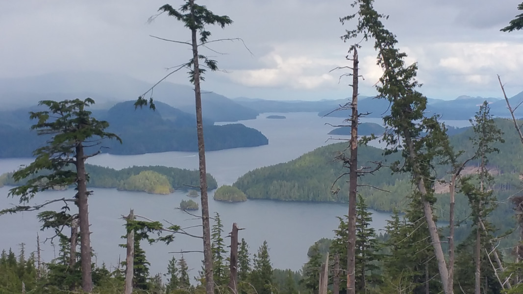 View of Quatsino Sound.
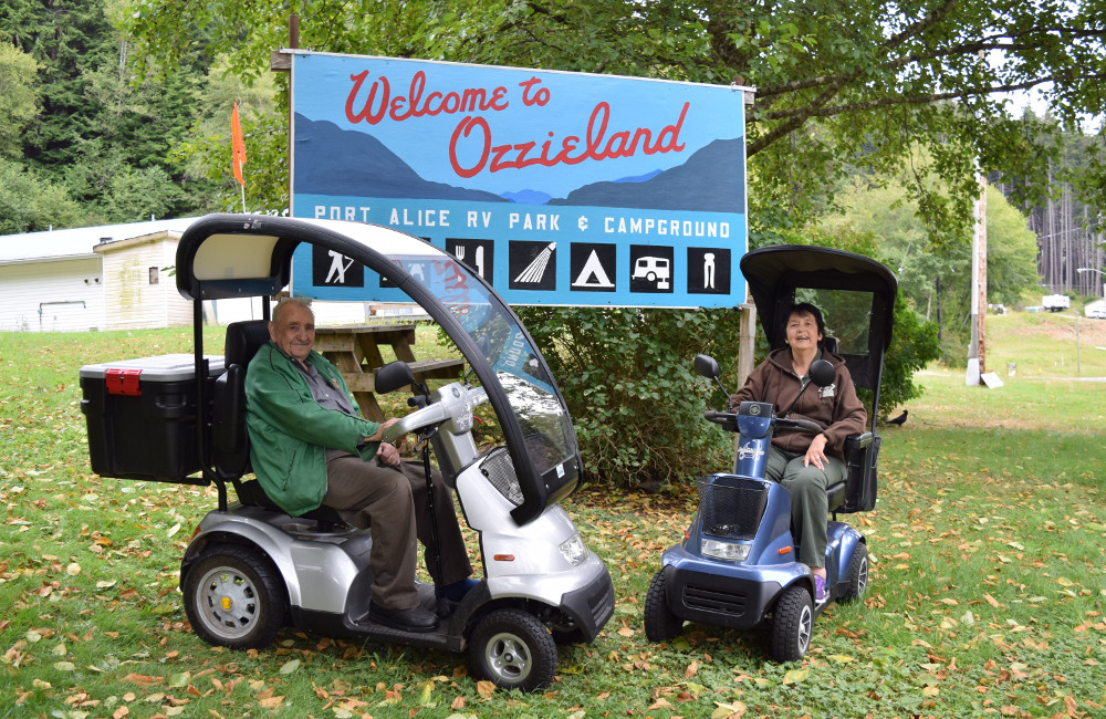 Rhetta and Ozzie: would anyone like to buy a campground? They would really like to retire!
At the bottom, we took the other fork, crossed the bridge over Lamere River and passed by a rock slide that gave us cause to pause. On Restless Main, we passed Harvey Cove, stopping a couple times to take pictures. Arriving at Gooding Cove, we met a couple of campers and had a chat with them before setting up. They warned us not to drive on the sandy beach with our 2-wheel drive. They suggested instead that we camp on a ledge at the side of the cove that was close to the road. To camp on the beach would have meant too much walking with our heavy gear, so we agreed that the ledge was the solution. We mentioned we were bloggers and got quite a reaction. They suddenly got horrified looks on their faces and begged us to not tell anyone about this place. How’s that an endorsement for you! I figure if only a handful of people know about places like this, they may end up getting used for some less than aesthetic purpose. The more people that know about places like Gooding Cove, the more likely they will be preserved and protected.
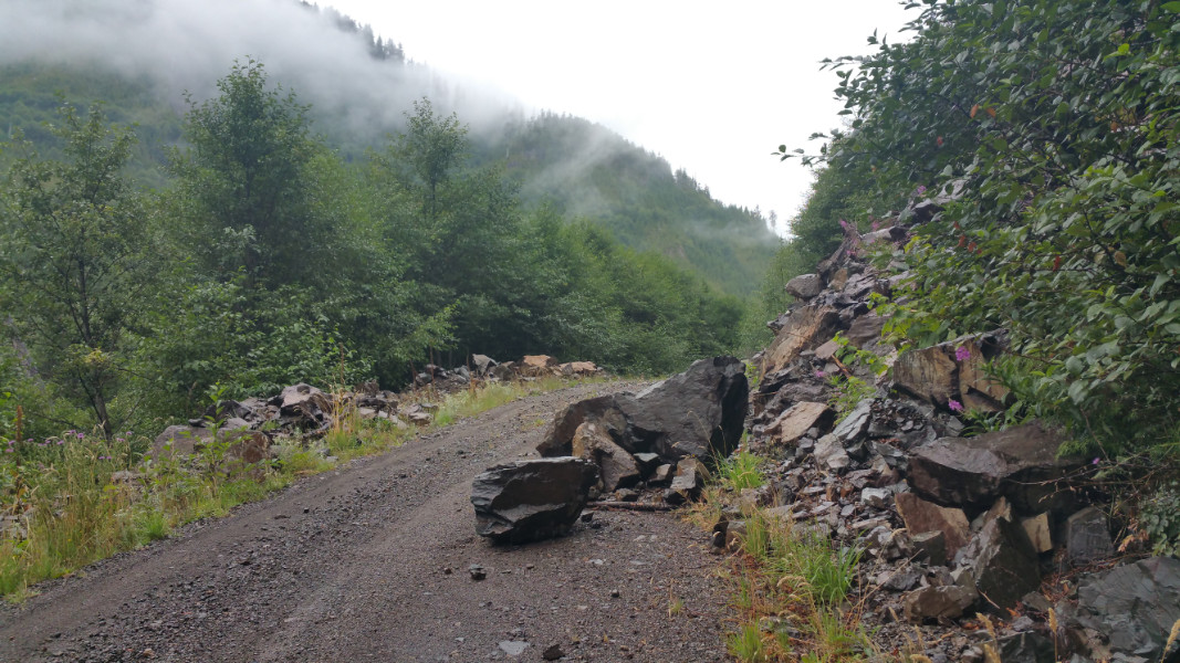 Rock slide that gave us cause to pause.
 Scene by Harvey Cove.
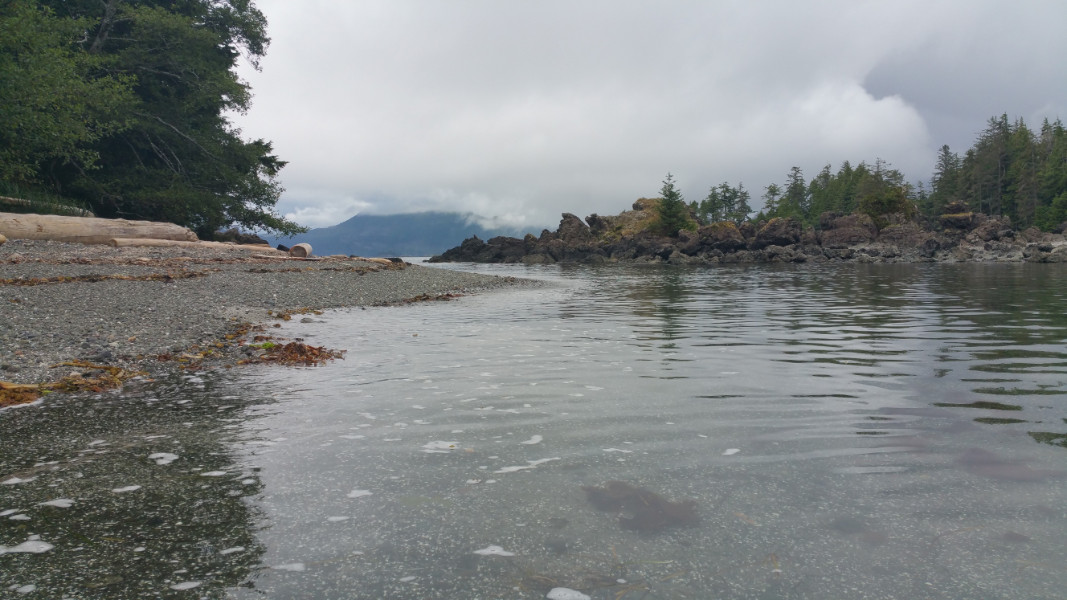
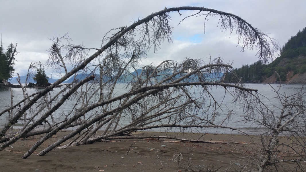
 Gooding Cove.
After setting up camp, we went for a walk along the beach. We contemplated going for a paddle, but we were too burnt out from the trip. We spent the night sitting around the campfire, watching the flames and not saying very much. Perhaps we were clearing our minds in preparation for the next day’s misadventures.
August 5, 2015
It rained all night. Luckily, it was a fairly light rain. James got up in a frenzy in the middle of the night. Our tent had become the location of a new mini lake! We had a tarp under the tent (as well as over), but part of it was extending past the tent, catching water and causing it to flow down the slight slope and straight under our air mattress! After James went out and made some adjustments to our tarps, we fell back to sleep. We woke up again around 8 am to the sound of raindrops hitting our tarp and waves crashing down below.
We opened the tent to find a miserable day out there, but it was only drizzling, not pouring. We contemplated what we should do, even considering going back home. We certainly felt frustrated enough to do so. The whole discussion was resolved by us falling gently back to sleep. When we got up at about 10:30, James opened the tent and peeked outside and proclaimed a couple of spots of blue sky. We felt hopeful. We took our time getting up, starting a campfire in the drizzle. The clouds seemed to anchor themselves just over the cove and the sun stayed out at sea. After a while, the clouds started to shuffle back and forth over the shore, causing the weather over us to alternate between drizzle and sunshine. I did my forest fire lookout weather forecasting and determined we had a short window of opportunity. I was a bit rushed, feeling we had to go soon or we would be going home unkayaked, but James wanted to deal with our wet clothes and the water problem in our tent.
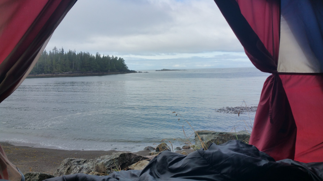 The view from our tent.
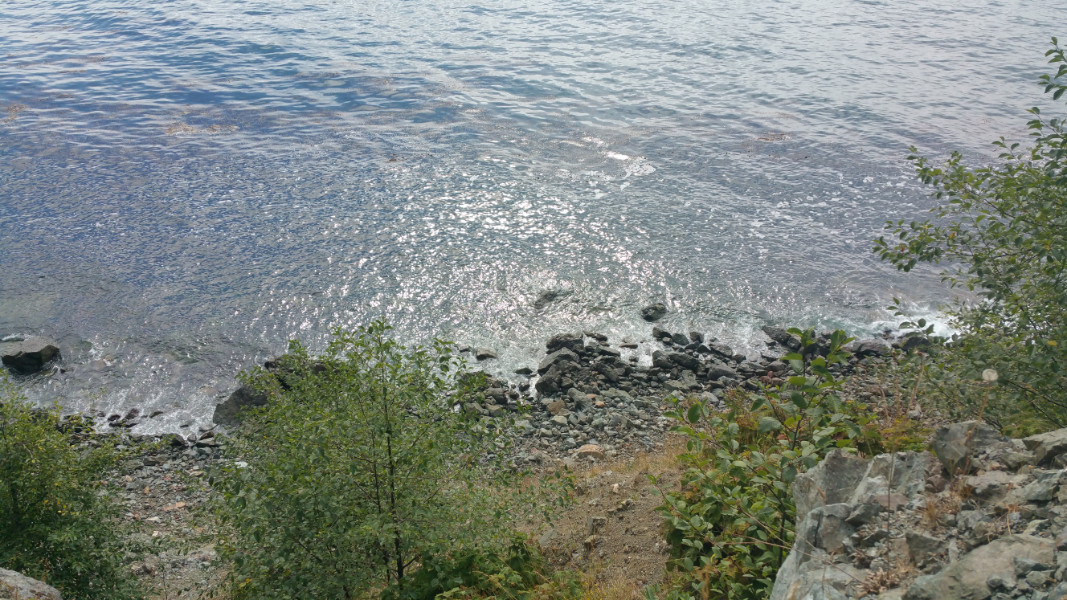 The view below our tent.
 Clouds anchored over the cove.
We lassoed a couple of saplings to make a clothes line. When I went into the tent to clean it out, it felt like a sauna. I removed all the clothes, putting the wettest ones on the line to half dry in the drizzle. We put our semi dry stuff and critical sleeping bags in the truck, so at least they wouldn’t get wetter. I lifted out the air mattress, finding a significant body of water. I took out the mattress and flipped it over so it could dry out in the occasional bits of sunshine. After soaking up what I could with a towel, I lifted the tarp off of the window in the back of the tent to create some air flow. I tied open the front entrance and left the tent to dry out…somewhat.
James and I quibbled over the campfire again. We put the bucket of water we had on it, but it was still smoking. I wanted to put another bucket on it, but he accused me of being over the top with this fire thing. He then told me to get the bucket myself. So I did. I found the wash water from last night and put that on the fire, but it was still smouldering. I went down the long way around the rocks to get more water. As I was getting my water, I looked up at James sitting on the camp chairs, and he didn’t look too happy. As I came back up the hill, he started walking down to the beach with the stuff for our kayaking trip, still very disgruntled.
After I satisfied myself that the fire was sufficiently out, I met him at the kayaks. There was one more fire that needed to be put out. James eventually apologized for getting mad at me. I told him, that I wouldn’t feel very comfortable out there kayaking knowing that the fire wasn’t completely out. Since he’s a pipe fitter, I told him it would be like him fixing a pipe and leaving a very small leak. He seemed to connect with the metaphor. Although the air above ground was wet on this day, the ground underneath, with all the dried leaves and other organic matter that is the “fuel” for a forest fire, was very dry. The rain was only wetting the ground’s surface and not sinking in very far. I could quite literally “feel” the dryness beneath me. I might have seemed “over the top” because the weather was so miserable. After eighteen seasons of taking weather calculations and seeing how they affect fire behaviour, I wasn’t fooled by the light rain. We had been having a long dry summer: it would take several days of heavy rain to bring the hazard down to safe levels. Even then, you should still be vigilant about putting out your campfires. As I explained in my Link River post, fires have ways of burning in low hazard, over a long cold snowy winter, and even underground for a hundred years or more!
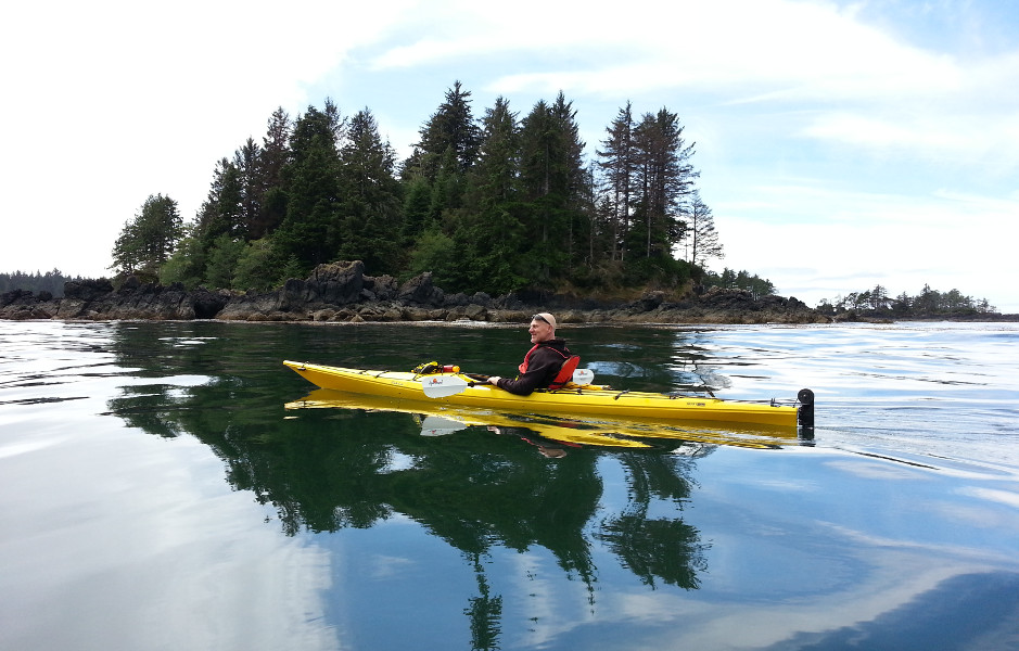
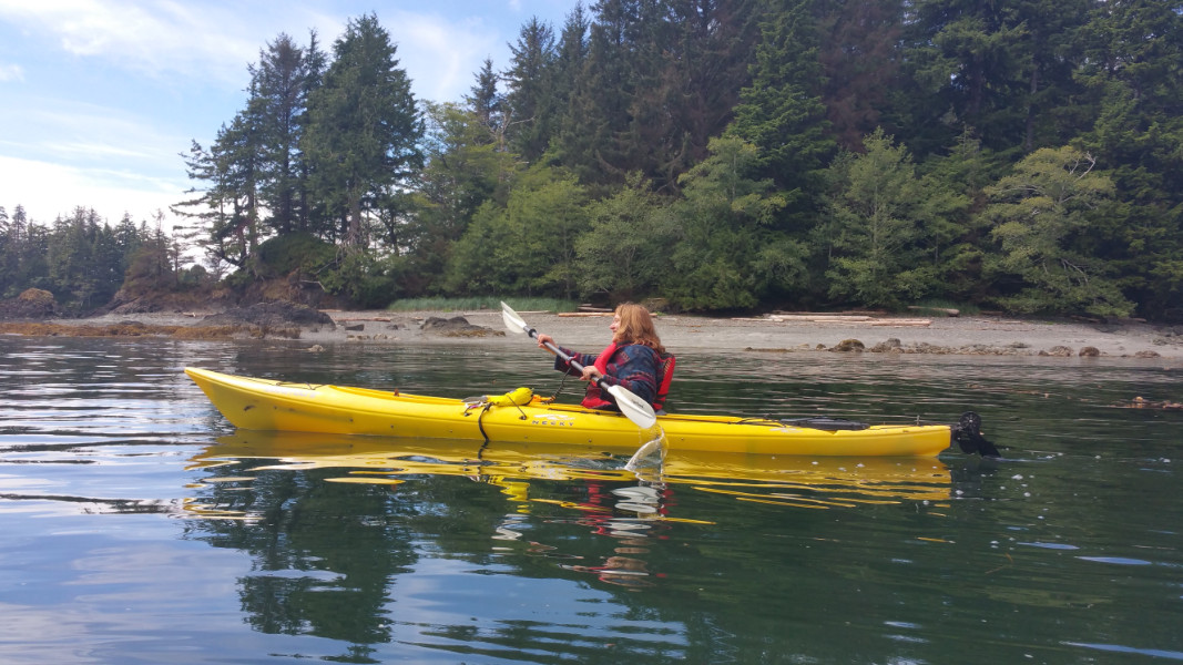
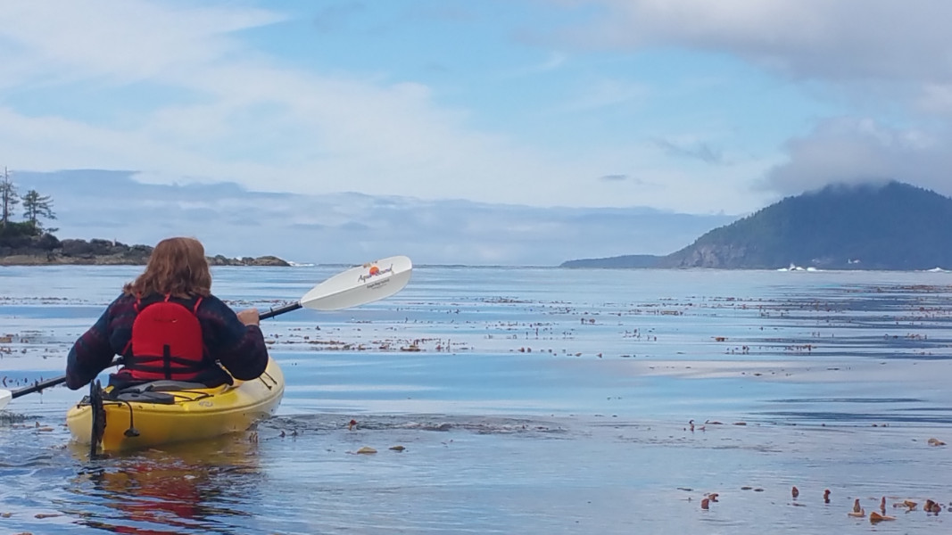
It seemed to be a rough start to the day all over. Dozy and uncoordinated, we carried the kayaks down to the shore to about the middle. We had Chloe in the kayak and were sort of lined up to launch—except I wasn’t in it yet. As I was trying to push the kayak onto the water and hop in, a big wave came in and landed on Chloe! She had such a look of ultimate betrayal in her face! I thought she was going to hate us forever! We both felt like terrible parents! Chloe’s blankets were soaked, and she was soaked! I picked her up in my arms and cuddled and consoled her a while in some dry blankets while we tried to figure out what to do next. We considered everything, from giving up to going to the quieter part of the cove. We thought about switching kayaks but, in the end, James decided to go in the water a little and pull me out. He probably shouldn’t have been in the front of my kayak. When it came time for me to paddle like a demon, I accidentally smacked him in the head with my paddle (take that for not letting me put out my campfire!) Alas alack, Chloe and I made it out past the breakers without getting soaked. I apologized profusely for smacking James, but he didn’t look like he was in too much pain because he was laughing. On the water, I couldn’t find my pedals. We had to paddle to a quieter part of the cove and get me adjusted (something we should have done before we launched). The big differential between the highs and the lows of the water level was giving me a bad case of turn-backitis; but, as soon as we were on the water, James was in charge and we were going. Sounding very professorial, he instructed me to avoid certain rocks, larger swells and breakers. Because it seemed like he knew what he was doing, I followed faithfully. At the mouth of the cove, paddling on the open ocean, we saw a wave farther out that was a huge fan of water splashing up 3 metres or more! The rocks the helped produce it were hiding stealthfully just below the surface of the water! I hate to think what would have happened to us if we were anywhere near there! We navigated between the spot with the scary wave and the rocks with the breakers, going up and down, up and down on the big swells. Finally, James paddled out ahead to check things out around the point and I stayed back. After he had a good look, he waved at me to follow. Swallowing my prairie chicken fear, and strongly resisting the temptation to go straight back to the shore, I did as he ordered. He told me to go slow and take my time.
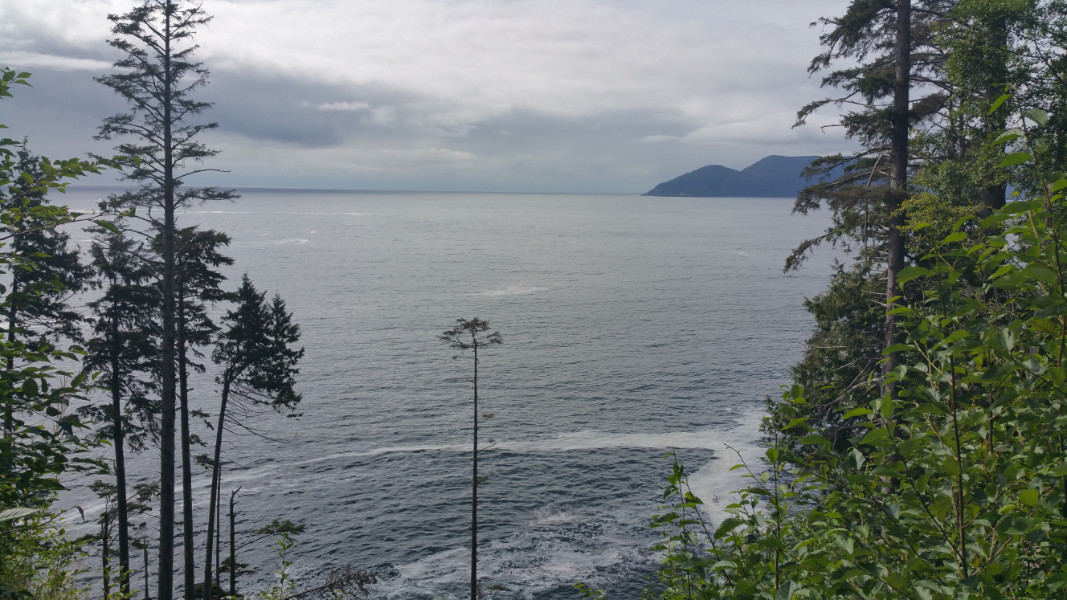
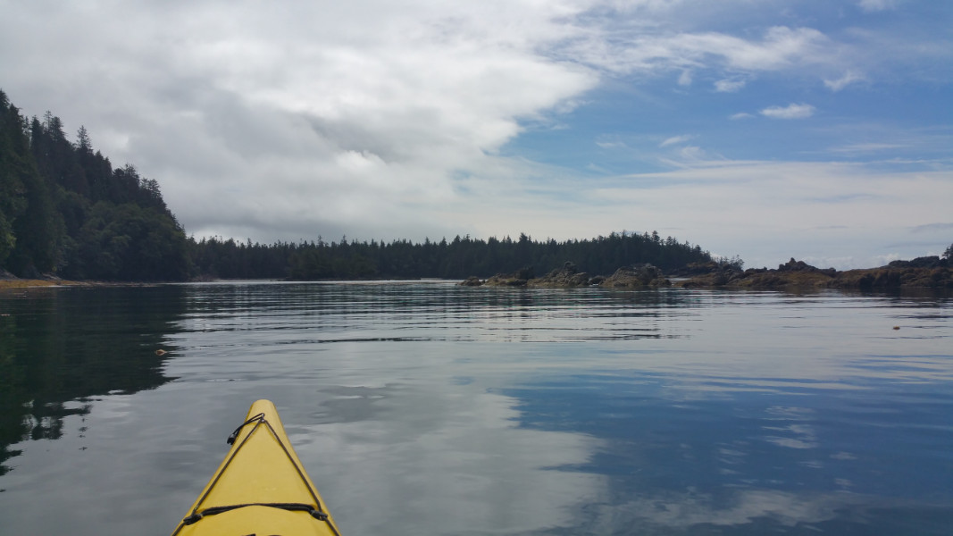
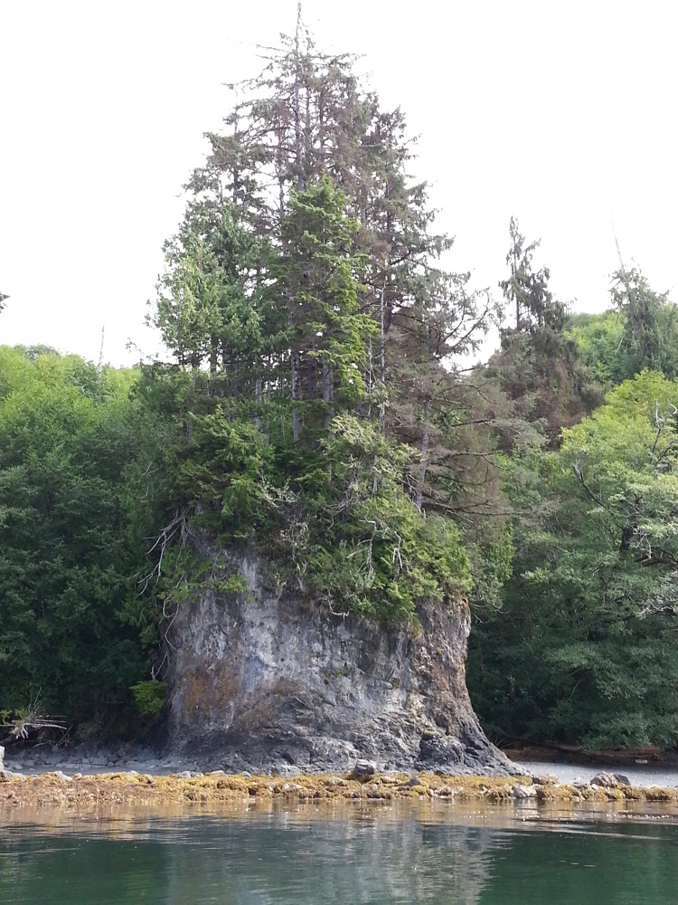
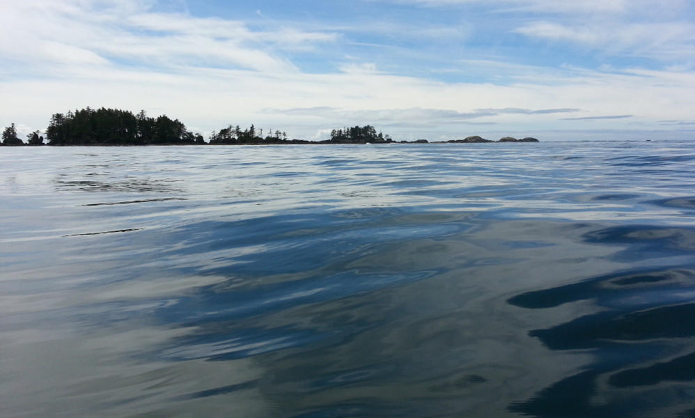
After a short stretch on rocky open ocean, we soon found ourselves in a tranquil cove with plenty of rock formations and islands. Staying close to shore, we snapped pictures and reveled in the beauty of the rocks, the islands and the marine life. James was looking for a cabin that was built by a friend of his that was supposed to be somewhere there. We saw a cabin, but it turned out to be someone else’s. Before heading there, we took the roundabout route, paddling between the rocks and islands.
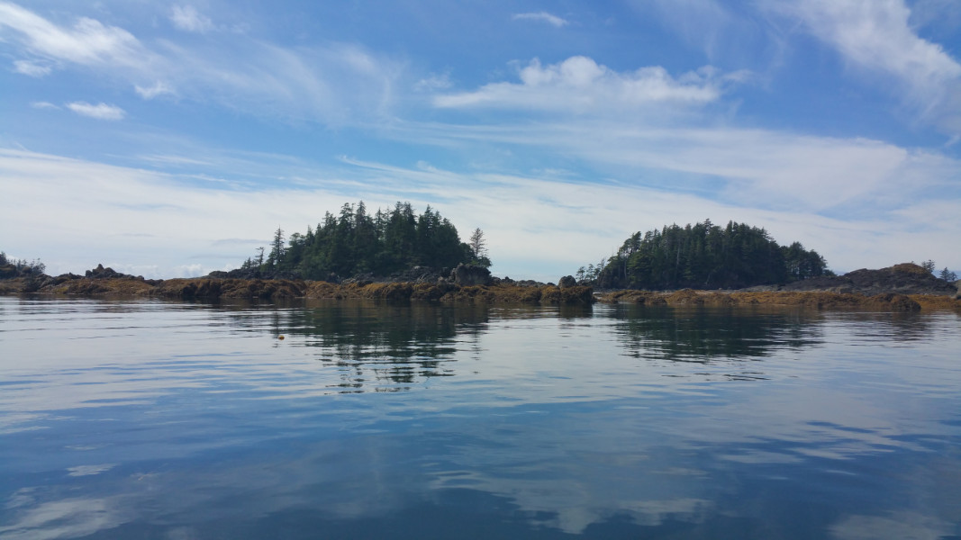 The tranquil cove.
 A photographic cameo effect.
 Smooth paddling.
Passing over calm waters between two rocks in between two islands, I felt my kayak suddenly rise up! I screeched at James, but it wasn’t enough warning. I rose about a metre into the air, but managed to avoid a splashing! Instead, James, who was little ahead of me, got swamped! It was a rogue wave! I remembered that when I paddled up to the rocks and looked out at the ocean, I could see no sign of waves for at least a kilometre! That mischievous wave had sneaked into the cove incognito, suddenly appearing under us the very moment we were passing between the two innocuous rocks. One is inclined to thing there was some kind of intelligence at work here! Thankfully, Chloe didn’t get swamped a second time, as she was in the Manitou with me. James, on the other hand, had to pull out the bilge pump.
 Beware of those rocks ahead!
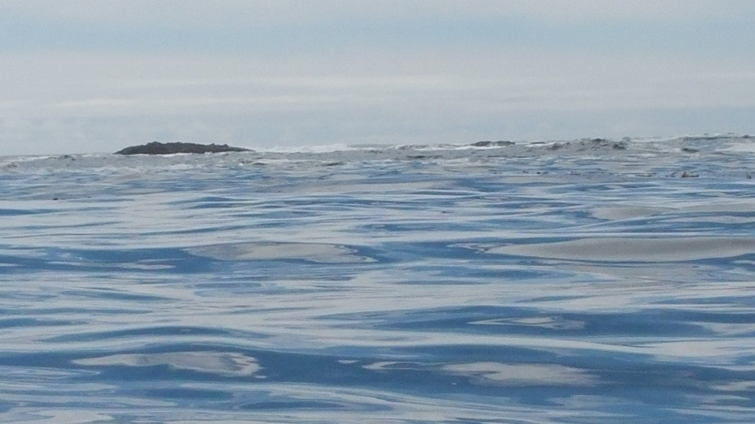
 Don’t let this flat water fool you!
On the way to the cabin, we said hello to Mr. Jellyfish and took some pictures. At the cabin, we delighted in using a real outhouse! We saw a folding chair sitting under a bunch of fishing floats hanging in the trees. The cabin looked nice on the outside, but it was very bare bones on the inside. The walls were made of unpainted particle board and it had few furnishings, essentially a big shelf full of cots. We found a guest book that had been written in extensively, possibly over the space of decades. I didn’t spend too much time reading, but noticed one passage where the guests had to contend with rats. Because it was cool and dreary inside, we went outside to have our snack. We walked around the beach and checked out the rocks. We found wild strawberries growing high up on a couple of large rocks on shore, their tiny habitat being high enough to be safe from the tides and waves.
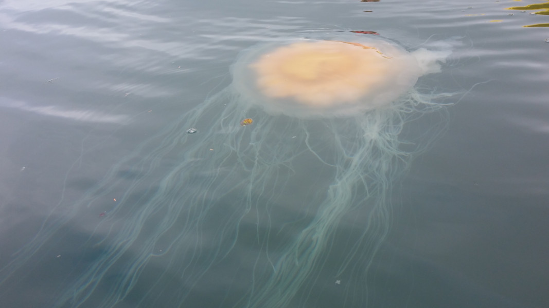 Hello Mr. Jellyfish!
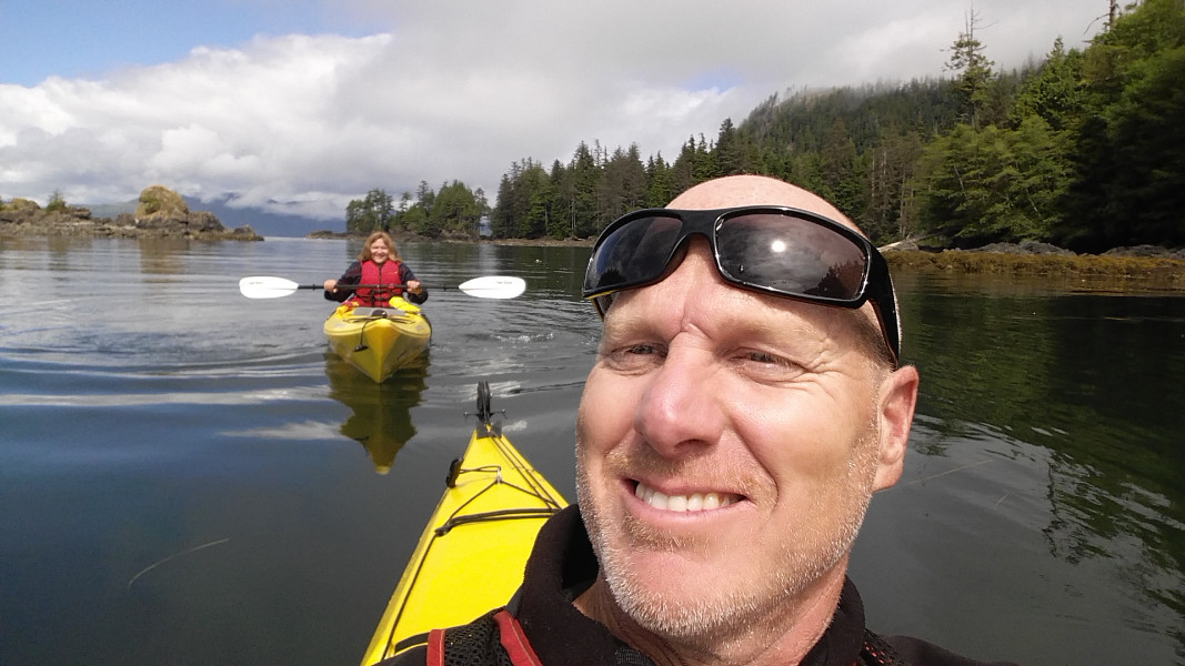 A selfie.
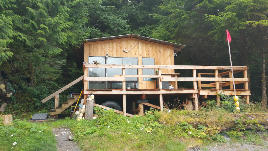 The cabin.
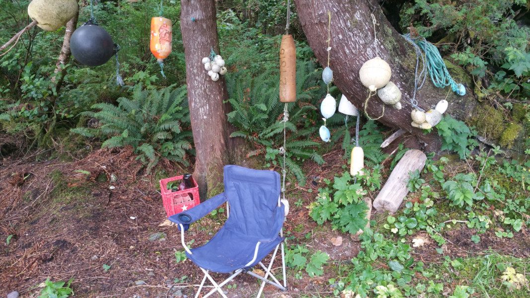 Fishing float decorations.
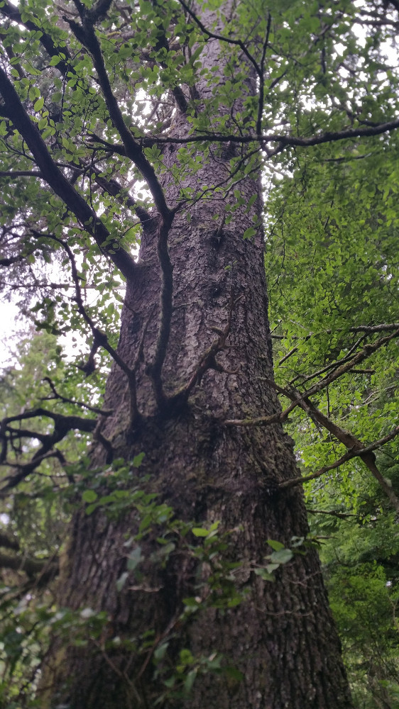 An old soul.
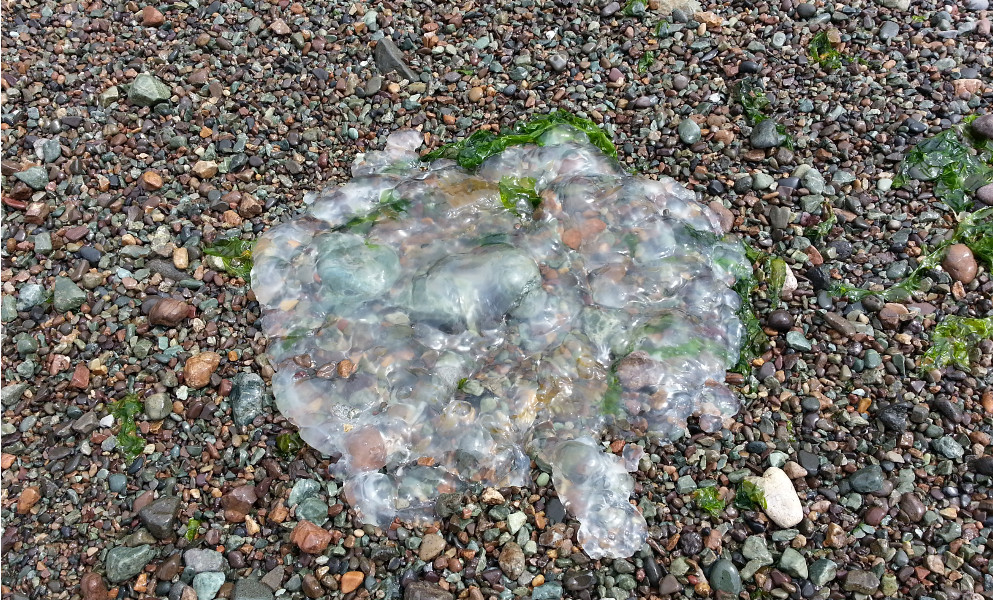 Deceased jellyfish.
We left the cabin and paddled to the point to check out Restless Bight to the south. James went out ahead of me to scout but, seeing high winds and a lot of breakers, he called off the attempt. On our way back, a large seal or sea lion had some fun with the tourists. He did a flip out of the water behind us, causing a noisy splash and making us jump. That rogue wave must have seriously spooked James. As we were going back around the point back to Gooding Cove, he was ahead and I was well behind. I was taking my time, because he told me to do that before. He started complaining about my slow pace, so I geared into my warp drive paddle. We rounded the point, riding high swells and keeping our eyes on the breakers further out to sea. Perhaps James realized we could easily be hit by a rogue wave again; but, on the open ocean, it would have been a lot more devastating! It was probably only the luck of the draw that we didn’t. The water was turbulent probably because of the stormy weather. On a calm sunny or generally overcast day, the trip might not be so risky.
 A serendipitous forest.
 Wild West Coast woman.
 Approaching a swell.
 Are you getting that queasy open ocean feeling?
I was glad when the point was behind us, but we still had to ride high swells all the way back to the shore. We decided to go far to the right on the beach that was more protected. The waves weren’t that bad by then though, and we probably could have landed in the centre. We walked back, looking for a walking stick for me because my knee was bugging me. As we were sitting on a log and looking at the bay and our kayaks, it occurred to me that we should name our kayaks. Calling them by their product name was a little too formal.
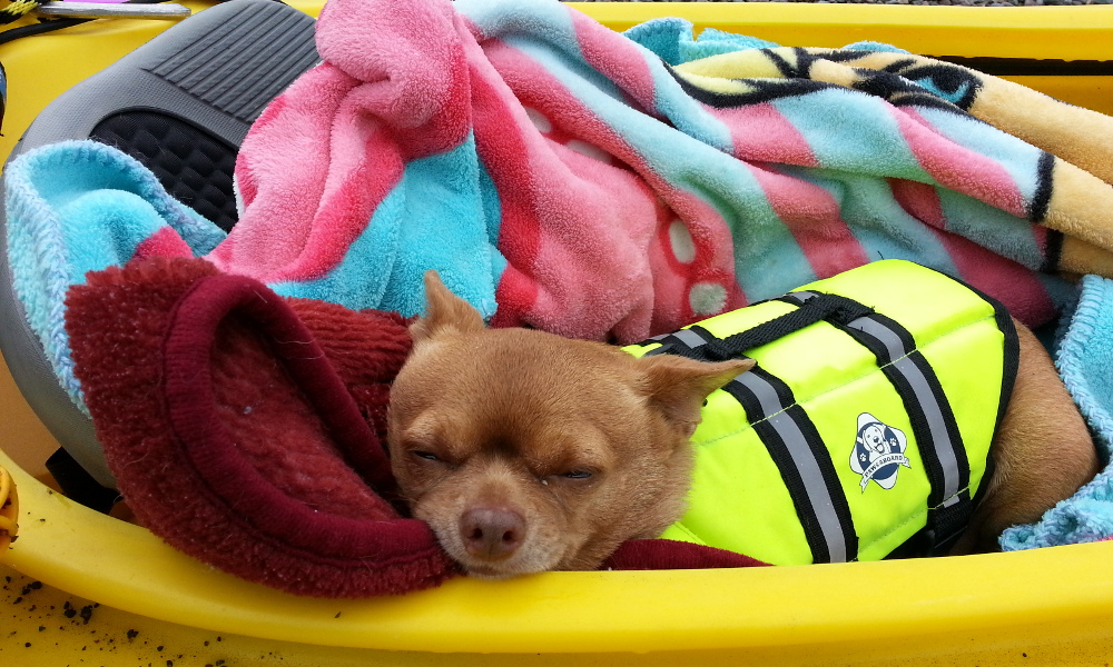 A pooped puppy.
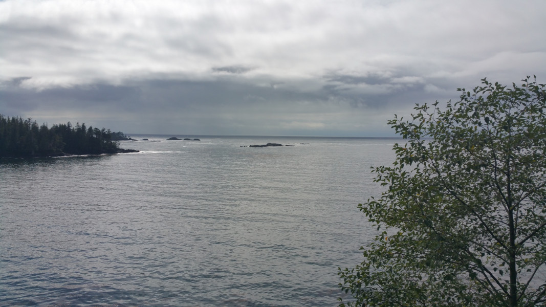
 View from Gooding Cove.
We got a fire going again—which was really hard because it was so wet (I wonder whose fault that is!)—and cooked up all our remaining meat, including steak and pork chops. We sat by our campfire watching it burn and listening to the crashing of the waves. I so love doing nothing sometimes!
August 6, 2015
It was dry in the morning, but we kept sleeping in our tents. As I was laying there, I contemplated the naming of our kayaks. I thought about naming the Eskia “Donovan Bailey” or “Andre Degrasse” because it was the fast one. Because the Manitou sounded like Manitoba, I thought about naming it after Winnipeg, as like in Winnie the Poo. Then I thought about the characters in Winnie the Poo. I thought, because the Manitou was the slower steady kayak, it should be named “Eeyore.” Then it occurred to me that we should name the Eskia “Tigger,” because it was the fast bouncy kayak. James had a laugh and seemed to agree. From then on, our kayaks were named Eeyore and Tigger. It is probably very apropos, since I’m a children’s author, and James is a children’s author’s boyfriend, who, by the way, is also a remarkably kid friendly person. We don’t have too many disagreements on how to deal with children (like we do about putting out campfires).
By the time we were out of our tent, it was raining steadily. James went to get the kayaks to put them on the truck. I stayed back and dismantled the tent. Even though we hadn’t started a fire that morning, when James wasn’t looking, I dumped some water on our campfire pit. Even though it didn’t look like it was burning and it was raining lightly, the fire pit hissed like a pit of snakes! Even I was surprised by this! That fire looked dead, but it was full on alive!
As we were packing up, our neighbours left and some new campers came by. We were worried that my two-wheel drive would not be able to make it up the road in the rain. We asked the new possible campers to look out for us. It was a good thing, as it turned out they were just about to leave. I got out of the truck to lighten the load. James made it up, giving a happy toot when he made it to the top. Otherwise, we might have been stuck there a few days!
We were planning to go to Side Bay for at least a quick look, but, because of the rain, we felt an urgency to get back. James left the final decision to me and I decided against. James later said it was a good thing, because, if we had gone there, we would have been coming back late at night, which, on long lonely logging roads, is not a pleasant notion—especially if we suddenly find ourselves on the top of a mountain with nowhere to turn around!
Driving back, we kept hearing a strange noise. I thought it was my differential (I forgot I used to have problems with it). After stopping a few times, we finally figured out it was because I didn’t twist the straps that hold the kayaks and it was causing “harmonic vibration.” In fact, I tried to make them especially flat and straight because I thought it was more aesthetic…silly artsie me! Alas alack, it wasn’t my differential! After fixing the straps by giving them a few twists, we continued on the slow long two and a half hour journey in the rain along logging roads J, I and K. Every once in a while, we had to stop to adjust our foam pads that kept falling out of place, as well as have a listen for the rumble of logging trucks in the distance.
Going over the mountain pass we took to get there, we found it much scarier than the trip the other way. There were no guard rails and we had a full on view of the very steep drop! Going up we were oblivious, as that scene was behind us. We inched along. I had to look away to avoid a panic attack. James was very cool, but I could tell he wasn’t at ease about it either.
Relieved to be past the scary part, we stopped at an overgrown campsite just below the pass and took pictures of the mill across the inlet. It’s funny how the mill, such a massive complex that is such a big part of people’s lives in Port Alice, looks so miniature in the expanse of nature! It makes you realize how the entity that created nature has a lot more resources and a lot more influence in the larger scheme of things. As we drove along Marine Drive, it was interesting to watch it change from a rough forestry road to a municipal paved road lined with signs, houses and pruned and trimmed lawns and shrubs.
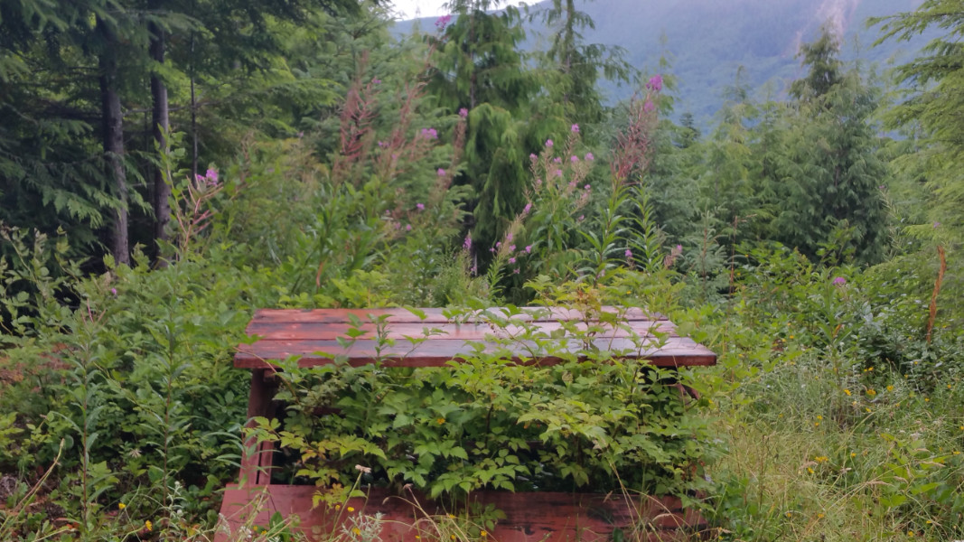 A picnic table that has seen better days.
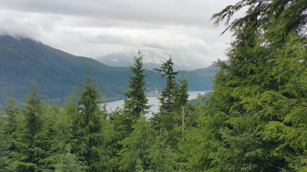 The Port Alice pulp mill.
I went to my place and had a good nap, my cats sleeping on top and beside me. They quite evidently missed me as much as I missed them. Later, I cleaned myself up a little and went down the hill to James’ place to have some grub.